A piece of the polar vortex has decided to pay NYC a visit in the days leading up to Christmas. Its arrival will kickstart the development of a powerful storm which will bring rain, wind and a arctic cold front to our area over the next few days.
https://www.nymetroweather.com/wp-content/uploads/2022/12/luiz-guimaraes-iu2l_gsQ-l4-unsplash-scaled.jpg14402560John Homenukhttps://www.nymetroweather.com/wp-content/uploads/2024/02/Empire-2000-x-300-px-2.pngJohn Homenuk2022-12-21 12:00:032022-12-21 12:00:06A Piece of the Polar Vortex Will Visit NYC on Friday as a Powerful Storm Sweeps Through the Northeast
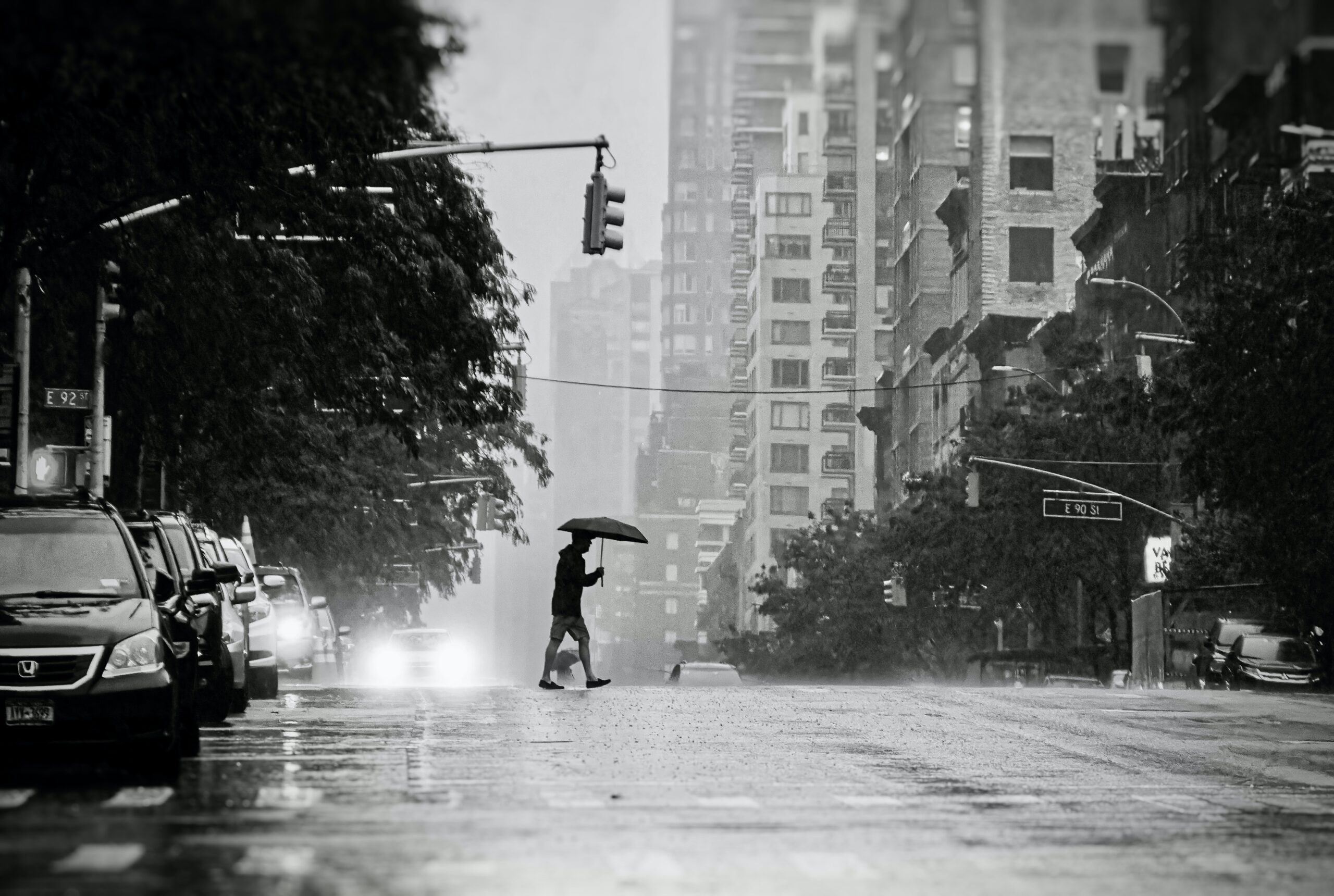
A large and impactful storm system is expected in the Central and Eastern US during the days leading up to Christmas. Widespread travel disruptions are a growing concern. In NYC, the main impacts from the system are expected to be rain and wind. Winter weather is possible in the interior Northeast.
https://www.nymetroweather.com/wp-content/uploads/2022/12/clay-leconey-uwjP5XhxnXU-unsplash-scaled.jpg17202560John Homenukhttps://www.nymetroweather.com/wp-content/uploads/2024/02/Empire-2000-x-300-px-2.pngJohn Homenuk2022-12-18 20:58:232022-12-18 20:58:28Impactful storm system becoming likely in the days before Christmas
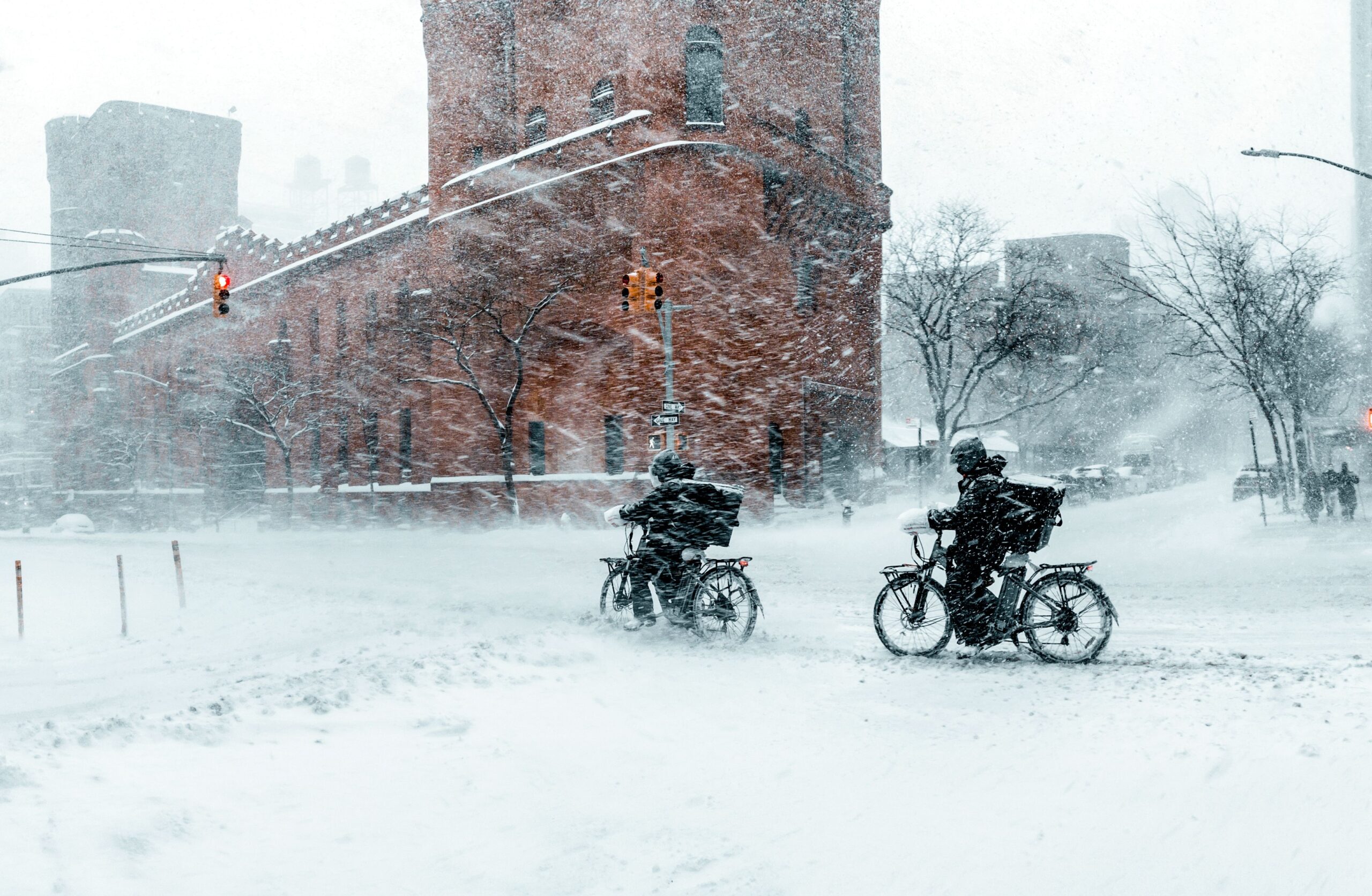
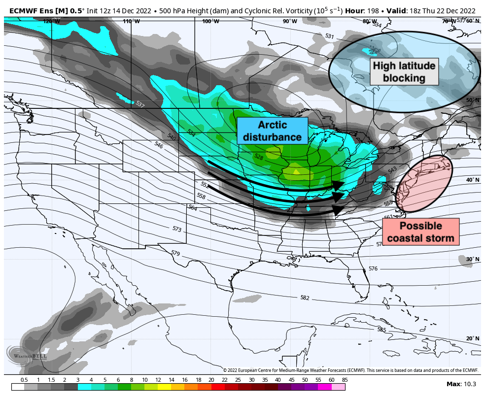
While a cold rain continues to fall in the NYC Metro Area late this week, the weather pattern around us is undergoing significant changes. High latitude blocking developing over both Greenland and Alaska will dislodge cold air into the area – and also slow down the jet stream – next week. The eventual result will be the potential for a strong coastal storm in the days leading up to Christmas.
https://www.nymetroweather.com/wp-content/uploads/2022/12/clay-leconey-oNbSx0PSxUU-unsplash-scaled.jpg16722560John Homenukhttps://www.nymetroweather.com/wp-content/uploads/2024/02/Empire-2000-x-300-px-2.pngJohn Homenuk2022-12-15 20:40:242022-12-15 20:40:28Coastal storm threat emerging in the days before Christmas
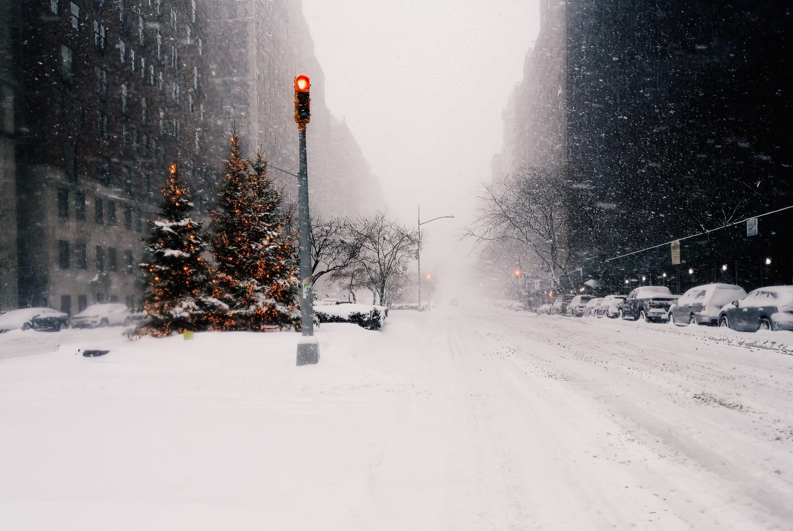
Another storm system will impact the NYC Metro Area on Thursday, with periods of rain likely in the city and snow possible in the higher elevation suburbs. This is the second system to bring similar impacts to the area in the last five days. A colder and more wintry weather pattern moves into the area next week.
The weather over the past few days has generally been quite nice. Despite chilly temperatures with highs only scraping the upper 30s and lower 40s, sunshine has been a common feature each day this week. That’ll change on Thursday as a large low pressure system approaches the area with clouds and unsettled conditions likely.
The original storm system is actually centered over Minnesota, but high pressure to our north will force the storm to redevelop near Long Island. For the NYC Metro proper, that means periods of cold rain are likely later on Thursday as the system passes through. Rain is likely to be heaviest during the mid afternoon into the mid evening hours.
The storm system will wrap up to our north and east but rain will continue into Friday morning. Periods of showers could linger into Friday afternoon before the system finally begins to clear out of the area to our north and east. Blustery west winds will eventually usher in drier, colder air late Friday night into Saturday.
Much colder, wintry weather moves in next week – is a storm brewing near Christmas?
As we have been mentioning for more than two weeks, the weather pattern is going to trend much colder and stormier during the second half of December. The signs of this change have been apparent for quite some time and are now coming to fruition on most forecast models.
High latitude blocking in both the Pacific and Atlantic oceans will dislodge air that usually resides in the polar regions and send it southward into Canada and eventually the United States. High pressure north of our area will also buckle the jet stream and hold colder air in place – allowing for a higher probability of slower moving storms with cold air nearby.
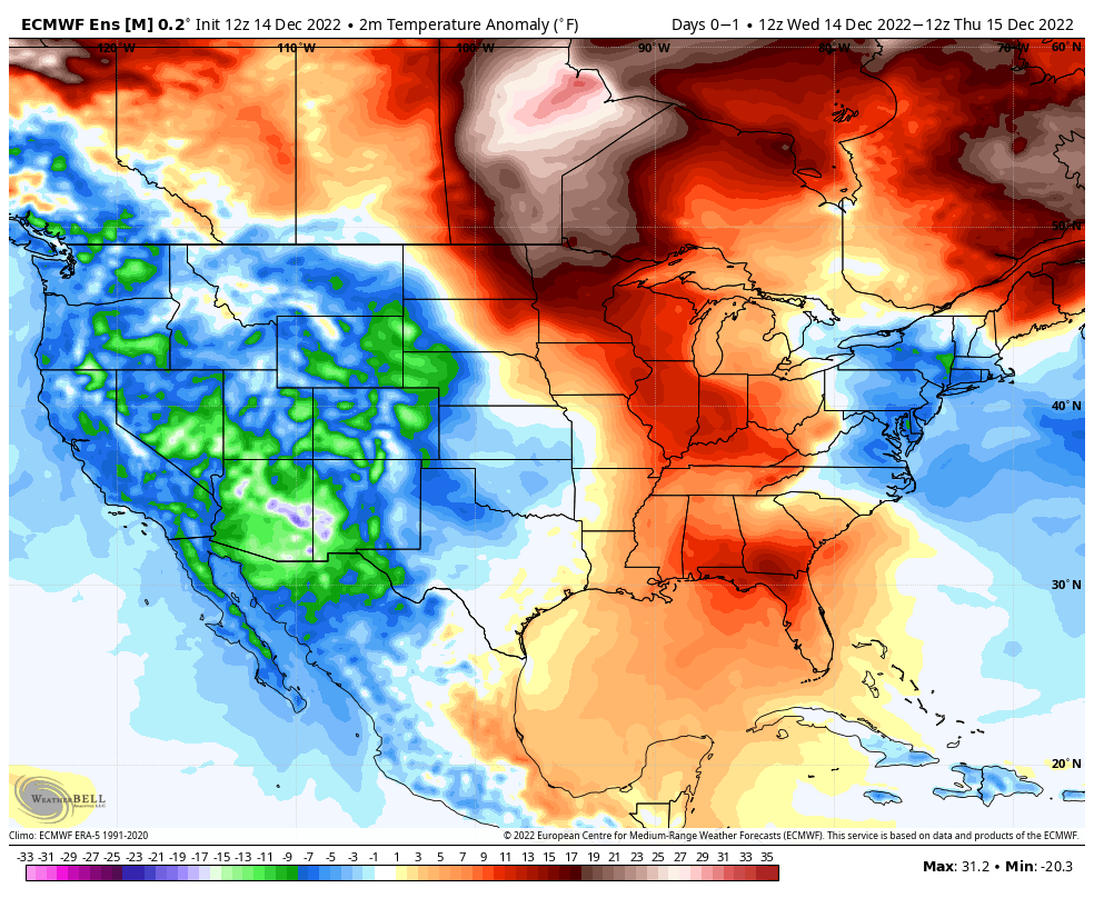
There is strong agreement among weather models that an outbreak of cold air will surge into the United States next week, with much below normal temperatures entering the country and reaching the NYC Metro in the days prior to Christmas. Temperatures are eventually forecast to fall several degrees below normal for this time of year.
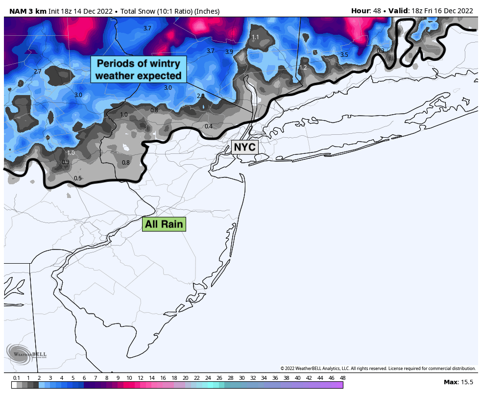
There is also a signal for a storm system emerging in the days leading up to Christmas – specifically from December 22 through December 25. Forecast models are hinting at a highly amplified disturbance surging southward from Arctic Canada. This system could force the development of a coastal system along an arctic front if it were to form similarly to how models suggest.
There is still a great deal of uncertainty and spread among models regarding how this system will evolve. Confidence in the forecast evolution remains quite low as a result. With that being said, there are certainly some eyebrow-raising signals appearing on models for this time period that suggest it’s time to start paying attention.
We’ll have further updates on the evolution of the pattern and the potential pre-Christmas storm system in the coming days.
Have a great night!
https://www.nymetroweather.com/wp-content/uploads/2022/12/clay-leconey-UkOEO-cjbY0-unsplash-1-scaled.jpg17142560John Homenukhttps://www.nymetroweather.com/wp-content/uploads/2024/02/Empire-2000-x-300-px-2.pngJohn Homenuk2022-12-14 16:43:412022-12-14 16:44:30Unsettled weather returns on Thursday, wintry pattern looms on Christmas week
Hi friends! Our website uses cookies to provide an optimal browsing experience for you. New "Cookie Consent" laws mandate us to inform you of this. As long as you're cool with it, just hit OK. You'll only see this message once.
We may request cookies to be set on your device. We use cookies to let us know when you visit our websites, how you interact with us, to enrich your user experience, and to customize your relationship with our website.
Click on the different category headings to find out more. You can also change some of your preferences. Note that blocking some types of cookies may impact your experience on our websites and the services we are able to offer.
Essential Website Cookies
These cookies are strictly necessary to provide you with services available through our website and to use some of its features.
Because these cookies are strictly necessary to deliver the website, refusing them will have impact how our site functions. You always can block or delete cookies by changing your browser settings and force blocking all cookies on this website. But this will always prompt you to accept/refuse cookies when revisiting our site.
We fully respect if you want to refuse cookies but to avoid asking you again and again kindly allow us to store a cookie for that. You are free to opt out any time or opt in for other cookies to get a better experience. If you refuse cookies we will remove all set cookies in our domain.
We provide you with a list of stored cookies on your computer in our domain so you can check what we stored. Due to security reasons we are not able to show or modify cookies from other domains. You can check these in your browser security settings.
Other external services
We also use different external services like Google Webfonts, Google Maps, and external Video providers. Since these providers may collect personal data like your IP address we allow you to block them here. Please be aware that this might heavily reduce the functionality and appearance of our site. Changes will take effect once you reload the page.
-2")