-2")
NYC Forecast: Dreary, cooler weather this weekend
Happy Friday! High pressure will allow for more sunshine to mix with clouds through this afternoon. High temperatures will reach the middle 70s, which is several degrees above normal. For tonight, clouds and onshore flow will increase, as a backdoor cold front moves through the area. Temperatures will drop overnight into the upper 50s and lower 60s.
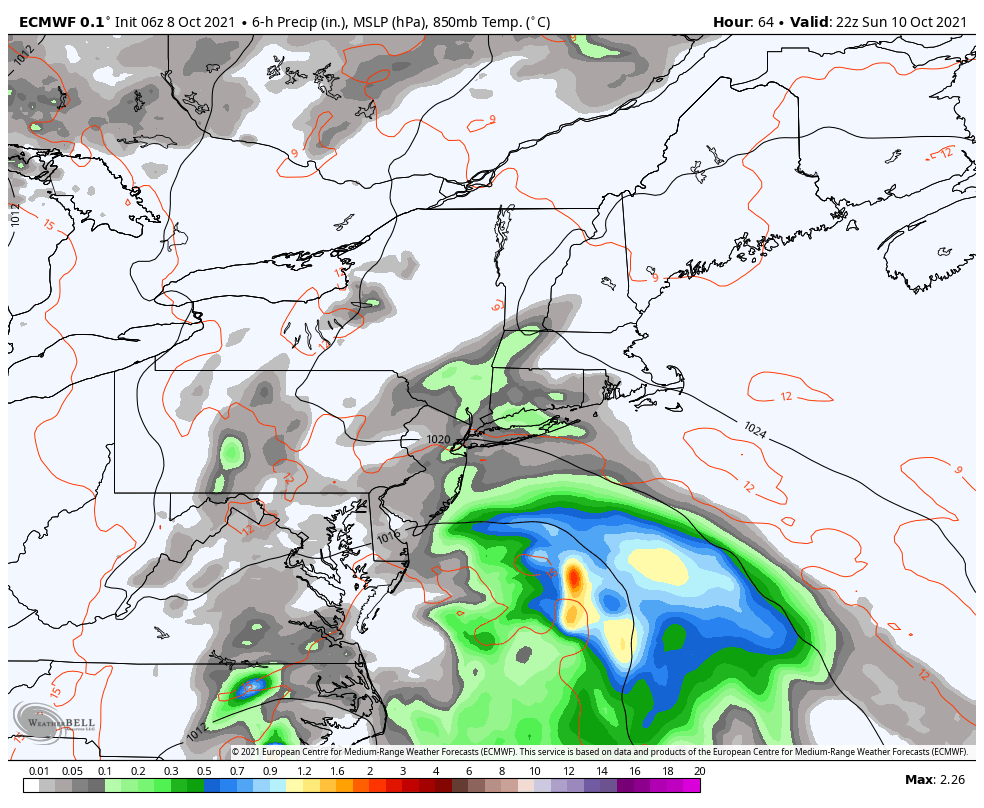
For this weekend, an onshore flow will continue to persist between high pressure to the northeast and a coastal storm developing off the Carolina coast. This will likely keep cloudy, cool dreary conditions for much of the weekend. Temperatures will likely struggle to get out of 60s in the area on Saturday and Sunday.
A few showers could develop over parts of the area later in the day on Saturday, as moisture convergence from the onshore flow increases. Then chances for showers will increase again on Sunday, as the coastal storm tracks a little further northeast and interacts with an upper-level trough passing to the north. But stronger high pressure to the northeast will likely keep any bands of heavy rain disorganized and south of the NYC metro area.
Some showers could linger into Sunday night. Then on Monday the coastal storm will begin weakening and heading further offshore. Chances for showers will decrease and skies could begin clearing by Monday afternoon. High temperatures will likely reach the upper 60s or lower 70s again with more sunshine.
Then a stronger upper-level ridge will build over the Northeast for rest of the next week. This will allow for warmer conditions to return with temperatures likely reaching the middle 70s again on Tuesday and Wednesday. A weak cold front may approach with few showers later on Wednesday. But temperatures will likely remain warmer than normal into late next week.
That’s all for today. Have a great weekend!