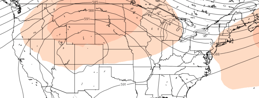
Western US Ridge will serve as pattern’s focal point

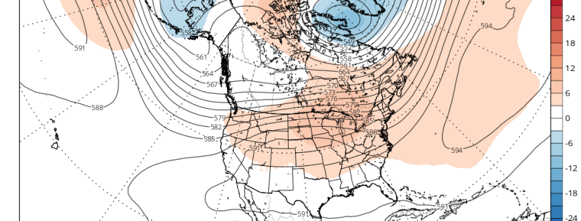
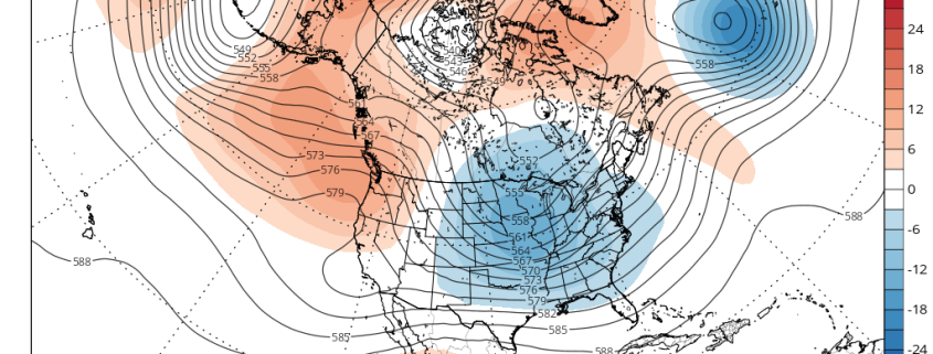
Much has been made over the past few weeks regarding the potential development of a large ridge, which forecast models once suggested would build into the Ohio Valley and Northeast States, providing widespread heat and humidity. As you may have figured out yourself, this ridge has yet to develop — and it doesn’t look it will at all, succumbing to the overall hemispheric pattern which has kept the ridge angled towards the Western United States.

Medium range forecast models were much too aggressive with the development of the ridge, once suggesting that the core of it would build into the Ohio Valley. In fact, for a few model cycles both the GEFS and ECMWF suggested that heat would build into the Eastern US, but have since backed off. The development of these large ridges is quite common in the summer (in other words, this isn’t all that anomalous), but the positioning of the ridge is often modulated by the surrounding environment. This year is no different.

Read more

Premium Long Range: More Heat & Severe Weather Risks Going Into July

After a few showers and thunderstorms this afternoon, more pleasant weather with temperatures near to slightly below normal will continue over the next few days. But there are many signs of overall pattern change support more typical mid-summery weather with some hot temperatures, humidity and some thunderstorms over the region, as we move into the few weeks of July.

A trough will dig into the Northern Rockies and Plains during the middle of this week. This will cause ridge build over Northeast and Mid-Atlantic region late this week and into this weekend. This will much warmer and humid airmass to return to region. Temperatures with more southwest flow and enough sunshine could exceed 90°F degrees in many spots by Friday and Saturday. Some afternoon sea-breezes each day will likely some coastal sections a little cooler. But it still be uncomfortably humid.

Read more

After the heat, blocking and wetter weather return

Good evening, everyone! We currently have a lovely stretch of warm weather coming up that already started today, so get out and enjoy it! While we will not necessarily go back to the consistently rainy and very cool weather from early this month, there are plenty of signs that we will go back to a relatively cooler and rainier regime starting this weekend.

For much of this month, we have had a large blocking pattern near Greenland that gradually retrograded into SE Canada and then the NW Atlantic. It has since dissipated, which allowed for a large ridge to finally move into the East and warm things up. But these blocking patterns often can be persistent and return in a relatively short period of time. We actually had a large blocking pattern in March, too, so this blocking pattern has already repeated itself, which gives more credence to the idea of continued returns of the blocking.

And indeed, that is where we are headed.

Read more

Midday Zones Update: Cool Weather Through Friday, Weekend Coastal Storm Threat Increases

Happy Tuesday afternoon! Some sunshine will continue for rest of today. But we will continue be under the influence of a large, anomalous cold upper-level low or trough over the Northeast US. This will lead to more cumulus clouds developing, instability increases with more daytime heating.  A few isolated showers could also pop up, but these will be over more Connecticut or New England today. Temperatures will rise in the upper 50s to lower 60s.

Read more