(Premium) Will There Be An East Coast Snowstorm March 4th-5th?

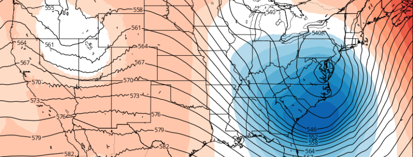
After the midweek storm which is likely to be all rain, we are watching for the potential for storm system to develop near the Southeast US in the March 3-5 period.

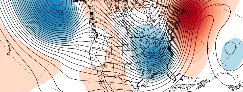
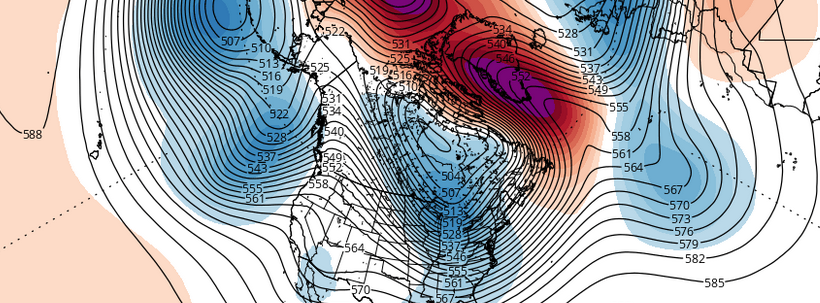
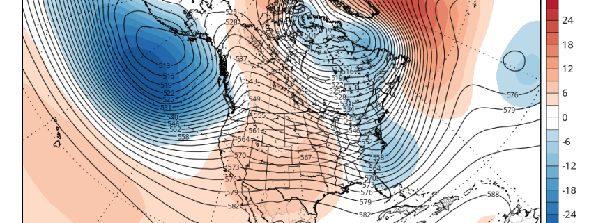
Strong high pressure with much colder air will follow behind the midweek storm. Meanwhile, a shortwave will dig downstream off the West Coast ridge over the Rockies. This shortwave will become part of the southern stream and cause a low pressure storm system to develop over the Central or Southern Plains. Models indicate this storm will track towards Southeast or Lower Mid-Atlantic coast by Friday.

Read more

(Premium) Winter storm threat next week

Forecast models continue to show a classic pattern progression across the Northern Hemisphere over the next several days, with a continuation of a wave progression that favors the development of a Western USA ridge and Eastern USA trough by the beginning of next week. The redevelopment of this large ridge in the Western USA, extending northward into British Columbia, is expected to be the focal point for the potential development of a storm system in the Eastern USA between February 24th and 28th.

Read more

Winter Forecast Update: Colder February, increased snow chances

What a turn around this winter has been able to pull off over the past week or two. Record-breaking warmth in December gave way to arctic blasts and a historic, crippling blizzard this month. We also saw an atypical fantastic performance prior to the blizzard by the NAM model for this region. We warned the winter could return with a vengeance in a public article we wrote shortly after Christmas. Pattern signals and ensemble guidance were strongly hinting at opportunities for more cold and snow.

While many aspects of our Winter Forecast published in November have worked out, there have been setbacks and surprises as well. This post will serve as an update and stepping stone for the several weeks of winter still left to come.

Read more

Colder air is on the way, but how about the snow?

Winter has finally arrived. Despite potentially record breaking warmth for one day this weekend (Sunday), and the return of rain this weekend as well, we will continue to transition into a colder pattern with an arctic frontal passage on Monday. The atmospheric global circulation pattern is trending much more favorably for winter weather lovers — with teleconnections favoring cold being dislodged into the Northern 1/3 of the United States. With high latitude blocking also in the forecast on all medium range models — the question now becomes: What about the snow?

Read more