October Outlook: Why anomalous warmth could return

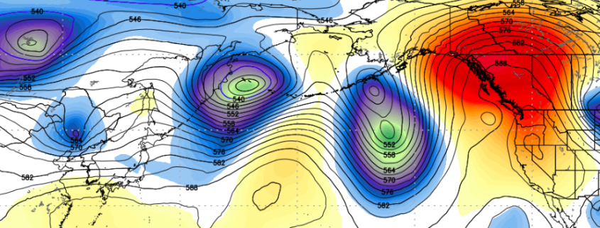
Several daily temperature records were broken over the past several days throughout the Eastern United States, particularly this weekend when temperatures reached into the upper 80’s and lower 90’s. Much of this warmth was aided and enhanced by the development of a large, sprawling mid and upper level atmospheric ridge. This ridge acted to enhance the flow of a warm, southwesterly flow, which effectively advected warmth into the agriculture regions and eventually into the Northeast as well.

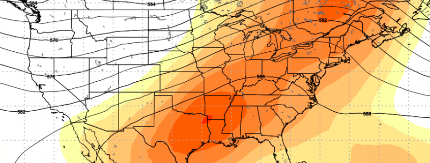
In the near future, a potent cold front is expected to gradually shift east/southeastward into the Great Lakes, eventually making headway towards the Eastern United States. This front will provide some temporary relief in terms of temperature for harvesting in the near future, and will have many thinking that fall weather is finally on the way — but not so fast. There is more to the forecast, suggesting that anomalous warmth could return very soon.

Read more

Irma a powerful Category 5 Hurricane moving toward Caribbean

Hurricane Irma maintained immense strength and power per this evenings 8:00pm National Hurricane Center Advisory, with maximum sustained winds of 185mph. The Hurricane is in the upper echelon of Atlantic-based storms, packing the second highest sustained winds on record since the satellite era of hurricane observations began. Irma will continue on a west/northwest heading this evening, on course for potentially catastrophic impacts in parts of the Caribbean.

Read more

Cool risks exacerbated by recurving typhoon in the Western Pacific

While much of the focus over the past few days has been on Hurricane Harvey, and rightfully so, another tropical cyclone will have an impact on the weather in the United States. We have spoken many times in the past regarding the importance of re-curving typhoons in the Pacific Ocean. These tropical systems can have major impacts on the mid level atmospheric patterns there, which eventually results in changes downwind over the United States.

Read more

Harvey Video Analysis: Significant Flooding in Texas Likely

Good afternoon! As we speak, Harvey has regenerated into a Tropical Depression and will soon become a Tropical Storm. It will continue to slowly move northwest over the next couple of days around the periphery of a ridge in the Gulf of Mexico. There are still a lot of uncertainties regarding its exact track and strength, but confidence is increasing in it strengthening to a strong Tropical Storm to a borderline weak Hurricane before making landfall somewhere in Southern Texas. But the big story will likely not be the winds from Harvey, but more likely the potential for significant flooding. The steering flow in the atmosphere is very weak, which will allow Harvey to essentially stall in Texas for multiple days, providing a strong fetch of tropical moisture directly into the Texas coast. All of the details can be found in our latest video:

Read more