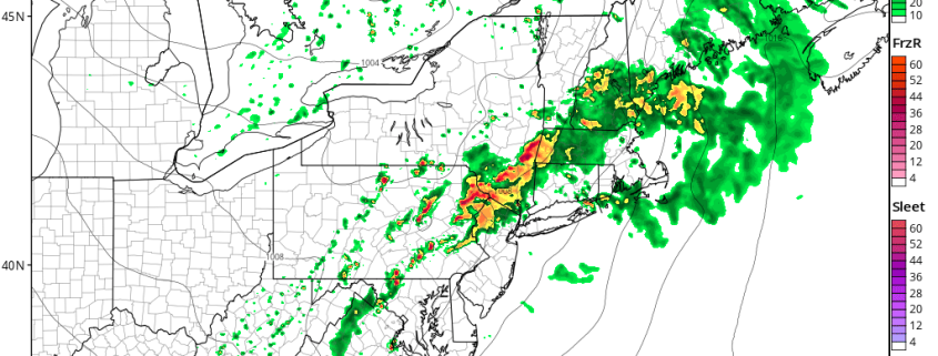
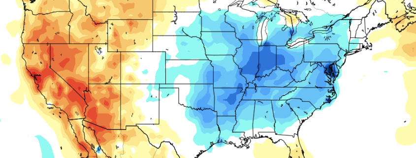
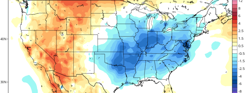
Cooler risks, Harvey concerns over the next week

A wonderful Tuesday morning to you, and thank you for joining us for our daily morning roundup. If you haven’t checked your email box for the latest details, we will (as always) lay them out in an understandable post-based format here. Today we’re jumping straight into discussion regarding the cooler risks in the weather pattern over the Central United States as well heightened tropical risks across the Western Gulf of Mexico late week and into the weekend.

Read more

Heavy Rainfall & Strong -Severe T-Storms Possible Today

Good morning! Happy Friday! More unsettled weather for today, as a frontal system and shortwave trough moves through during the day. Some scattered showers and thunderstorms are likely this morning, as warm front moves through the region. Instability is mostly weak or elevated. So the main threat with these showers and thunderstorms will be some heavy downpours, that could cause some localized minor flooding on roadways and poor drainage areas. Otherwise, later today, as the warm front lifts further northward, skies may clear for some sunshine by early this afternoon. This will help temperatures rise into the lower to middle 80s this afternoon. Except over Long Island and south-facing shores,  more southerly winds will keep temperatures from rising out of the mid-upper 70s.

Read more

Cool risks will return to Central US, September coming into view

Good afternoon! We hope we caught you in the middle of a great Thursday afternoon. To piggyback a bit on our overnight and early morning thoughts, today’s midday update will focus mostly on the evolving pattern across the Central and Eastern states over the next 5 weeks — much of which has come into better view over the past 12 to 24 hours. The weather pattern, largely, has been defined by an Eastern Pacific ridge and high latitude blocking anomaly over the past few weeks, which has led to cooler temperatures and troughing in the Central States and much of the AG Belt.

This pattern has lagged into this week, as a storm system developing over the Central Plains states again drags cold air into the Northern 1/3 of the USA and eventually the Ohio and Mississippi River Valley. Minneapolis, in fact, has seen temperatures below normal averages in 13 of the last 14 days! The well-established pattern is finally forecast to become more transient, as a ridge retrogrades from the Eastern Pacific westward into the Central Pacific.

Read more

PM AG Update: After Moderation, Cool Risk Returns

The retrogression in the Pacific has long been advertised, and it will certainly help a good chunk of the US modify in week 2, and into a decent chunk of the week 3 period as well, as a large ridge builds across much of the US. Now that we have this idea figured out with a decent amount of confidence, it becomes a bit easier to roll forward with expectations in the extended period.

While there will be a lot of modification taking place, the orientation of the retrogression will allow a large piece of a trough to break off in Canada and slide eastward towards the Great Lakes and the Northeast. Thus, despite the overall progression towards modification, there will be a decent shot of cool air for much of the Eastern third of the US to begin week 2, and a potential for a lot of rain to be focused in the Northern Plains, the Great Lakes, and parts of the Northeast in the midst of this trough’s arrival.

Read more