Weekly Outlook 11/22-11/28: Cold Start…Mild Finish

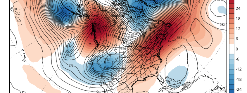
A cold front with limited moisture available will move slowly east of the region today. A wave of low pressure developing off the Southeast Coast will stay well offshore as well. However, our area will fall underneath the right-rear entrance region of a 130kt+ upper-level jet streak with an amplifying upper-level trough associated with the cold front. In simpler terms, this enhances lift in our region — aiding in the development of showers later today and tonight. A period of steady light or moderate rain is even possible for Eastern Long Island and Southern New Jersey, if the low offshore comes close enough.

With the offshore coastal storm aiding in the development of clouds as well, temperatures will stay generally capped in the 40s to lower 50s. Cold air advection increases during the day as well, which will bring temperatures down into the 30s and 40s by later this evening throughout the area.

Read more

The PDO, MJO and Their Potential Influence In This Upcoming El Nino Winter

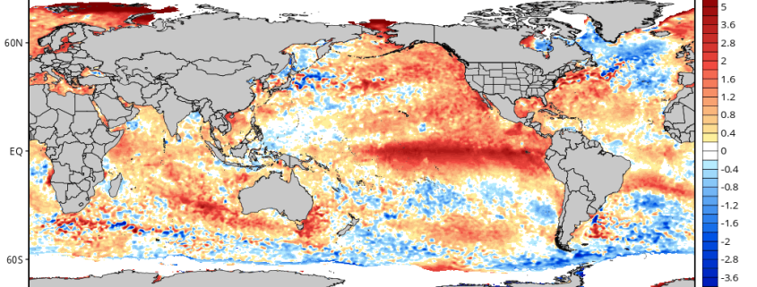
When a forecaster makes a seasonal outlook or forecast, he/she must consider all possible climate drivers and variables with teleconnections. Previous articles such as Monitoring the Stratosphere and The Importance of High Latitude Blocking in Upcoming Winter discussed the variables that were considered for our winter forecast, and how much weight was put into each. Now it’s time to look at some other climate patterns in Pacific.  For example, this year’s strong El Nino is something you probably have heard the most about.

There is little doubt that a strong El Nino has a large influence over the atmospheric pattern in the Pacific Basin. Some have used the term “Godzilla El Nino” to describe this year’s phenomenon; which, while catchy, could perhaps be unneeded sensationalism. Another common thought is that after 1997-98 — the last “Super” El Nino, which was an extremely warm and snowless winter — that this winter will also be very warm and snowless in the Northeast. However, there are other climate patterns in the Pacific that can still have influence, even in the midst of such a strong El Nino, which makes such strongly-worded conclusions about this winter not justified.

Read more

The Importance of High Latitude Blocking in The Upcoming Winter

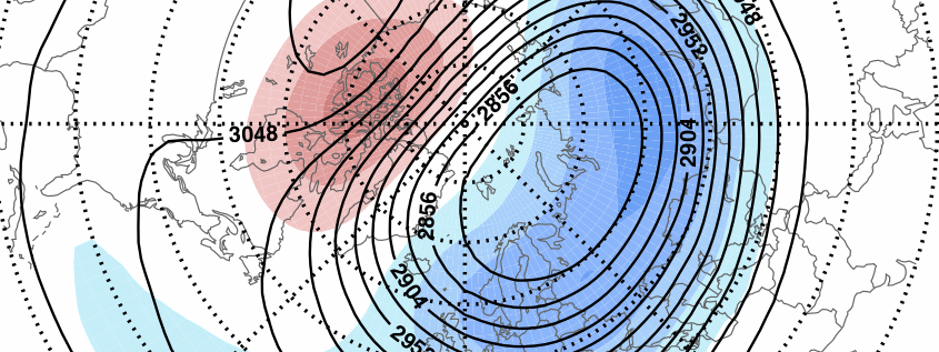
In our winter forecast, we discussed certain signals that supported high-latitude blocking developing for the middle and late periods of this upcoming winter. High-latitude blocking often comes with negative phases of the North Atlantic Oscillation (NAO), the Artic Oscillation (AO), and/or the Eastern Pacific Oscillation (EPO). High-latitude blocking is one most important factors in any winter forecast, as it typically supports colder temperatures and larger snowstorms for the Northeast US. This is an even more important factor in during a strong El Nino winter, as the Pacific or Subtropical jet is generally more active and stronger.

Research from Al Marinaro (@wxmidwest ) brought to light a strong correlation between the sea-level pressures in North Pacific and the NAO modality, during +ENSO (El Nino) winters. North Pacific sea-level pressures less than 1013 mb had a -NAO value on average for the December, January, February, and March period (DJFM). Sea-level pressures above 1013 mb during the month of October had either a positive NAO value or very close to netrual in the following winter. An official pressure for North Pacific reading has not been released for October yet. However, NCEP/NCAR reanalysis tells us that sea-level pressures were on average around 1010 mb over the region 65N-30 & 160E-140W in the North Pacific. That would be well-below the 1013mb threshold for a -NAO DJFM.

Read more

Monitoring the Stratosphere in November

Well, we’d be wrong not to mention that we are all rejuvenating from releasing our winter forecast for 2015-16. We hoped you all enjoyed reading it –whether or not it was what you were hoping to hear. It took a lot of collaboration, research, and efforts between all of us here to put it together.

In the upcoming days, we plan for a series of technical posts for our premium subscribers to explore more on important topics from the winter forecast. For this post,  we discuss more about Stratospheric Warming.

There’s been a high volume of discussion within the weather community regarding snow cover extent over Eurasia, and it’s potential foreshadowing of Sudden Stratospheric Warming (SSW) events, which may be correlated to a negative Artic Oscillation phase (-AO), 2 to 3 weeks thereafter.  According to the automated graph below, snow cover is now expanding and running close to 2009 at this time. As some of you may already know, the winter following that was featured colder than normal temperatures with above normal snowfall for December; and then same again in February. We also had a minor stratospheric warming in event in November, before a major SSW later in January and February.

Read more