Mild December Likely to Continue…Pattern Change for January?

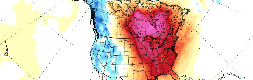
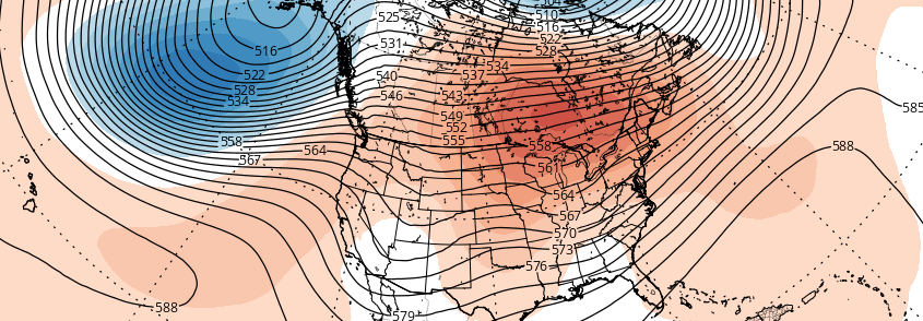
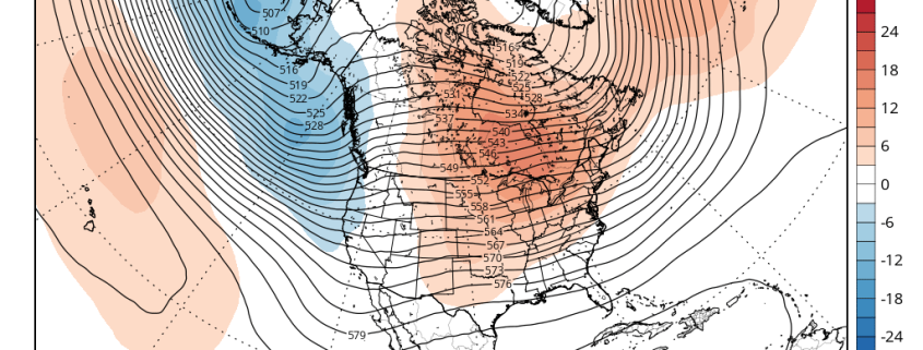
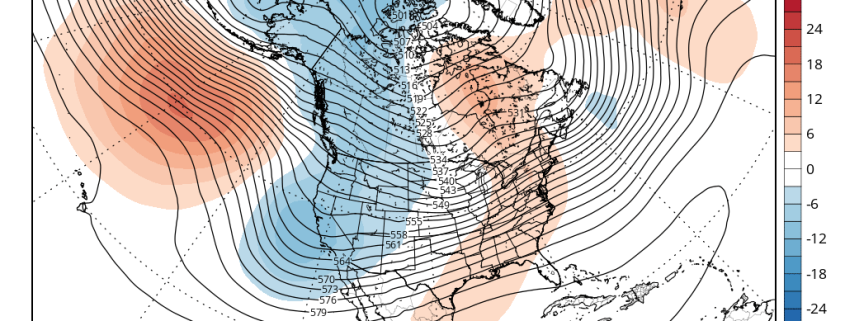
About one week into Meteorological Winter, much of the meteorological community is aware that the coming weeks are not likely to offer many wintry precipitation prospects. Our long range outlook will discuss the meteorological pattern for the upcoming 30 to 45 days. With an in depth look into meteorological patterns and the developing global circulations, we’ll explain the processes occurring that will drive our weather pattern through the rest of this month and into January.

Read more

December likely to be mild, Nor’Easter possible next week

Three days into Meteorological Winter, much of the meteorological community is aware that the coming weeks are not likely to offer many wintry precipitation prospects. Our long range outlook will discuss the meteorological pattern for the upcoming 30 to 45 days. With an in depth look into meteorological patterns and the developing global circulations, we’ll explain the processes occurring that will drive our weather pattern through the month of December and into the first 10 days of January.

Today we discuss the middle of December and look more into pattern between X-mas and New Years.

Read more

Long Range Outlook: Active Pattern in December. But Will it Snow?

Meteorological winter is just one day away, and while snow lovers are beginning to get excited, much of the meteorological community is aware that the coming weeks are not likely to offer many wintry precipitation prospects. Our long range outlook will discuss the meteorological pattern for the upcoming 30 to 45 days. With an in depth look into meteorological patterns and the developing global circulations, we’ll explain the processes occuring that will drive our weather pattern through the month of December.

Read more

Long-Range Outlook: Late November and December; December 1 Storm Threat

Welcome to our long-range outlook for the next 30-45 days. We hope to provide these outlooks with more in-depth analysis and discussion about every Monday and Thursday. The discussion is divided into several topics to cover all aspects of the model guidance and climate indicators.

For today, we discuss the overall pattern and what to expect going into late November and through much of December.

1. Model Guidance Discussion

The 500mb pattern this week will feature a North Atlantic ridge being suppressed by a deep polar vortex developing over Greenland and Iceland. This is a classic +AO/NAO pattern that typically supports a strong ridge for the East Coast. A -EPO ridge forming over the the Northeast Pacific and Alaska will cause a trough to dig into the Western US. In response, a ridge will build over the Central and Eastern US.

Read more