-2")
Public Analysis: Record-breaking Warmth Gives Way To Seasonable Weather
Today has been yet another absolutely beautiful day with scattered clouds and light winds making for an excellent and unusual end to another February workweek. After a cold front and possible associated line of showers and thunderstorms move through tomorrow, a return to more seasonable temperatures is likely.
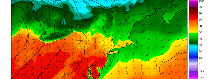
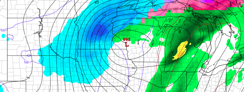
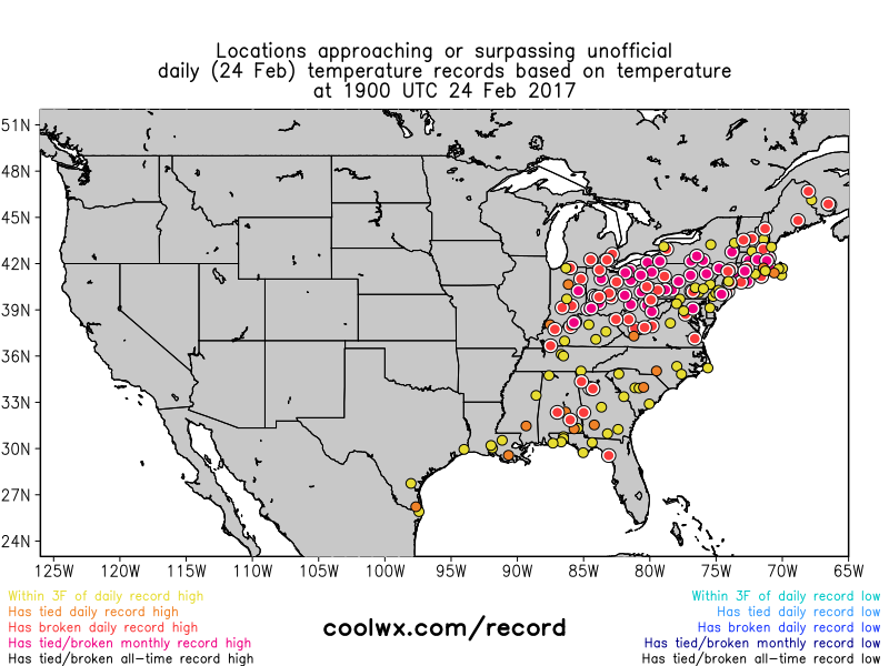
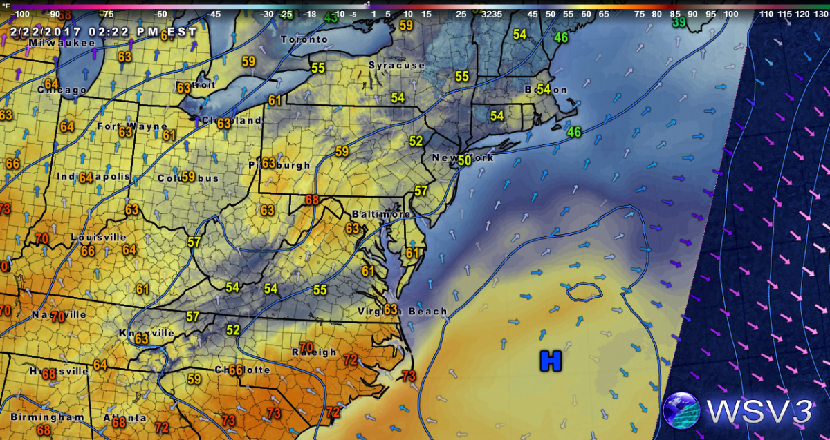
Temperatures this afternoon have soared into the low to mid 70’s across much of the area. with coastal locations along Long Island and Connecticut seeing temperatures a bit lower in the mid 60’s. As was mentioned as early as Monday, these temperatures are 25-35 degrees above normal for this time of year, and as a result, numerous monthly high temperature records are falling across the entire Northeast. All of this warmth has been caused by a high pressure system over the western Atlantic that continues to provide winds out of the southwest that will continue through this afternoon. As we progress through the afternoon and into the evening, the persistent ridging and attendant high pressure system will begin to give way to a stronger mid-level disturbance currently located over the central Plains this afternoon. (This system is also responsible for the marginal severe threat in the Ohio Valley this afternoon and evening-see our Severe Analysis for more on this event)
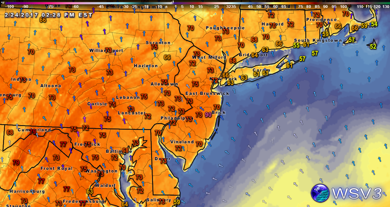
A look at the record-breaking temperatures across the metro area this afternoon
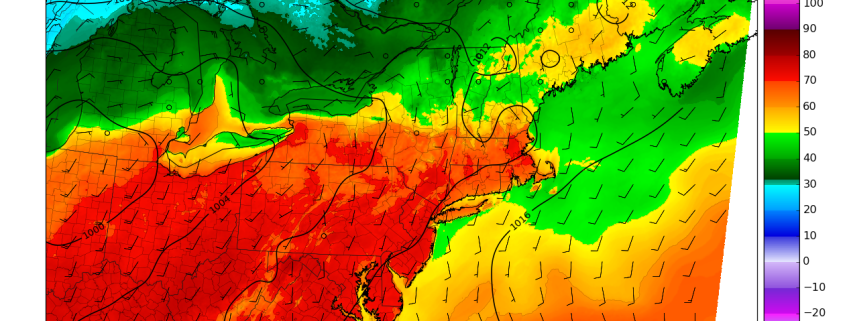
As the influence from this system increases later this evening, the amount of moisture available in the atmosphere will also increase. This low level moisture will become trapped underneath a temperature inversion, which will act as a “lid”, and enhance the possibility for some dense fog for coastal regions this evening and lasting into early tomorrow. This moisture should linger into the morning hours, with low level clouds and even some patchy drizzle taking place in the areas that have more available moisture to work with. As we move into Saturday afternoon, temperatures should not be as warm as today as winds from the southeast start to work into the metro and limit highs to the upper 60’s for inland locations and 50’s for the coast. Some locations that are stuck underneath prolonged low level clouds tomorrow afternoon will also struggle to really warm up too much tomorrow afternoon.

HRRR model showing limited surface visibility tomorrow morning due to low clouds and fog (Valid 7am)
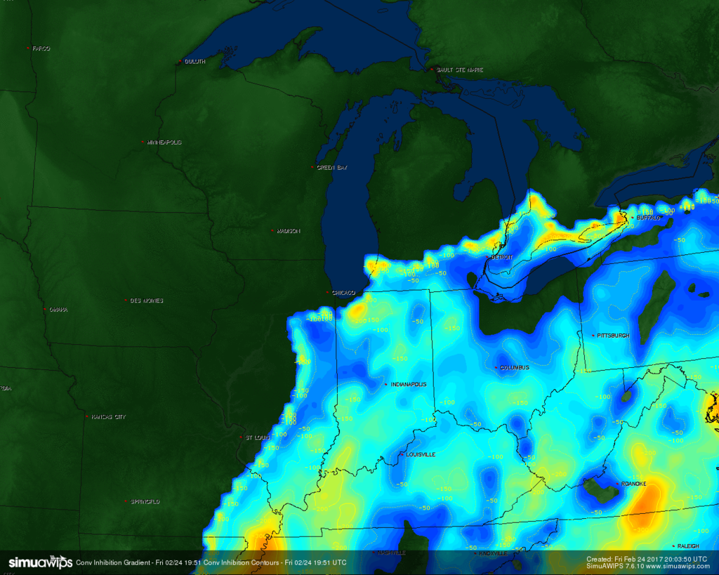
The main story tomorrow will be a cold front advancing eastward from the Ohio Valley and into Pennsylvania by tomorrow afternoon. Due to some limited instability as well as some lift provided by the upper level jet overspreading the area, a line of showers and thunderstorms will likely develop over Pennsylvania early tomorrow afternoon and quickly race eastward. As this line of thunderstorms reaches eastern Pennsylvania, southern New York, and New Jersey, what limited instability and dynamics that this line had to begin with will gradually fade. As a result, by the time the line of showers and thunderstorms reaches our area they should begin to weaken quite a bit. Heavy downpours, some brief gusty winds, and even some thunder are all possible, especially across inland zones.
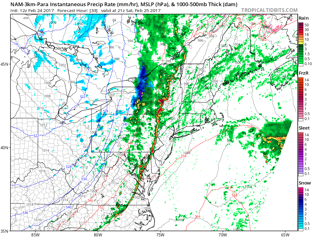
3km NAM showing line of thunderstorms and associated showers along the cold front (Valid 3pm Saturday)
After the front moves through late tomorrow afternoon/evening, some lingering showers will be possible as temperatures begin to return to seasonable levels, and then even back down to below-normal temperatures by early Sunday morning. Although this below-normal period of temperatures appears to be short-lived, it should be quite the contrast from what we have seen over the past week or so. Once we get into the upcoming work week, temperatures should hover around normal to slightly above-normal with the chance for a few weak disturbances passing near our area to provide some precipitation for the area starting on Monday. This unsettled weather will continue for the rest of the week, but as we move on in time, long range guidance is beginning to indicate that the very fast flow that has prevented a few significant winter storms this season will begin to relax. This could possibly lead to at least some cooler weather and possibly a full return to winter by March. Make sure to stay tuned for updates on tomorrow’s possible heavy rain threat as well as the evolving long range pattern! For more information and posts like this one, make sure you sign up for Zone Forecasts — where multiple detailed articles, videos, and interactives are posted each day.
Have a great weekend!