-2")
NYC Area Forecast: Colder, active pattern arrives late week
After a very warm start to Autumn, which featured temperature several degrees above normal essentially from late September through the middle of October, the weather pattern is set to change. You can thank the North Pacific Ocean for that – while just one of many factors responsible, it is a big one – as the large scale wave pattern (ridges, troughs, etc) is changing dramatically there. Eventually, these changes make their way toward the Lower 48.
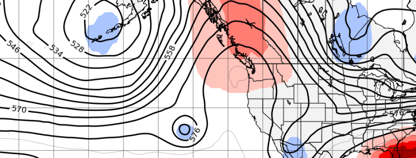
Most notably, a large ridge is forecast to develop from the Pacific Northwest into British Columbia and other parts of Western Canada. The poleward reach of this ridge will be impressive and quite anomalous, with 500hPa (mid level) atmospheric heights running well above normal. As this ridge pushes northward, it will disrupt the higher latitude weather pattern, sending colder air surging further southward into Eastern Canada, the Great Lakes and Northeast.