PM Update: Calm, cool weather ahead of weekend Nor’Easter

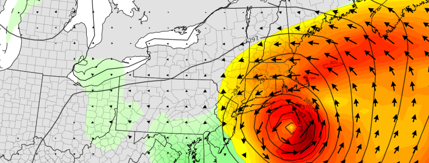
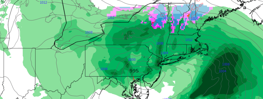
Generally calm and cool weather is expected to continue over the next few days, with plenty of sunshine throughout the Northeast states and temperatures solidly below normal for this time of year. Building clouds on Friday will be the first sign of an impending storm this weekend, with a significant Nor’Easter expected to develop from late Friday Night into Saturday. Heavy rainfall, strong winds and moderate coastal flooding are all expected in the Mid-Atlantic, with even some wintry precipitation on the front end of the storm in the higher elevations of New England.

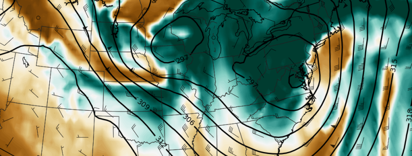
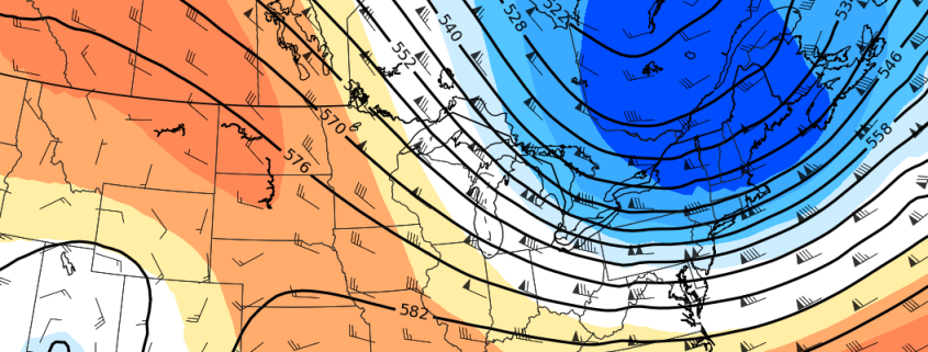
The system is forming several days after the potential for its development was first discussed. A highly anomalous pattern in the atmosphere, including the presence of blocking ridges of high pressure in Canada, set the stage for the storm. For meteorologists, these “warning signs” are important to catch, as they can provide enhanced lead time for storm development.

Read more

NYC Area Forecast: Nor’Easter increasingly likely this weekend

A colder than normal pattern has become well established throughout the Northeast states over the past few days – in case you haven’t noticed yet -and will remain established for the remainder of the week. In fact, a low pressure system is expected to strengthen in the Gulf of Maine later tonight into Wednesday, producing the first accumulating snowfall of the season for parts of Maine.

Meanwhile, the weather pattern across the Central and Southern United States is forecast to become more amplified. Forecast model guidance suggests that a few disturbances will eject southeastward from the Pacific Ocean into the Central United States, and a second disturbance will linger off the Southeast Coast. The interaction of these two features will aid in the development of a low pressure area off the Southeast US coast by Friday.

Read more

NYC Area Forecast: Cool, transient weather ahead of potential weekend storm

An active and colder weather pattern appears likely to continue for at least the next week, and it may be capped off with a large storm system as its grand finale this coming weekend. The pattern has been well advertised, and it arrived with some fanfare – a few strong cold fronts over the past few days have brought a myriad of hazardous weather to the Northeast states. Sunday featured the first real brisk, cold day in a while with a deep northwesterly flow and even a few lake effect snow/rain bands streaming into the Catskills.

Speaking of cold air, Freeze Warnings and Watches were in effect for fairly large majority of the region through Monday AM where the growing season had not yet ended – for many areas, it has now concluded. If you are in an area where it has not ended, or continue to leave plants outdoors, take care of sensitive vegetation – and yourself (bundle up!) during the next few days.

Read more

NYC Area Forecast: Freeze watches issued as coldest air of season arrives

The coldest air of the Autumn so far is set to arrive in the Northeast US later tonight through Thursday, as a piece of the polar vortex swings through New England. The anomalously cold airmass will only deliver a parting shot, but it will be sufficient to temporarily usher in the coldest air of the season to date. Temperatures will fall into the 20’s and 30’s throughout the Northeast states, with wind chill values in the 20’s even in the NYC Area.

The National Weather Service has issued Freeze Watches and Freeze Warnings for parts of the interior that have not yet received a hard freeze or ended their 2018 growing season. Blustery winds are expected to preclude or inhibit the formation of frost, but wind chill values in the 20’s will create harsh conditions for any remaining vegetation.

Read more