-2")
Dry and Seasonable Pattern Holding On, Substantial Changes Looking More Likely Next Week!
Good Evening!
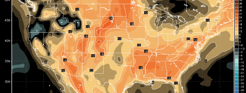
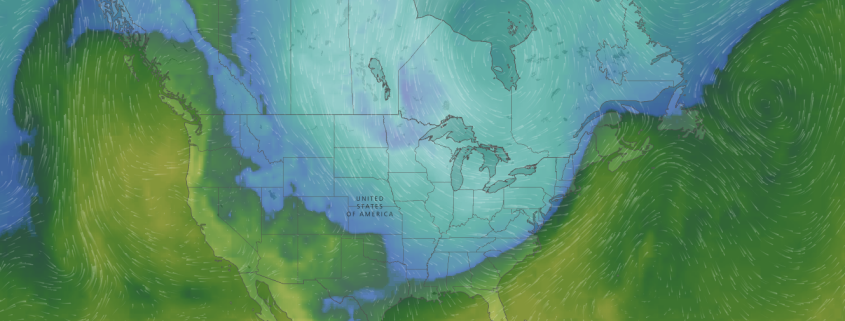
Today was the warmest in a series of mild days across the entire Northeast. Dry air in the mid levels of the atmosphere was quite abundant this afternoon, and this dry air helped to mix the warmer mid level temperatures down to the surface with stout northwesterly/westerly flow. Mostly sunny skies and light winds helped much of the region see highs rise into the well-above normal values this afternoon, with many stations across the Northeast breaking the 60 degree mark. In fact, some stations across portions of Long Island and southern New Jersey saw readings in the middle 60’s, which is a good 10-15 degrees above normal for this time of year! As the day progressed, we had a weak cold front with extremely limited moisture push through the Northeast. This front was weak enough that surface temperature did not/have not immediately responded as the main cold air pool is located well behind the surface front. High pressure is gradually building into the Northeast this evening, with the onset of cooler temperatures finally reaching northern portions of New York and New England where temperatures have since fell off into the low to middle 30’s.
The rest of this evening should be quiet, with winds shifting to more northerly/northwesterly. As this happens, conditions will be rather good for efficient radiational cooling to take place across much of the Northeast. This should allow for lows to drop into the middle to lower 30’s across much of the area, with middle to upper 20’s possible further north and west.
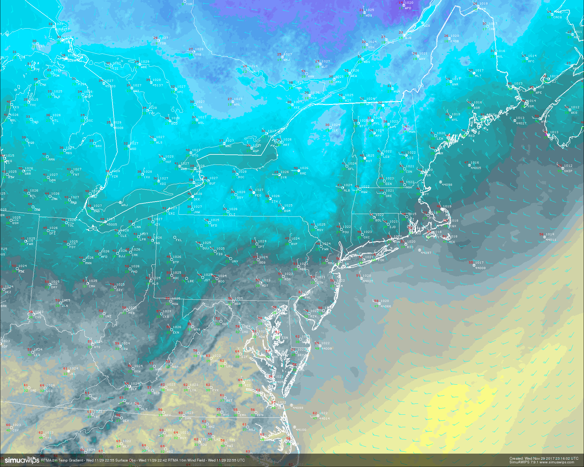
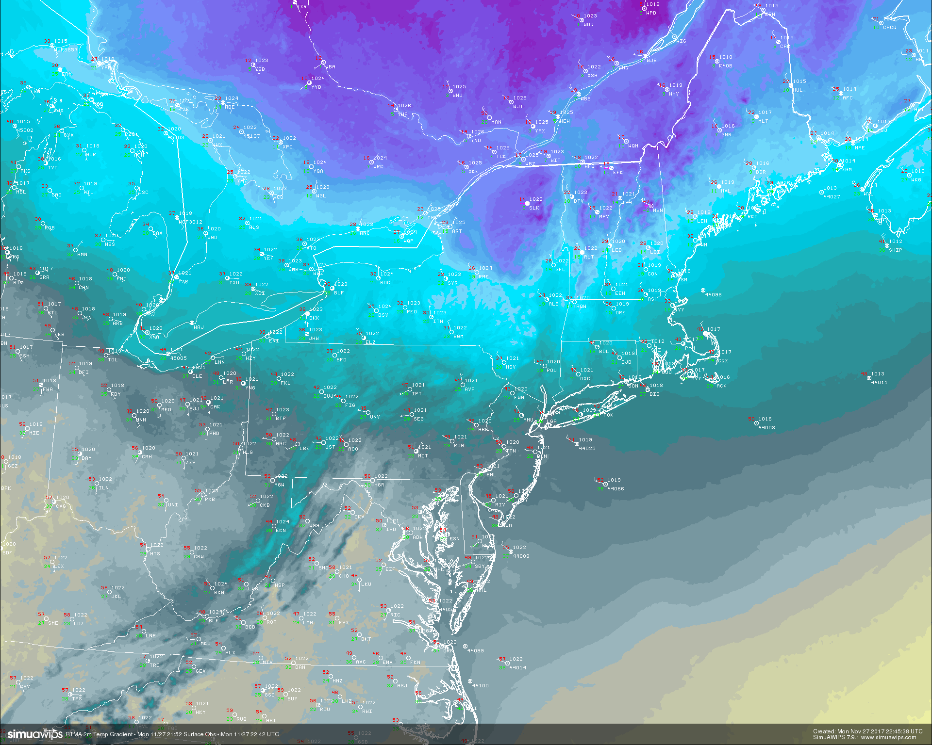
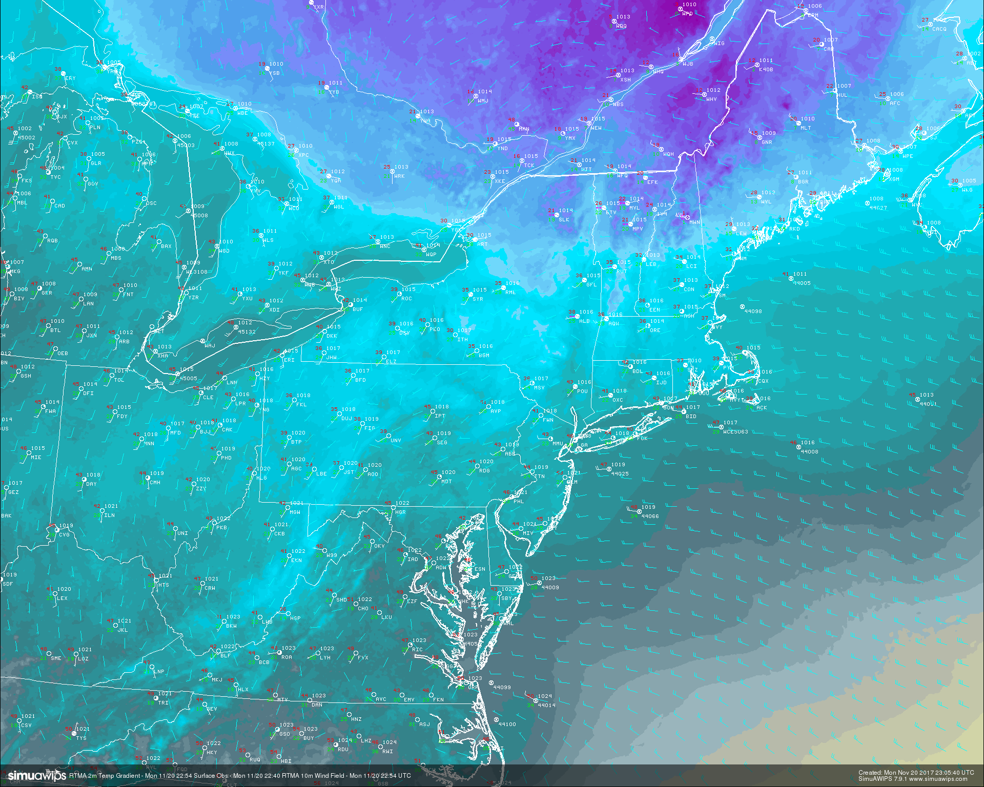
This evenings Real Time Mesoanalysis showing surface temperatures and surface observations across the Northeast. Temperatures are gradually becoming cooler from north to south across the region as a cooler airmass works in (Courtesy of Simuawips)
Thursday and the Weekend
Thursday should start off a good deal cooler than Wednesday did, but as the area of high pressure currently located over Canada quickly moves offshore, we should see offshore flow overspread much of the Northeast, leading to increased temperatures and available moisture. As this high quickly rockets east, a shortwave trough will also be quickly heading east, embedded in the fast west to east zonal flow over the country. This disturbance should be located over the Great Lakes region by tomorrow afternoon, with a cold front extending southward. Unlike the past few fronts, this one may be able to tap into some moisture lingering over the Gulf of Mexico, which should allow the front to be a bit more active with showers likely along the front. As we head into tomorrow afternoon, southwesterly flow should be rather stout at the surface as well as the mid levels, ushering warmer mid level temperatures as well. With the increased low level moisture from the offshore flow, there may be more clouds than sun across portions of the Northeast, but we still expect temperatures to still reach into the upper 40’s to lower 50’s. This should be right around normal for this time of year, but some locations to the south of the NYC area may see readings into the middle 50’s.
By tomorrow evening, the cold front should begin to move through the Northeast with light to occasionally moderate rain likely. The rain along this front should be limited due to the overall dry mid to upper level conditions and quick movement of the upper level system. With clear conditions behind the front expect temperatures to generally fall into the lower to middle 30’s across much of the area, with colder readings to the north and west.
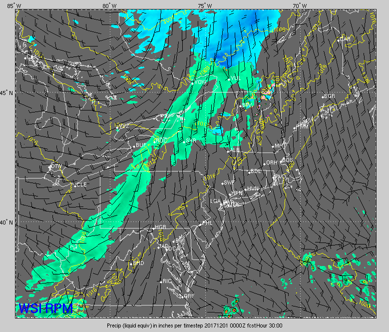
This evenings RPM model showing the progression of the weak cold front moving over the Northeast tomorrow evening. Only light rain accumulations are expected (Courtesy of WSI)
Another high pressure will build into the Northeast by Friday morning, bringing in renewed northwesterly flow and slightly cooler temperatures in the mid levels. The vast majority of the day should be dry, but a couple of spotty showers may be possible around Long Island and Connecticut as some residual energy behind the aforementioned cold front moves over the area. Highs will likely stay around normal for this time of year, with readings in the middle to upper 40’s-with a couple of locations reaching 50 possible. Friday night looks to be a calm and clear evening with radiational cooling likely, so we expect lows to drop down into the upper 20’s and lower 30’s across the immediate NYC metro area. Areas farther north and west could see lows drop into the middle 20’s if conditions allow strong enough cooling to take place.
Saturday and Sunday look rather quiet and seasonable, with highs likely staying in the upper 40’s to lower 50’s range. The only real chance of precipitation may come on Sunday night when a sloppy mid level piece of energy moves quickly eastward from Canada. This system looks to be rather moisture-starved, so it does not appear to be of major concern at this time.
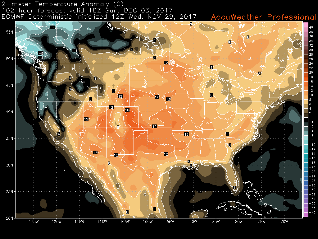
This afternoons ECMWF model showing above normal temperatures persisting across much of the country this weekend as a mid level ridge builds in.
Substantial Changes Likely Next Week!
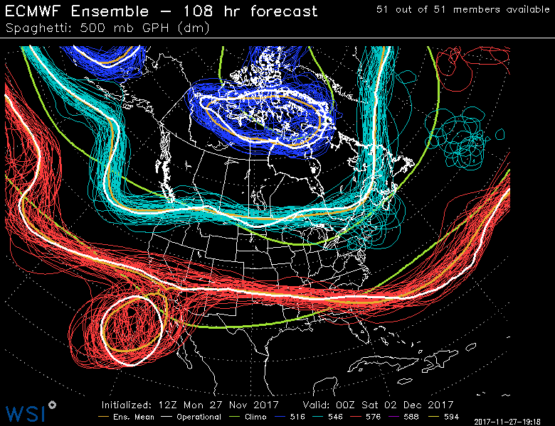
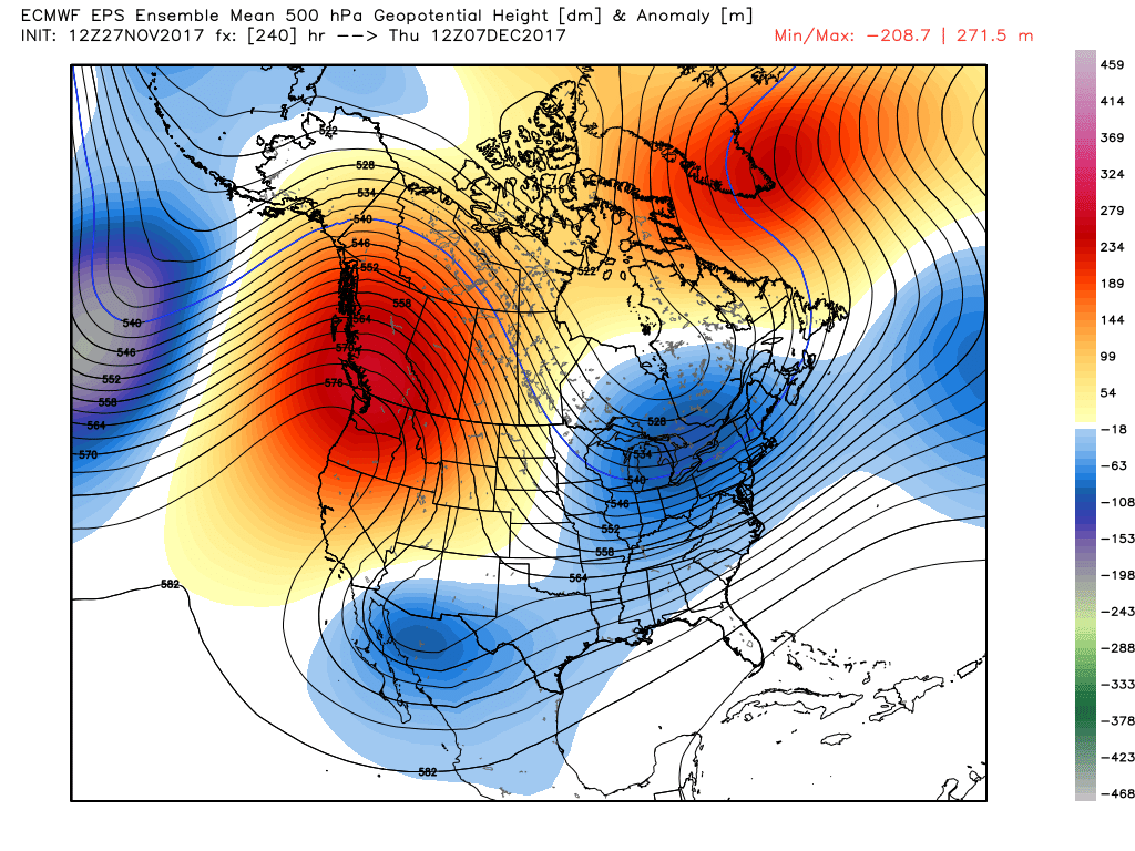
We have been watching the pattern for the upcoming week very closely for the past seven days or so, and it seems like with every successive model run, things continue to look more and more interesting for a major pattern change to take place in this time period. By the middle of next week, we should begin to see the development of a major ridge over the west coast of the United States, which should extend deep into Canada. This ridge is whats referred to as a “PNA ridge”, and when coupled with the right ingredients, can lead to a very cold and potentially stormy pattern across the United States. As this ridge gets stronger as time goes on next week, it will begin to send Arctic air from the far northern regions of Canada and even Russia into a building trough which will likely be located over the central part of the country.
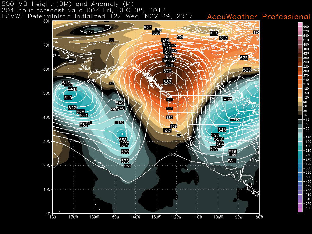
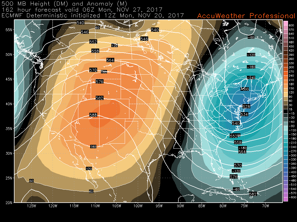
This afternoons ECMWF model showing a very impressive area of mid level ridging going up over the west coast and deep into Canada. This pattern is highly supportive of colder weather in the east.
Another key ingredient of this pattern change will be increased high pressure/ridging over Greenland (a negative NAO), which will help to slow down the trough in the central/eastern US. This is very important as it will allow the Arctic air to pour in and build as it moves east. Model guidance has been very consistent on these ingredients taking shape, and have even been strengthening them to a degree as we get closer in time which is extremely important for this pattern to actually come to fruition. With the ridging in the west and in the east, the pattern becomes “blocked up”, meaning that systems have a chance to slow down and amplify, which is the exact opposite of the pattern we are currently in! This means that there will be an increasing storm threat for the eastern half of the country starting late next week and into the middle portion of December. At this point in time, it seems that below-normal temperatures are very likely in the 8-14 day period across the central and eastern parts of the country, and possibly extending deep into the month. In summary, it appears that starting next week we will see major changes taking place across the hemisphere that could gradually push us into a classic winter pattern for the month of December! We’ll have more on this pattern as new details arise!
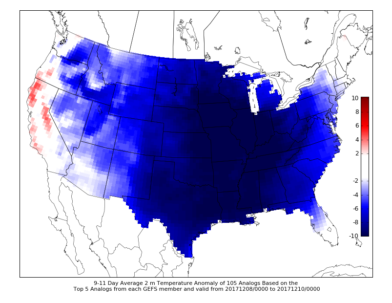
University of Wisconsin CIPS analogs based on the GEFS showing extremely high probabilities for below normal temperatures starting as soon as next week!
For more information and posts like this one, make sure you sign up for Premium Forecasts — where multiple detailed articles, videos, and interactives are posted each day. Also, come interact with our staff and many other weather enthusiasts at 33andrain.com!
Have a great night!
Steve Copertino