-2")
PM Rain Exits, Storms and Cooler Weather Possible This Weekend!
Good Evening!
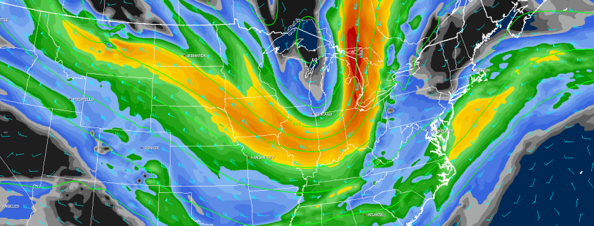
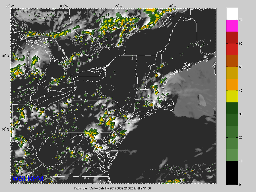
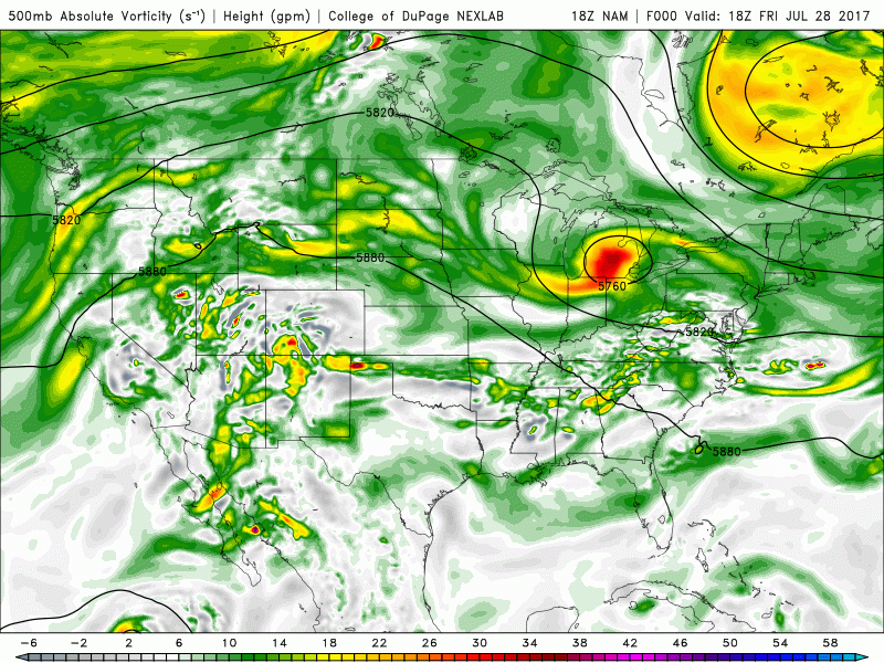
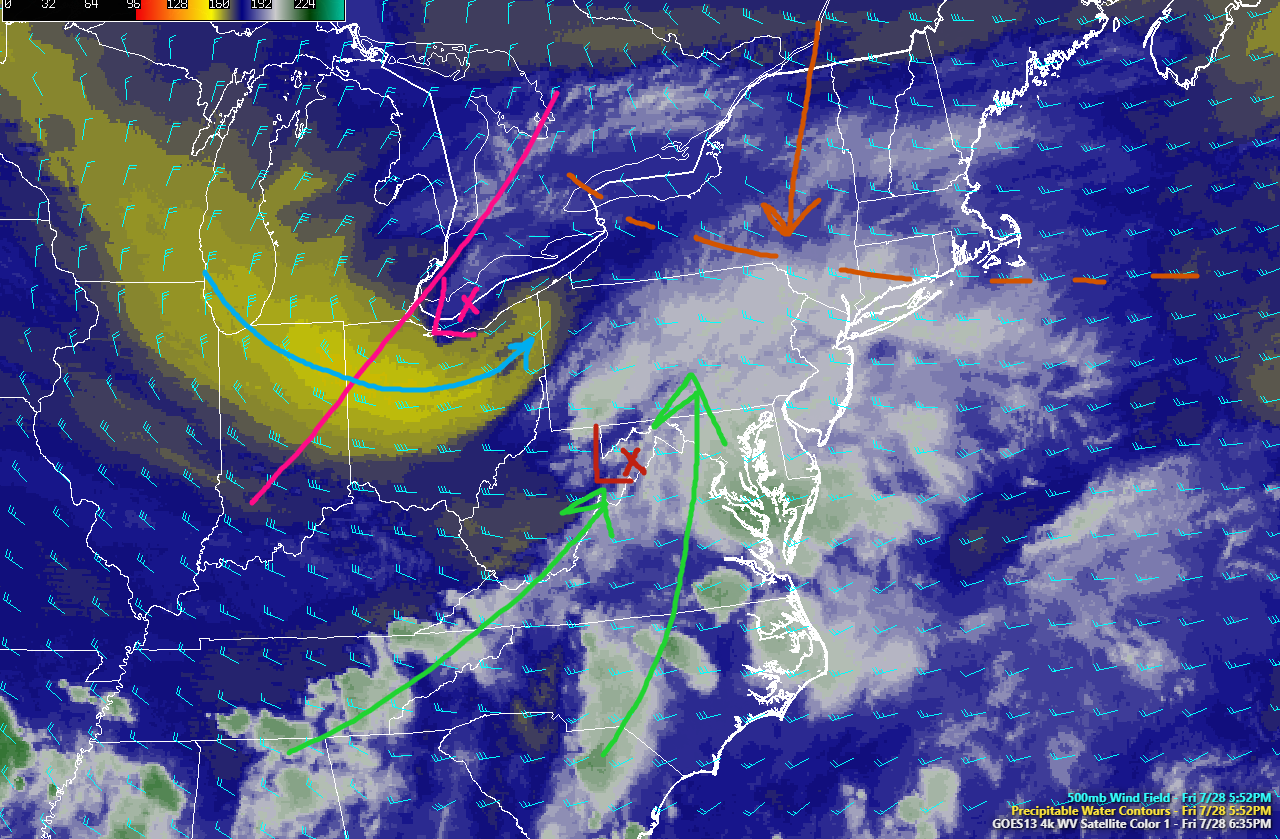
After a relatively hot and humid day across the entire Northeast and Mid Atlantic regions, we have seen large-scale thunderstorm development courtesy of the mid level shortwave that we discussed back on Monday. This shortwave was located to the west of the area, and with CAPE values of around 2000-3000 j/kg^2, PWATS near 1.5″, and strong low level lapse rates, the weak amount of energy associated with the disturbance was more than enough to set off numerous showers and thunderstorms around 2pm. Due to a significant lack of vertical wind shear, these storms were not able to move all that much from where the initial updrafts formed, and thus most cells rained themselves out over time. However, when these updrafts collapsed and the rain cooled air rapidly sunk to the surface, it created new boundaries which served to provide breeding grounds for renewed storm development. In some locations we saw this happen three to even four times over, which caused serious street flooding.
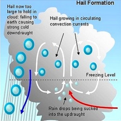
In addition to the street flooding, cool/dry air aloft allowed for some of the more robust thunderstorms to develop marginal to severe hail stones, with some reports of stones reaching the 1.75″ mark! Some folks may have noticed that these storms were also producing a cooler rain than one would expect during August, and this also can be attributed to the cooler air aloft. These drops were whats know as “Big Drops” (I know, very creative) and form when an updraft just isn’t able to keep ice suspended long enough to freeze sufficiently to reach the ground as hail. However, a few thousand feet up in the atmosphere, these drops were frozen, and when they crashed into one another, they create a negatively charged particle in the atmosphere, called an electron. When enough of these electrons build up in an updraft, they connect with positively charged particles (protons) at the surface, the path they take to get to one another creates lightning! With a ton of ice in the atmosphere from numerous updrafts this afternoon, there was a very impressive amount of lightning that went up across the area. Some of this lightning even caused damage to houses and property, with some areas losing power. Otherwise, today’s storms mainly posed a very heavy rain, lightning, and gusty wind threat.
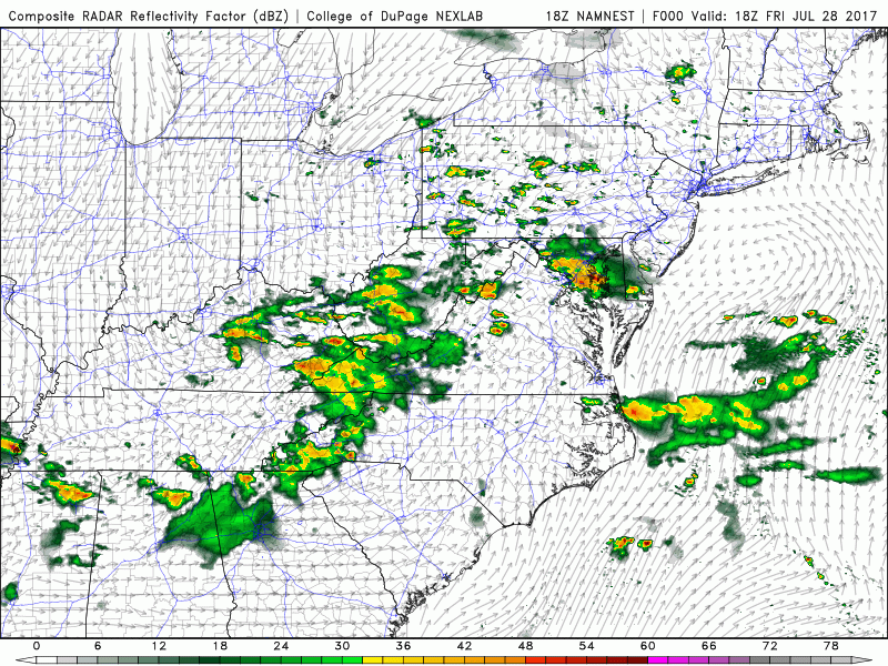
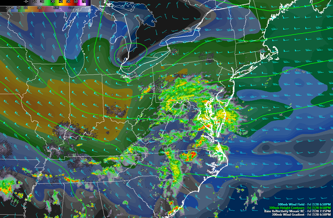
As of six o’clock this evening, most of the showers and thunderstorms that formed early this afternoon were finally beginning to wind down. Lightning activity over the area has greatly weakened over the past hour or so, and this also points towards a gradual dissipation of the rest of the thunderstorm activity. As this time, we think that the heaviest showers and thunderstorms should dissipate by sundown, with only a few lonely cells remaining thereafter. Some residual cloud cover is likely as we head into the overnight hours, and this will help to keep overnight lows rather mild, with temperatures dropping to around the low to middle 60’s.
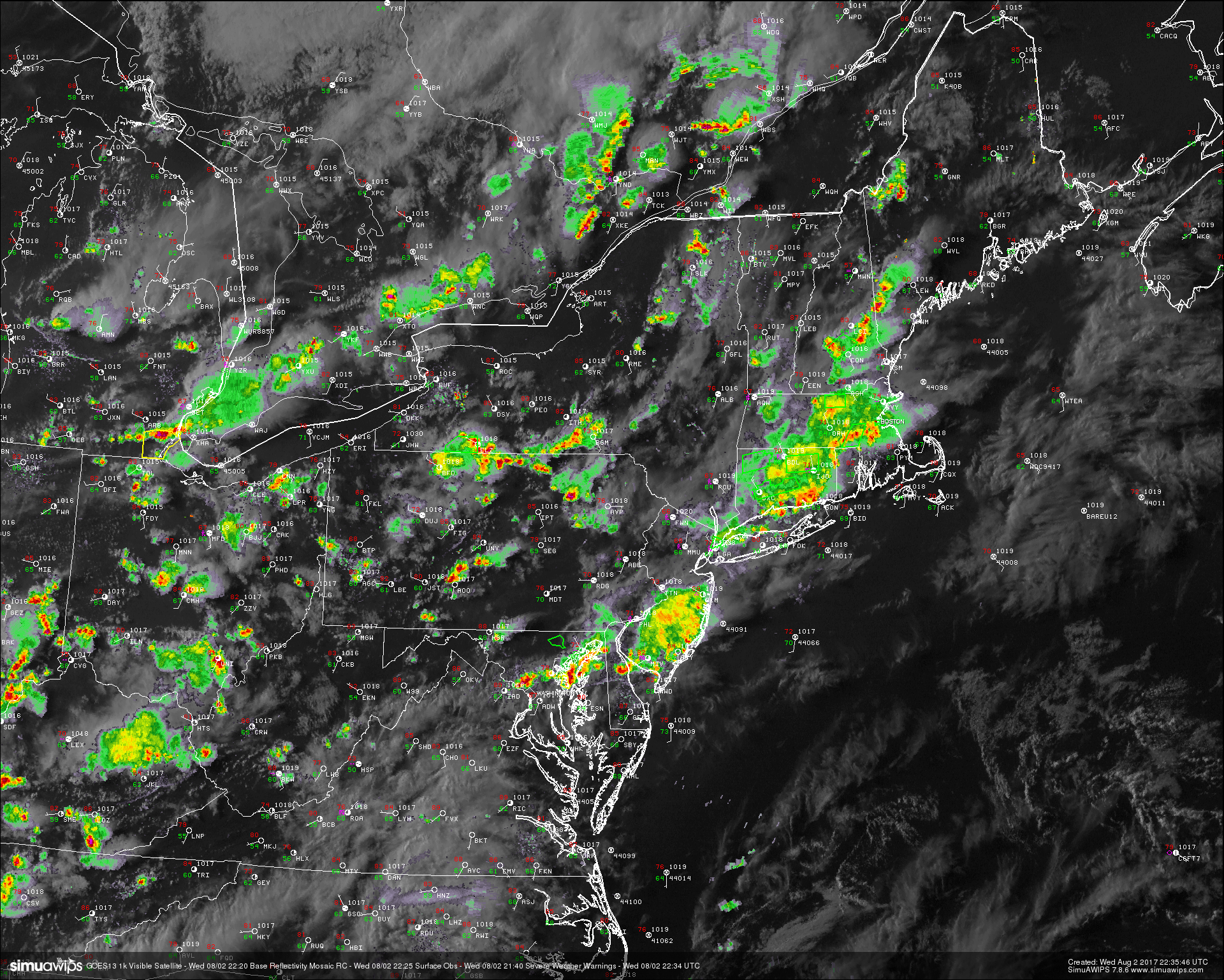
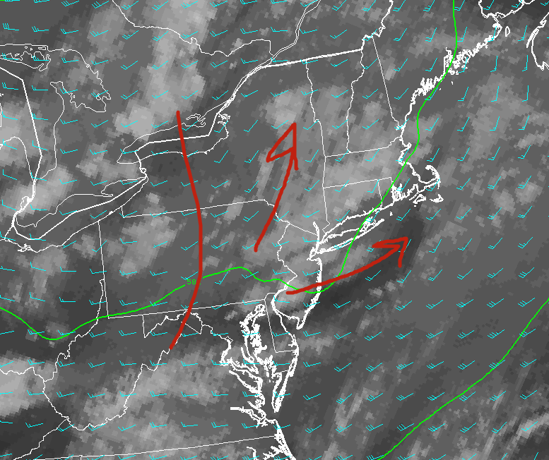
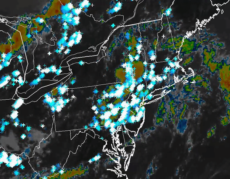
This evenings latest regional radar. high resolution visible satellite, surface observations. and severe warnings, showing the bulk of the heavy rain dying off. This trend should continue as we head deeper into the evening (Courtesy of Simuawips)
Thursday and Beyond
Thursday should start off just as the past few days have, with any low clouds quickly burning off by the mid to late afternoon hours. This will allow afternoon temperatures to climb significantly during the afternoon hours, with highs likely reaching the middle 80’s to lower 90’s across the area. With a moist airmass in place tomorrow, we should see the region destabilize once again by the mid to late afternoon hours, similar to as we saw today. The main difference will be that tomorrow does not look to have a coherent area of forcing to initiate thunderstorm development, so any thunderstorms tomorrow afternoon will likely have to rely on convergent boundaries from local sea breezes. This activity will likely be limited to a heavy rain and lightning threat given the lack of favorable parameters for anything outside of heavy thunderstorms. Storms should gradually fade tomorrow evening, leaving generally mild and humid conditions in their wake.
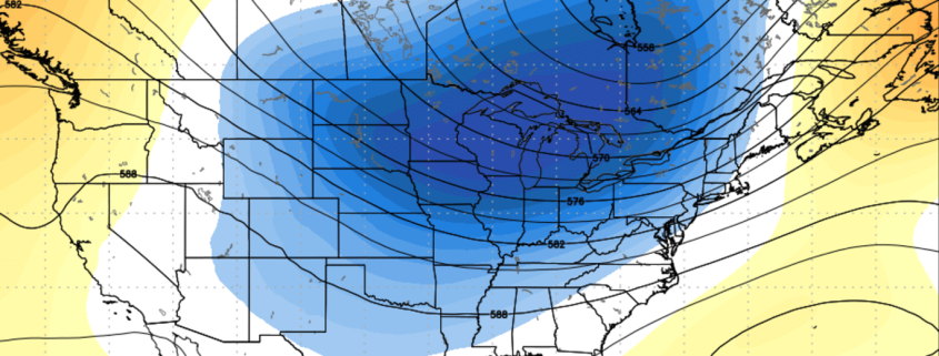
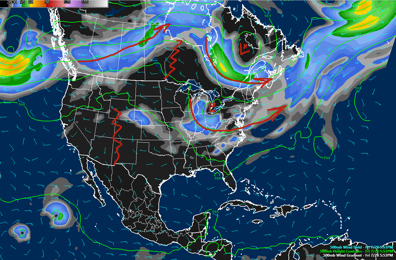
As we head into the first half of the weekend, a large shortwave trough diving out of Canada will provide a threat of heavy rain and possibly some thunderstorms over the area as moisture begins to surge north from the Gulf States. This system will be watched closely, as it does have a very favorable upper level jet streak which could potentially enhance a heavy rainfall threat over our area. A strong cold front looks to push through late Saturday and into Sunday, which should bring not only cooler temperatures to our area, but also much lower humidity compared to what we’ve been seeing-which should make for an enjoyable end to the weekend!
Now here’s a sample of what our Premium clients get with a special video discussion with Doug Simonian!
(Detailed Discussion With Doug Simonian)
For more information and posts like this one, make sure you sign up for Premium Forecasts — where multiple detailed articles, videos, and interactives are posted each day. Also, come interact with our staff and many other weather enthusiasts at 33andrain.com!
Have a great evening!
Steve Copertino & Doug Simonian