Heat builds, severe thunderstorm risk increases

As a mid level ridge builds throughout the eastern half of the nation today, temperatures in the mid and low levels of the atmosphere will increase. South of a warm front, which is organizing and becoming more well defined to our north, west-southwesterly winds will begin to usher in the warmer airmass. Mid level temperatures (at 850mb) will warm over 17 C, and with sunshine expected during the afternoon hours on Tuesday, temperatures will warm into the upper 80’s to lower 90’s. When coupled with increasing humidity, it will feel hot and quite muggy.

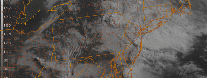
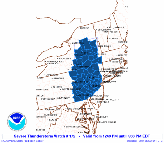
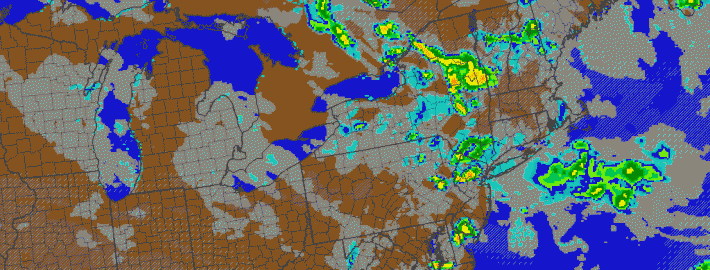
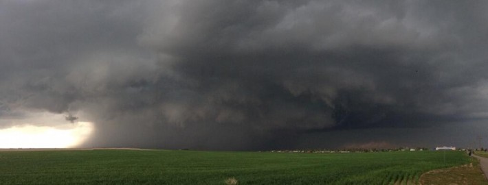
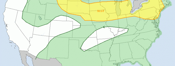
Back to our west-northwest, a mid level disturbance will be riding along the northern periphery of the building ridge axis. As it does so, it will help to trigger the development of thunderstorms — some of which could be strong to severe. These storms will initially form well to our north and west, but are expected to slide east-southeastward through the Northeast States as the disturbance shifts accordingly. Subsequently, the Storm Prediction Center has placed much of the area in a Slight Risk for severe thunderstorms.

Read more

Strong to severe thunderstorms possible this afternoon

1:00pm Update: The NWS Storm Prediction Center has issued a Severe Thunderstorm Watch for Northern New Jersey and Southeast New York until 8:00pm tonight. Thunderstorms are expected to develop over the next few hours and shift southeastward through New Jersey and New York. The combination of developing instability, a nearby frontal zone, and a disturbance aloft will aid in organization of storms. Thunderstorms will be capable of producing frequent lightning, hail, and strong winds.

Severe Thunderstorm Watch graphic from the Storm Prediction Center. Blue highlighted counties are included in the watch.

Severe Thunderstorm Watch graphic from the Storm Prediction Center. Blue highlighted counties are included in the watch.

The Storm Prediction Center has placed much of the area in a Slight Risk for severe weather on Thursday, including much nearly all of New Jersey. The Slight Risk area runs to about New York City and Western Long Island northward through Southeast New York and near the Connecticut border. A Slight Risk is issued by the Storm Prediction Center when organized severe thunderstorms are possible, in this case there is a 15 percent chance of gusty winds or hail within 25 miles of any point within the Slight Risk area.

Read more

Thunderstorms with gusty winds, downpours Thursday

Update: The Storm Prediction Center has placed our area in a Slight Risk for severe thunderstorms today (Thursday). Stay tuned for further updates and information including a live blog post.

As a mid level disturbance moves toward the area on Thursday, a frontal boundary and convergence zone will shift near the area during the late morning to afternoon hours. The combination of the two, when juxtaposed with daytime heating and some instability, will lead to sufficient lift to develop thunderstorms during the afternoon hours. Accordingly, the Storm Prediction Center has placed parts of the area in a “Slight Risk” for severe thunderstorms.

The threat for strong to severe thunderstorms is likely to be focused west of the area beaches and shores, but heavy downpours and thunderstorms are still possible there. Farther west, over the interior parts of New Jersey and New York, more focused instability and southerly winds are more likely to work with marginally favorable wind fields to help develop thunderstorms. These storms will be capable of producing very heavy rain, frequent lightning and possibly even some small hail and gusty winds.

Read more

Incredible photos of hail accumulation from Colorado supercell

A large supercell, which formed and moved near Denver eastward past Aurora earlier on Wednesday, produced tremendous amounts of hail which accumulated in many areas. The storm also produced a lowering wall cloud, which was observed by many storm chasers, and a possible tornado touchdown east of Denver. The variety of pictures received via social media showed the accumulating hail (a relatively rare occurrence, but more common out west due to colder air aloft) for the second straight day in Colorado. 5″ (yes, 5 inches) of hail fell in parts of Denver.

The maturing supercell also tracked nearly directly over the radar site at KFTG and the Terminal Doppler radar site at TDEN. The “shadowing” effect and the black hole/circle in the middle of the storm is a phenomenon not too often observed. When heavier precipitation moves directly over a radar site, the radar beam cannot register precipitation which is immediately near it’s location. In essence, the precipitation is falling below the radar beams, which shoot outward and upward from the radar site.

Featured image courtesy Mike Oblinsky (Twitter).

Read more