-2")
Public Analysis: Heavy Rains Possible Tonight, Another Storm Likely Friday
Good Afternoon!
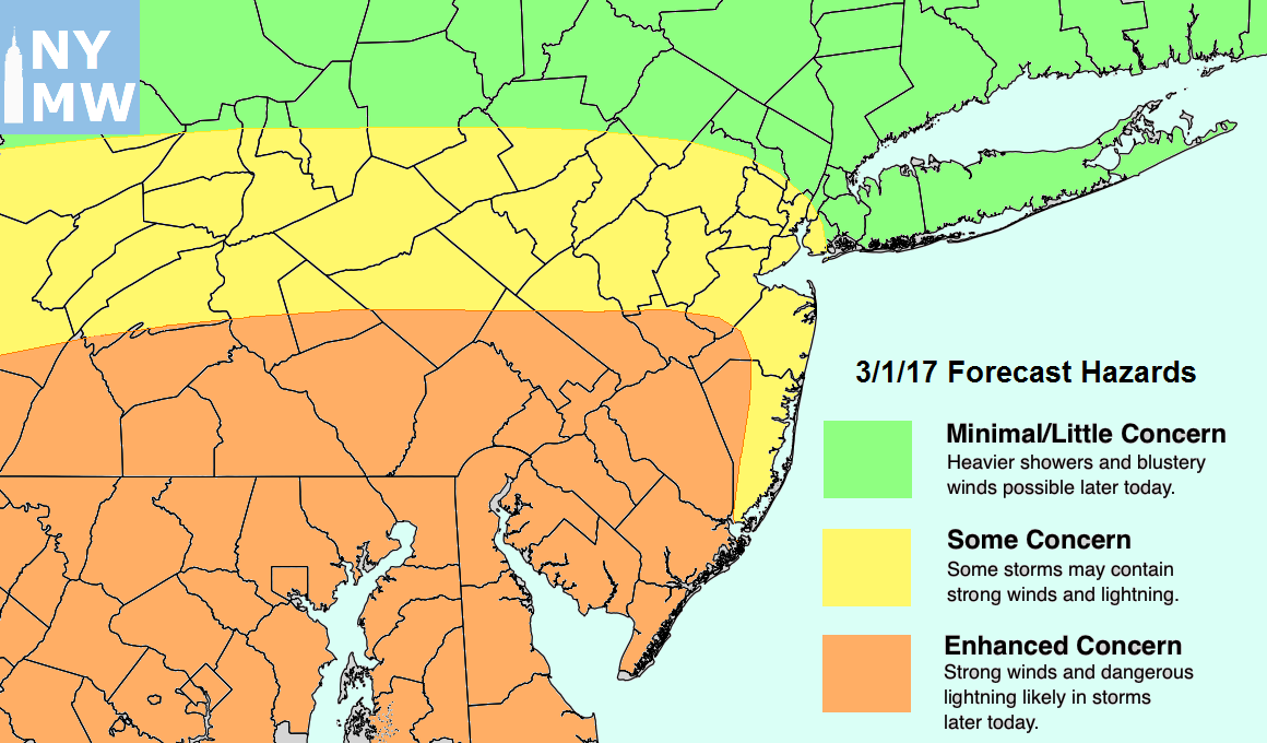
A strong cold front that was a part of a very large storm system that affected the Central US this past weekend will be moving through parts of the Mid-Atlantic states this afternoon and into this evening. This cold front will bring the potential for strong thunderstorms capable of producing heavy rain, gusty winds, and some small hail. Cooler weather is expected behind this front Tuesday through Thursday, but we may have to worry about a stronger storm system gathering to our south late Thursday. Depending on the track that this system takes Friday, a wide range of impacts are possible with gusty winds, heavy rains, and some thunderstorms possible.
Monday Into This Evening
After some thick cloud cover and spotty shower activity earlier this morning and into the early parts of the afternoon, some breaks in the clouds have been common across southern and central portions of the area. With clouds clearing out more significantly over portions of southeastern Pennsylvania and southern New Jersey, temperatures have been able to climb into the mid 70’s to lower 80’s across that region. While more significant clearing has taken place over northeastern NJ, and western Long Island, cool and much more stable air is being introduced from the Atlantic which has prevented similar warming. This will limit the highs today from the low to upper 60’s (with a few 70 degree readings possible), with the higher temperatures to the south and cooler readings being confined to southern New York, Long Island, and Connecticut.
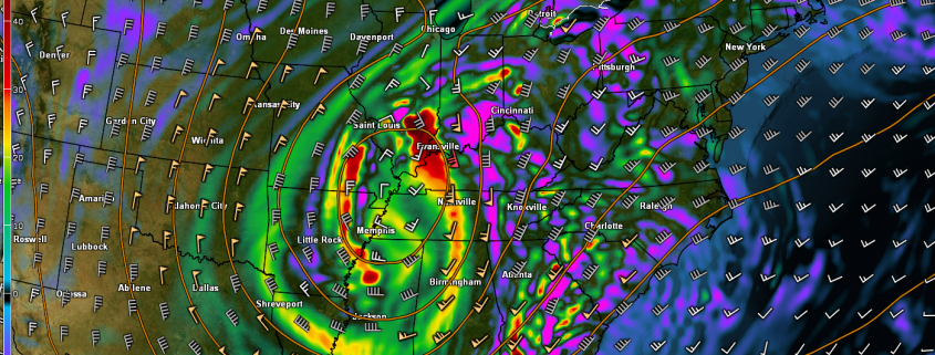
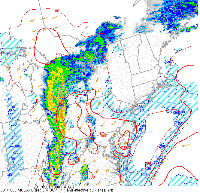
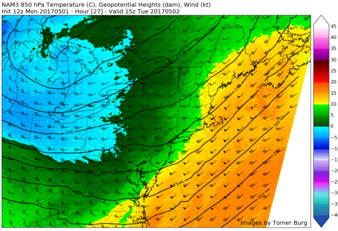
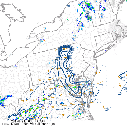
As the strong cold front works its way through Pennsylvania, instability and wind shear to our west may be just strong enough to support some isolated showers and thunderstorms. This threat will mainly be focused to the north and west of New York City as the cool and stable marine layer that is currently over the majority of the area will quickly weaken any storms that approach the area later this evening. Additionally, the overall timing of the storms not arriving until after the peak heating of the day will also limit the overall potential for any severe thunderstorms in the immediate NYC area.
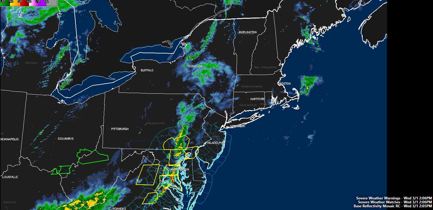
However, given marginal conditions still in place and strengthening low level winds arriving after dark, any shower or storms that do approach the area will have the potential for some gusty winds and heavy downpours. With a good deal of moisture trapped in the atmosphere, some localized street flooding and ponding on roadways may be possible with any of the heavier storms or storms repeatedly tracking over the same area. The latest outlook from the Storm Prediction Center in Norman, Oklahoma has placed the majority of our area in a “marginal risk” for severe thunderstorms, mainly for locations to the west of NYC.
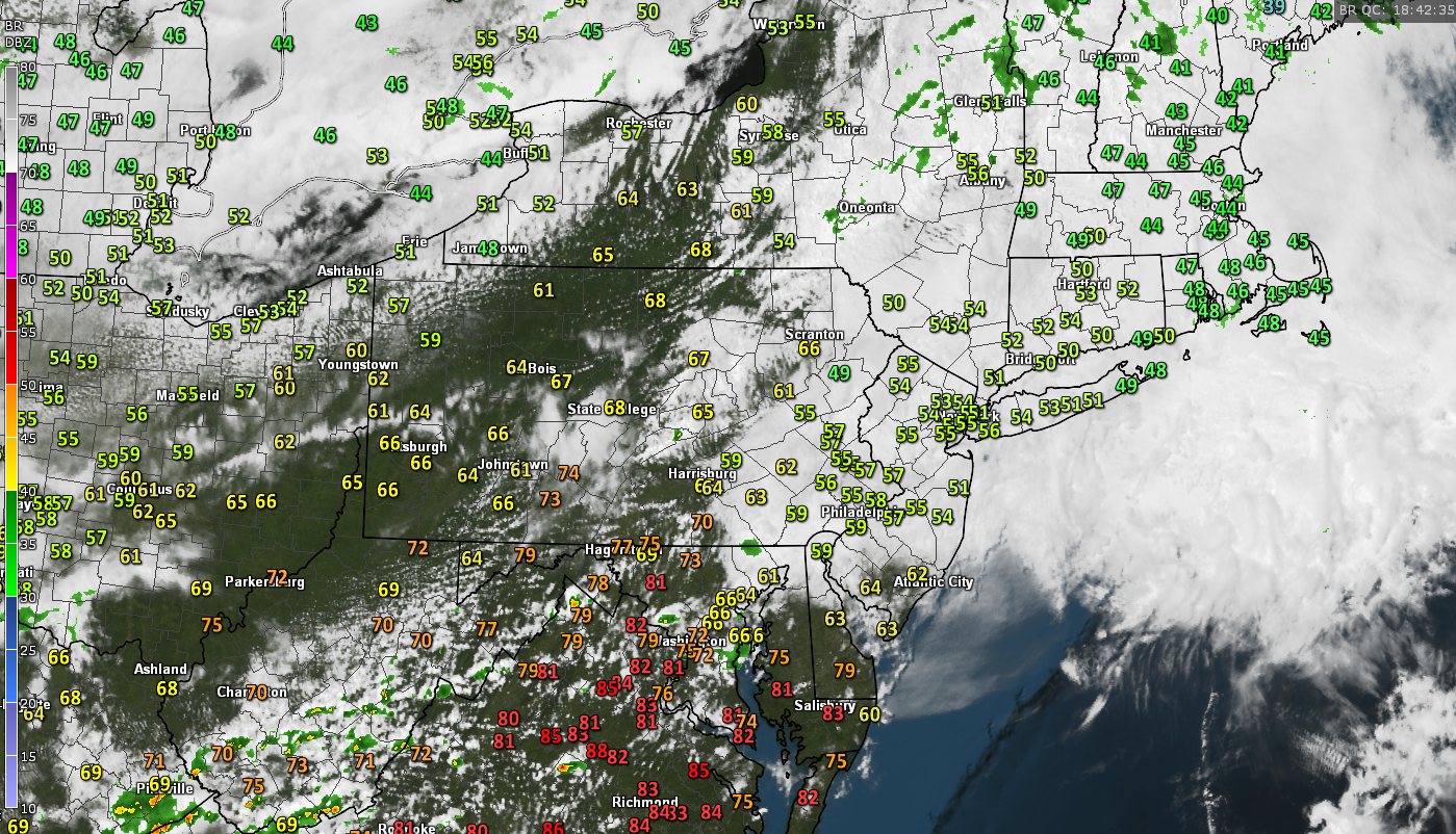
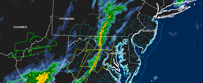
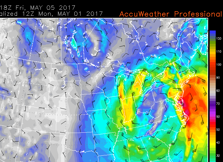
Latest regional radar composite, surface winds, visible satellite imagery, surface temperatures, and SPC watch information. Note the Tornado Watches out to the west in red (Courtesy of GREarth)
Tuesday Through Thursday
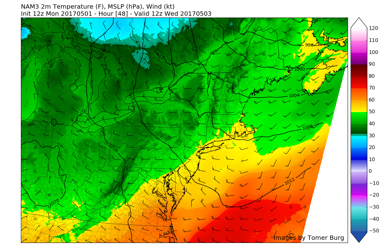
Much calmer and cooler weather looks to be on tap starting tomorrow morning after the passage of the cold front. With cool winds out of the northwest tomorrow morning, the day should start off in the upper 50’s to low 60’s with some broken clouds leftover across the area. Much drier air also should be able to work its way into the area behind the front tomorrow, which should allow most clouds to give way to clear skies by the afternoon. With clearing skies and dry air, temperatures should be able to rise into the 60’s and possibly low 70’s further south. Later in the evening, another cold front will pass through the region giving another shot of cooler air to the area, so expect temperatures to fall into the 40’s tomorrow evening, with 50’s possible near the coast.
After the second cold front moves through on Wednesday, a much cooler airmass in the mid levels of the atmosphere in addition to stronger northwesterly winds will make for an overall cool Spring day on Wednesday. High temperatures should range in the low to mid 60’s during the day, which will be somewhat below average for this time of year, but it will feel somewhat cooler when combined with the gusty winds from the northwest.
Much of the same will be expected for Thursday as an area of high pressure moves to the north of the area and then off of the Mid-Atlantic coast ahead of a gathering storm system in the southern US. Highs will range in the 60’s for the most part across the entire area on Thursday, but as the day continues on, clouds will begin to increase from southwest to northeast. Later in the evening temperatures should be capped off in the low 50’s due to increasing moisture ahead of the upcoming storm system
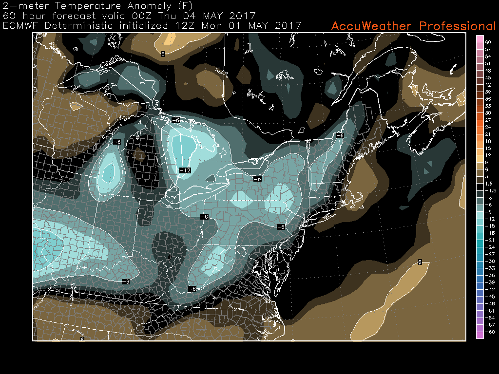
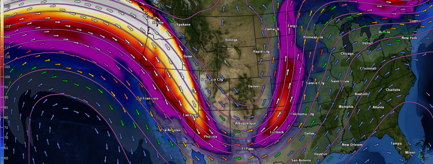
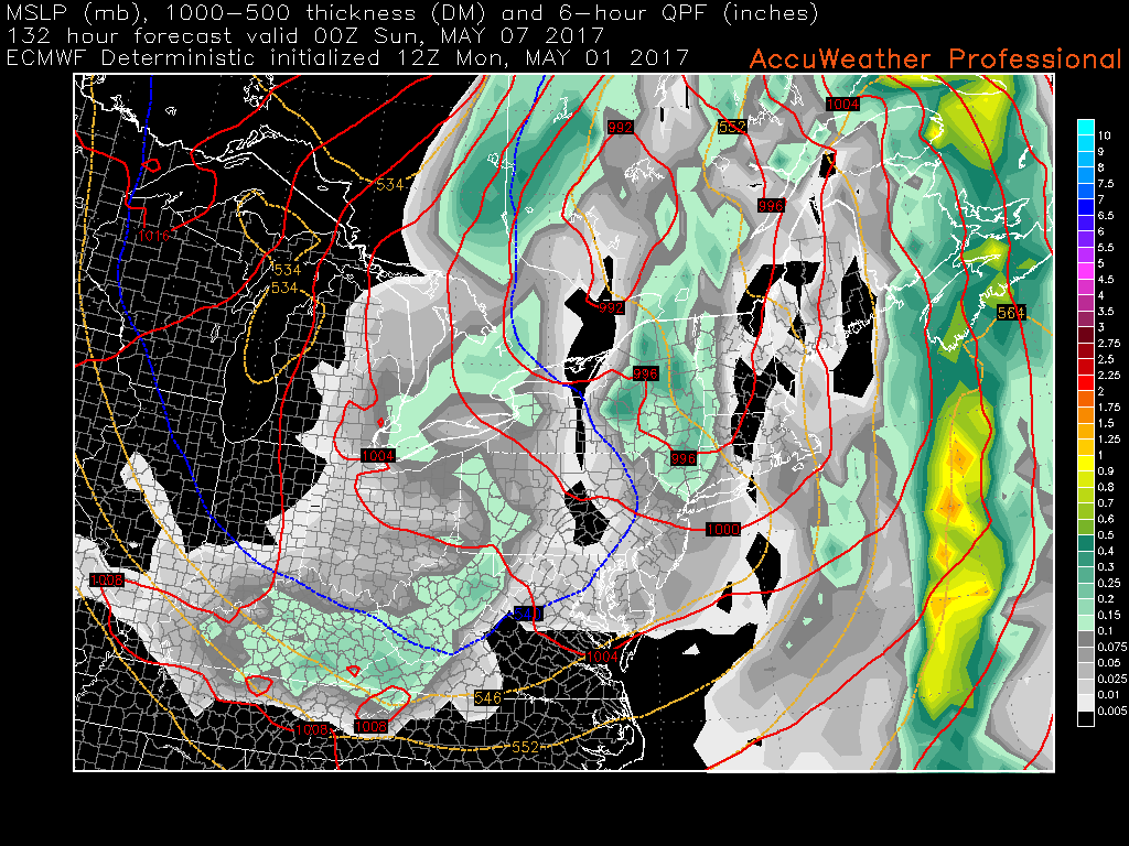
Afternoon European model showing below-normal temperatures across the area on Wednesday behind a second shot of cooler air (Courtesy of Accuweather Pro)
Friday and Beyond
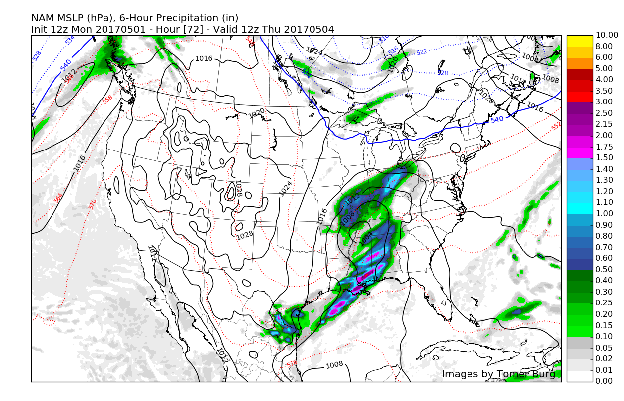
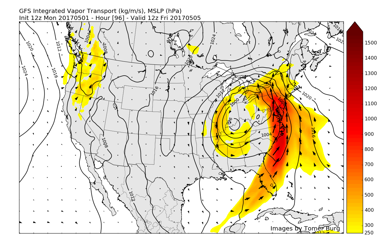
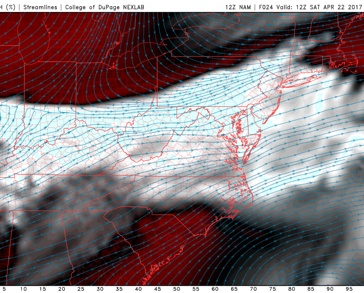
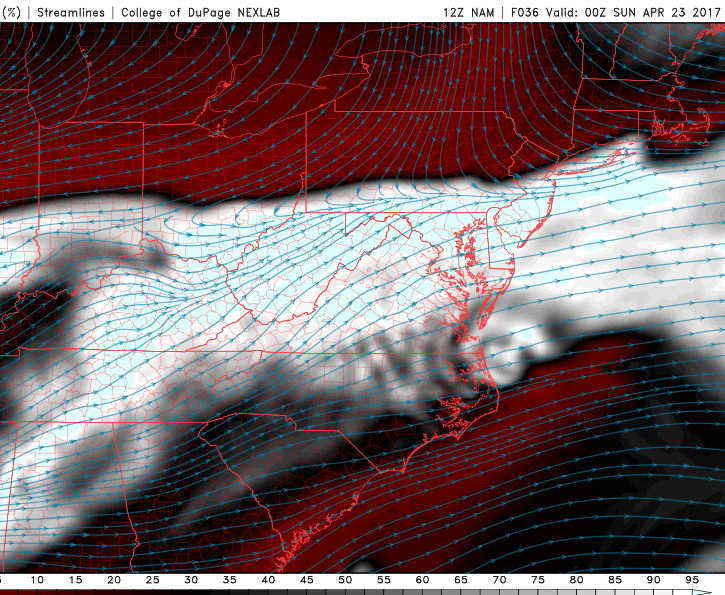
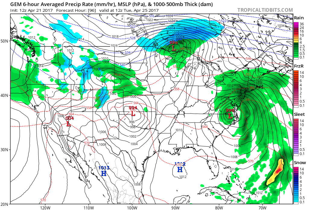
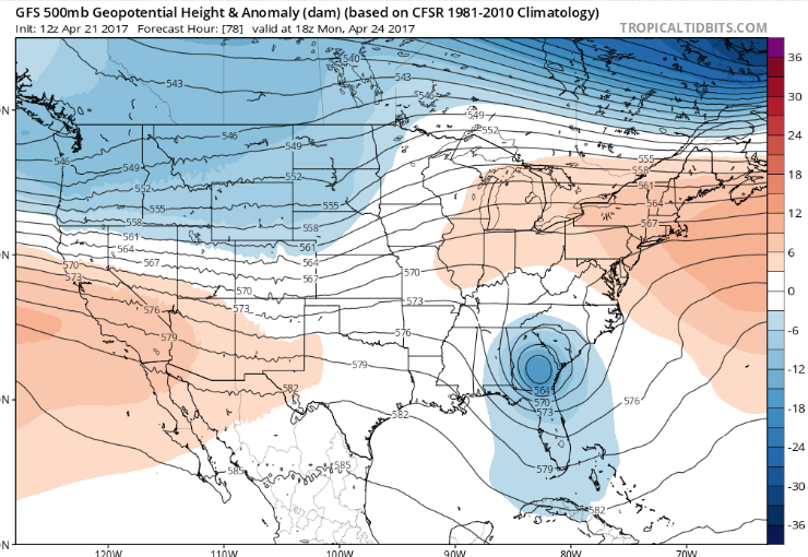
A large and very energetic closed-off low pressure system will be over the Tennessee valley very early Friday morning. This strong upper level energy will cause the development of a powerful surface low pressure system along the Appalachian mountains that will be capable of drawing copious amounts of moisture from the Gulf of Mexico northwards and into our area. This afternoons model guidance is in very good agreement that a potentially significant amount of rain could set up during the day Friday and into the early morning hours of Saturday as a strong low level jetstream continuously brings deep, tropical moisture to the north.
While there is some uncertainty in the exact timing and evolution of this storm system, there is a reasonable chance that there could be the potential for flooding rains, with totals of around 1-3″ and strong, gusty winds affecting the area. We will be monitoring the latest trends over the next four days to pinpoint the exact timing and severity of this system as we head deeper into the week.
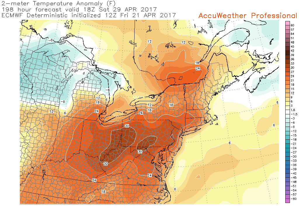
Low pressure will be into Quebec by Saturday. A cooler, a Canadian airmass will come in behind it for the for this upcoming weekend. Temperatures will may several degrees below normal, especially by Sunday. An upper-level low linger over the Northeast may enhance enough instability for some isolated or widely-scattered showers. But mostly dry conditions with a mix of clouds and sunshine is anticipated, at this time.
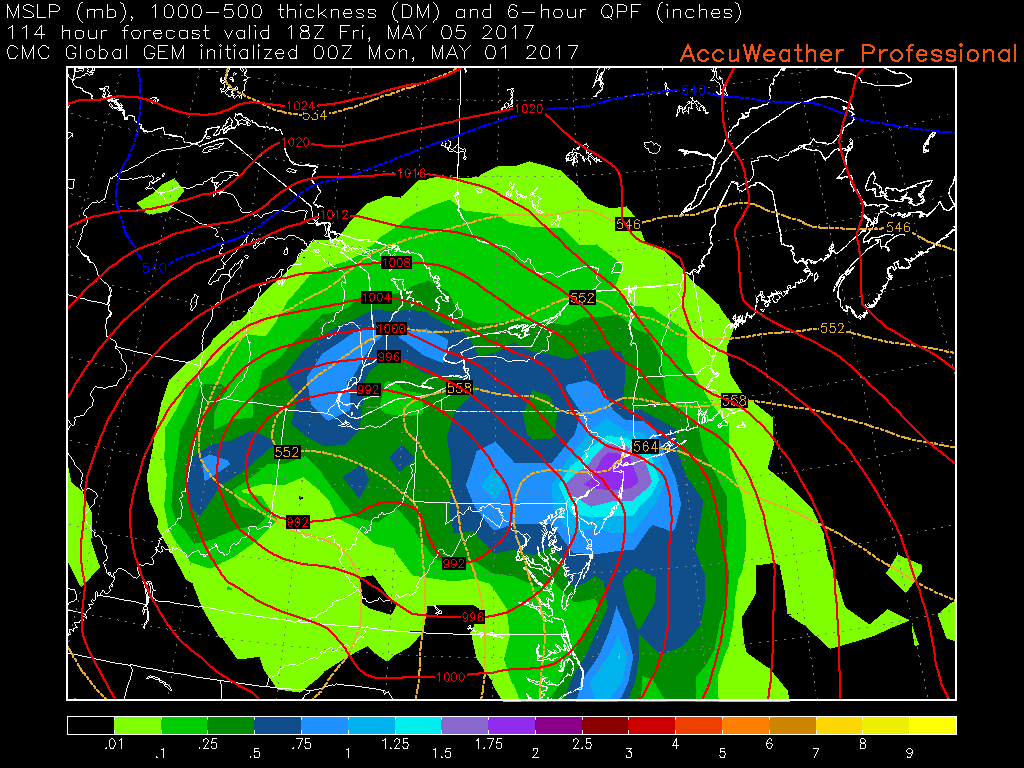
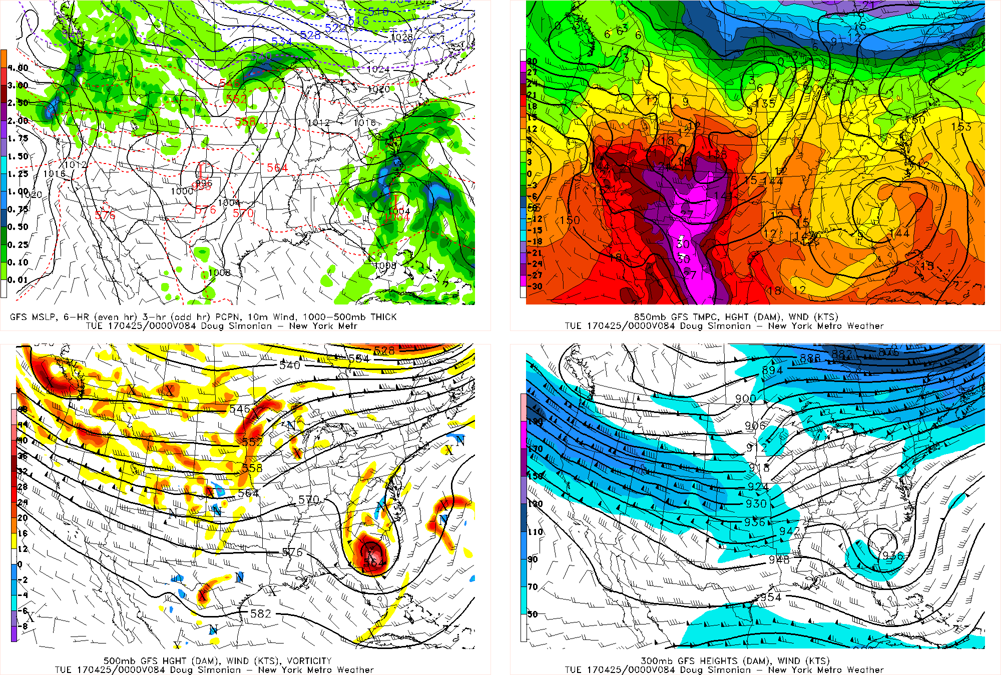
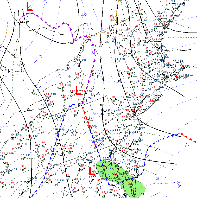
Afternoon Canadian model showing the potential for very heavy rainfall during the day on Friday across the area. Trends will need to be monitored for any changes over the next few days
For more information and posts like this one, make sure you sign up for Zone Forecasts — where multiple detailed articles, videos, and interactives are posted each day. Also, come interact with our staff and many other weather enthusiasts at 33andrain.com!
Have a great evening!
Steve Copertino