Good Evening!
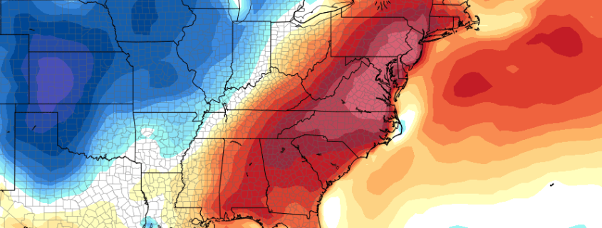
As promised earlier in the week, today was looking like it was going to be the most active day in the forecast period, and it certainly did not disappoint! The large upper level trough and associated surface low pressure system located over the Great Lakes region pushed a warm front through most of the New York metro area and Northeastern states early this morning, which brought very heavy rainfall, lightning, and locally gusty winds. While the rain was quite heavy in some locations, widespread flooding was not an issue, and any flooding was confined to street and small stream activity. As this warm front moved through the region, it ushered in a very moist and unstable airmass characterized by 3000-4000j/kg^2 of convective available potential energy (CAPE) and very, very moist precipitable water values-above two inches in some locations. The main question was whether or not the low level jet associated with the sprawling low pressure system would be strong enough to wipe out some of the cloud cover of the region and allow for further destabilization and dynamics to take over, but as we saw early this afternoon, the sun did in fact make an appearence over eastern portions of the Northeast. As the sun heated the soaked grounds from this mornings storms, this created and even more unstable and moist airmass for any future storms to work with.
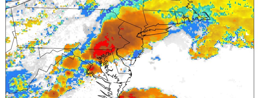
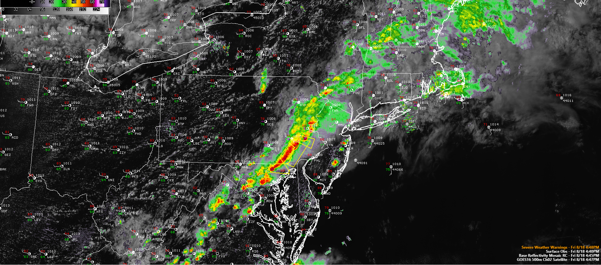
Later in the afternoon-around 4pm or so, discrete thunderstorms began to form over portions of Pennsylvania and the northern Mid Atlantic states in response to moderate to strong mid level forcing interacting with the very unstable environment present. Rapid growth into supercell structures occured in the strongest of storms, which went on to produce severe hail, damaging winds, and very heavy rains which caused flash flooding. Eventually the large scale forcing took over a good portion of the unstable warm sector and this led to the development of numerous showers and thunderstorms, which congealed into a more linear line of storms. As of 5pm, this line was located over portions of Pennsylvania and Maryland. While the line has lost some strength in the past hours, there are a few areas of stronger activity that are currently severe warned for damaging winds and potentially severe hail. With wind shear being in the moderate 25-45 knot range and cloud levels being quite low, these embedded stronger cells may pose a brief tornado threat as they head east into New Jersey within the next few hours.

This afternoons NAM model showing very high PWATS in addition to strong mid level winds, perfect for the development of heavy rain across the area this evening.
Otherwise, this line looks to propagate east at a gradual pace, with the main threats outside of the severe activity being torrential rainfall which can produce flash flooding within a matter of minutes. This threat has been exacerbated due to this mornings storms leaving behind very moist soil which may have trouble if rain rates do reach the 1-3″ range. As these storms head east this evening, they will begin to encounter a much more stable airmass from the Atlantic ocean, which should gradually shut down any strong to severe thunderstorm activity that may remain close to sunset. The heavy rain threat will still exist until these storms and the accompanying cold front push out past the region and into the open waters of the Atlantic.
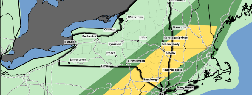
For the severe risk this evening, the Storm Prediction Center in Norman, OK has issued a severe thunderstorm watch for the majority of the Northeast and Mid Atlantic States. The main threats include strong wind gusts up to 70 mph, locally severe hail up to ping-pong ball size, torrential rains, and frequent lightning.
In addition, the National Weather Service in co-ordinance with the Weather Predictions Center in Camp Springs Maryland has issued a Flash Flood Watch for rainfall rates of around 1-3″/hr possibly producing small stream and urban flooding. Rainfall totals may be in the 3-6″ range where the heaviest storms track over this evening.

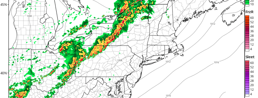
This evenings latest high resolution Goes 16 visible Satellite imagery, regional radar mosaic, surface observations, and severe warning from the NWS (Courtesy of Simuawips.com)
Saturday and Sunday
Conditions look to gradually improve beginning tomorrow morning as an are of high pressure begins to build off to our north and west. This will allow for decreasing cloud cover, warmer temperatures, and light and variable winds throughout much of the day. Expect highs to generally be in the mid to upper 80’s, with lows dropping down into the low to middle 60’s overnight. Conditions will likely be quite the same on Sunday as well, as the area of high pressure begins to move overtop the region. Conditions this weekend should be rather favorable for any outdoor activities, but we may have to keep an eye on the beaches as there may be at least a moderate risk for rip-currents and strong wave action along the coasts.
Mondays Eclipse Weather
With the models coming into their more-reliable range as of this afternoon, things still look quite favorable for the viewing of the partial eclipse on Monday afternoon. The area of high pressure that will be approaching the region this weekend looks to be just offshore of the NJ coast by mid-Monday afternoon, which should allow for onshore flow to overspread the area. This will create a rather stable airmass, with few prospects for cloud development. To look at it another way if you do not trust a few models, the European ensembles, which consists of 50 different model runs and one control run, show less than ten-percent cloud cover for NYC during the event-which is near perfect! All in all, conditions look excellent on Monday for experiencing quite a rare event, but remember to do so safely with the special eclipse glasses that can be found online and at local stores.

ECMWF Ensembles showing a blend of 51 models with less than a 10% chance of cloud-cover for the eclipse on Monday!
For more information and posts like this one, make sure you sign up for Premium Forecasts — where multiple detailed articles, videos, and interactives are posted each day. Also, come interact with our staff and many other weather enthusiasts at 33andrain.com!
Have a great evening!
Steve Copertino
-2")