High Wind Warning issued, strong wind gusts likely Sunday

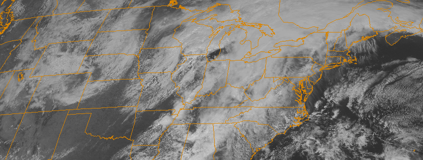
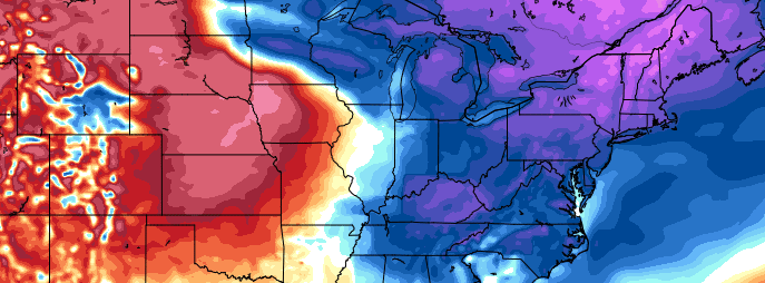
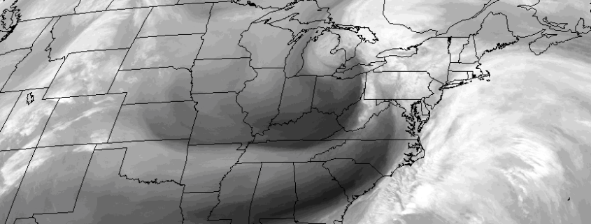
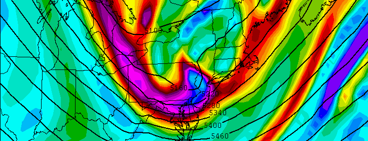
A powerful arctic front, associated with a strong mid and upper level atmospheric disturbance, will approach the area late Saturday Night into Sunday morning. Along with a rapid drop in temperature will come the possibility of showers and thunderstorms, followed by rapidly increasing northwesterly winds. As a strong low pressure area develops over New England, snow is possible for a period of time in our area on Sunday morning (generally non-accumulating), especially over Long Island and Connecticut.

The main story, however, will be the powerful wind gusts which will accompany both the arctic frontal passage on Sunday morning, and the developing storm system on Sunday afternoon. These wind gusts, tapping into very strong atmospheric dynamics and a powerful jet stream aloft, may approach and exceed 60 miles per hour at times both during the morning and afternoon hours on Sunday. This will be especially true nearer to the coast.

Read more

Warmer, unsettled weather to close the week

The roller-coaster ride continues this week, as temperatures again have fluctuated dramatically over the past several days. The cold weather from earlier this week has been replaced with warmer air today, and the trend will continue into Friday. Warm southwesterly winds will continue to advect in a moderating, moist airmass ahead of a major storm system over the Central United States.

With this warm, unfortunately, will come unsettled conditions as well. Although high temperatures will approach the upper 60’s to lower 70’s in many areas over the next few days, clouds and showers will become increasingly likely as well — essentially from Thursday afternoon onward.

Read more

(Premium) Intensity of weekend cold still uncertain

After many of us geared up for Spring with warm weather in both the early and middle part of March, the atmosphere reminded us that no transition is as smooth as it may seem. Colder, blustery air has returned to the area, and although a mild stretch is expected during the middle of this coming week, very cold air will again surge into the area by this weekend. As we spoke about several days ago, forecast models have done an excellent job of signaling the overall pattern teleconnections and evolution, with a surge of cold air possible during the first week of April.

Over the past few days, however, the intensity and duration of this cold air has come into question. Forecast models have trended slightly weaker overall with the lobe of the Polar Vortex which will break off and head southward into Southeast Canada and Northern New England. Accordingly, the forecast temperatures in our area have moderated a bit. While the overall evoltion of the pattern still suggests anomalously cold air gets to our region, a more south-to-north gradient appears likely, with the coldest temperatures likely north of New York City and more slight to moderate departures from normal to the south.

Read more

Rain today, increasingly windy tonight into Tuesday

After a beautiful, cool Easter weekend, wet weather has returned to begin the week. An upper-level shortwave amplifying west over Great Lakes region will cause a surface area of low pressure to deepen while tracking northeast over Great Lakes. A cold front will move across the local area by early this afternoon. A secondary low pressure area, developing off Delmarva coast this morning, will track northeast well to the south and east of Long Island this afternoon. These systems are combining to bring periods of rain region through early in the day — and contributing to the raw, wet conditions as well.

Read more