Could it actually snow on Saturday?

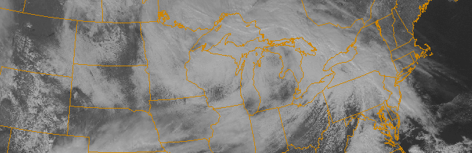
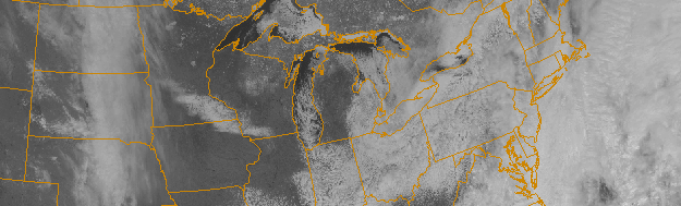
You can’t really be surprised that snow is once again in the forecast, can you? After a two month period featuring record breaking cold and snow, temperatures soared into the 60’s on Thursday evening. But a cold front swept through the area Thursday Night, ushering in colder than normal air once again. Highs on Friday barely reached into the 40’s. And on Friday Night into Saturday, forecast models are indicating a return of post-frontal precipitation with a chance of, yes, light snow throughout the area and into New England.

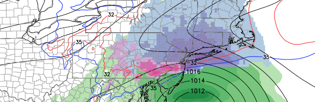
As a large mid and upper level system slides from the Ohio Valley to the Northeast US Coast, enough atmospheric energy will force the development of a low pressure system offshore. While the center of low pressure will be hundreds of miles to our east, an inverted trough extending westward from it will be the culprit in our snow chances. Light snow could develop as early as Friday Night and is expected to continue in parts of the area until Sunday morning. But the location and intensity of the snow becomes the main detail we’ll have to iron out.

Read more

Showers, thunderstorms likely through Thursday

These days, Spring’s impacts are fleeting at best. This week won’t be much different, as Spring will make a one day appearance on Thursday and  disappear for several more days thereafter. Nevertheless, the impacts over the next 24 to 48 hours will be noteworthy when it comes to our sensible weather. A warm front approaching the area will be first signaled this afternoon by steady showers, which will continue on and off through the evening. Temperatures will rise into the 40’s as winds turn southerly from the late afternoon into the overnight period.

A low pressure system developing from the Ohio Valley into the Northern Mid Atlantic will aid in the continuation of the aforementioned southerly flow on Thursday. The approaching warm front will continue the chance of showers, with clouds and fog likely in the morning hours. Temperatures, however, will rebound into the 50’s during the day. The warm front will also be home to a tremendous thermal gradient, which will shift northward through New Jersey toward New York City on Thursday.

Read more

First week of Spring looks to only be a technicality

Happy Spring, everyone! Well, sort of. Most of the area was blanketed with between 4 and 7 inches of snow on Friday, which was the first day of Spring. This has helped to bring many official weather stations in our area to over double their average snowfall.

Central Park: 4.7″ on March 20-21, 18.6″ of snow in March, 50.3″ seasonal total.

LaGuardia: 4.6″ on March 20-21, 17.2″ of snow in March, 53.8″ seasonal total.

Islip: 5.5″ on March 20-21, 17.9″ of snow in March, 62.2″ seasonal total.

The snowiest March on record was a whopping 30.5″ in 1896, which is unlikely to be broken this year. But snowfall nearing 20″ this month, combined with temperatures averaging between 3 and 4 degrees below average so far has certainly helped to contradict the fact that March is “Meteorological Spring”.

Unfortunately, the cold pattern looks to be continuing, with perhaps even another chance or two of snow over the next ten days.

Read more

Spring begins Friday…with another snowstorm

A disturbance in the mid levels of the atmosphere shifting from the Ohio Valley to the East Coast will force the development of a surface low pressure system, which will move off the East Coast on Friday. Terminology like this has become all too familiar over the past several months, hasn’t it? Nevertheless, this surface low will develop close to the Mid Atlantic coast on Friday, aiding in the development of enhanced mid and upper level atmospheric lift for precipitation. With cold air in place over New England, anchored by a high pressure shifting northeastward, the result will be: More snow.

Snow is expected to spread from southwest to northeast throughout the area on Friday morning. Initially light, it will quickly increase in intensity as a band of enhanced lift moves through the area. Moderate snow is expected to continue through Friday afternoon and evening, when it will accumulate up to 3 to 5 inches throughout the area. The higher amounts of that tier will be more common in bands of heavier precipitation — where heavy snow continues for prolonged periods of time.

Read more