Warmup this week, followed by rain on Thursday

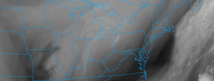
In the wake of a departing Nor’Easter and heavy snow in parts of coastal New England, it was very chilly and windy this afternoon. Temperatures will fall through the 40s this evening strong winds. The National Weather Service has issued a Wind Advisory for SW CT, NYC, and Long Island, for northwest winds between 20 and 30mph, and gusts up to 45mph. Winds will still be strong in NJ, but probably around 10mph weaker on average.

This cold airmass will also lead to very chilly temperatures tonight, with lows generally in the low 30s. The strong winds may keep frost to a minimum in immediate coastal areas and NYC, though interior areas in NJ who have not already had their growing season end may have theirs end tonight.

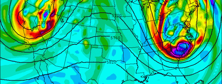
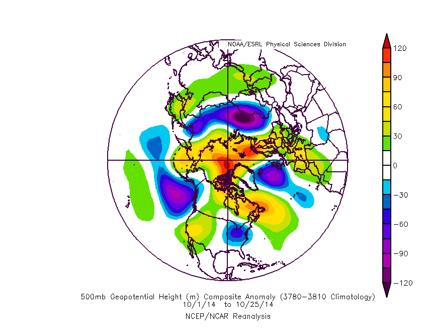
Fortunately, however, despite this cold airmass, it will quickly be on the way out. In fact, our November Outlook we issued on Tuesday calls for a warm start to the month.  This is because there is no high-latitude blocking to keep the cold airmass in-place, and it will be replaced by a warm airmass to our west and south, as evidenced in the above featured image. The middle and latter part of November could cool off to below average temperatures — even more-so than originally thought — but that’s a different article for another time.

Read more

Seaward she goes: Weekend Nor’easter will spare our area

Reports of the early arrival of winter may have been premature after all. A significant coastal storm system, developing this weekend, will move from the Carolina coast to a position east of the Gulf of Maine. As it does so, it will organize off the East Coast and bring periods of showers and gusty winds to our area beaches. But the storm system won’t become truly organized and mature until it is well to the Northeast of our area. As a result of this, the cold air being drawn in behind the system won’t move in until the storm is well past us — and the precipitation that does fall (as rain) isn’t expected to be heavy.

Still, the disturbance is extremely impressive and quite anomalous for this time of year. The initial disturbance swings out from the Tennessee Valley on Friday, and a surface low will develop as a result. The second disturbance is much more impressive, however, surging southward from Canada through the Great Lakes. This shortwave will race through the Tennessee Valley and to a position near the Southern Mid Atlantic Coast late on Friday — bringing 500mb anomalies to nearly -6 standard deviation. It will be, without a doubt, the most anomalous feature on the globe at the time. But the system will shift northeast, a good length behind the initial disturbance, while the surface low pressure remains unorganized.

Read more

Rain, wind, and even snow possible this weekend

An energetic mid and upper level disturbance will shift from Central Canada through the Northeast United States late this week into the early part of this weekend, helping to develop a coastal storm. In addition to the coastal storm will come a strong cold front, and a cold Canadian airmass which will drop temperatures into the 20’s and 30’s at times after its passage. With models hinting at the development of multiple surface lows off the coast, the potential exists for not only rain and wind — but some snow in the higher elevations and the first flakes for others as the storm develops.

But the setup remains extremely complicated. The source region of the disturbance means forecast models are already working with a somewhat limited dataset. And, as is often the case with storms in our area, the mid level disturbances will be involved in fragile interactions, all of which will have a major impact on exactly how the storm develops. Confidence, as a result of these small nuances and features, remains very low. The general idea of a strengthening coastal storm passing along the East Coast, however, is gaining traction quickly.

Read more

Despite cold weekend, November looks to start off warm

As many of you have probably heard by now, a major shot of cold air is on the way for this weekend, with the potential for a storm system to bring the first snowflakes of the season for some areas. For more information on that threat, check out our article we published earlier this afternoon. This article will focus on what’s to come after that blast of cold air.

October is just about complete, and it was a very warm month both nationally and regionally.

It has been much warmer than average for most of the country this month (ACIS).

It has been much warmer than average for most of the country this month (ACIS).

In predicting the future weather patterns, we often like to take a look at what has happened in the recent past, and roll forward with any expected changes to the pattern, or lack-there-of. Here is the 500mb pattern that has occurred in the Northern Hemisphere this month:

The 500mb pattern this October featured a large trough in the NE Pacific, which largely prevented Arctic intrusions.

The 500mb pattern this October featured a large trough in the NE Pacific, which largely prevented Arctic intrusions.

The two big features that stand out are the large amount of blocking near the North Pole — particularly the Eurasian side of the Pole, and the large trough in the NE Pacific. The blocking supported a large amount of snow in Eurasia, as the snow cover this year in those regions is among the highest it’s ever been in October. This doesn’t affect our current weather pattern this month so much, but it does lead to the higher probability of a snowy winter.

Read more