-2")
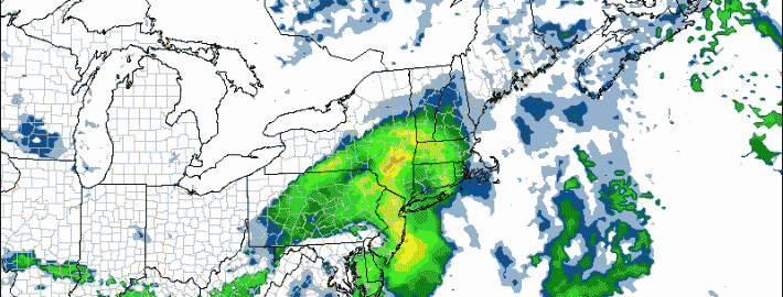
Heavy rain and embedded thunderstorms tonight
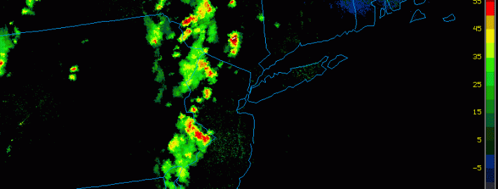
We are currently watching a complex of showers and thunderstorms in the Midwest and Ohio Valley as it swings eastward, along a stationary frontal boundary. Additionally, a mid-level trough will be working its way into the region from the north, which will allow the storm system to strengthen, as they interact with each other. The strengthening storm system will provide plenty of lifting in the atmosphere, as well as greatly increase the strength of a southerly low-level jet, which will help to pump plenty of moisture into the region. The combination of plenty of moisture in our atmosphere and the lift will lead to the threat for heavy rain and embedded thunderstorms. The primary threat is flash flooding, as some areas may pick up 1-2″ of rain in a short period of time.
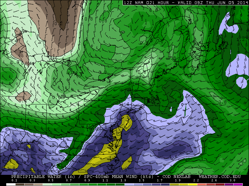
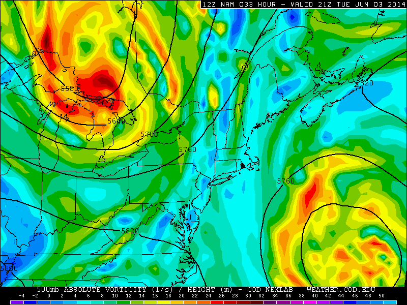
Today’s NAM model valid for 5:00am tomorrow morning shows very high precipitable water values, which is an indicator of a very moist atmosphere profile. This supports the threat for heavy rain. (weather.cod.edu)
However, the threat for severe thunderstorms with severe winds should only be confined to the southern third of New Jersey, and that threat will be isolated. This is because the frontal boundary that the storm will be tracking on should remain in Central New Jersey. North and northeast of the warm front is where more broad lifting is expected, thus the threat for heavy rain over the entire New York Metro region.
But south of the warm front is where the lifting for precipitation is not as widespread, but the atmosphere overall is more unstable — thus the threat for isolated severe weather. This means that southern NJ may not see widespread rain, but could have a brief localized heavy downpour, with flash flooding, and a strong wind gust. The instability overall, however, is only marginally strong for severe weather — thus the severe threat being marginal and isolated. Plus there is also the fact that the instability may not be strong enough for the complex of storms to entirely maintain itself as it crosses the Appalachian Mountains.