Unsettled weather continues with more storms Friday

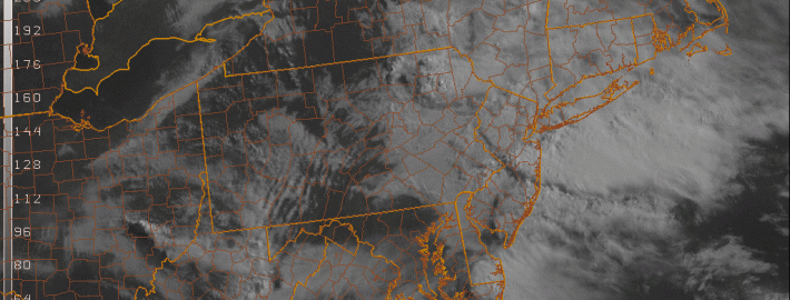
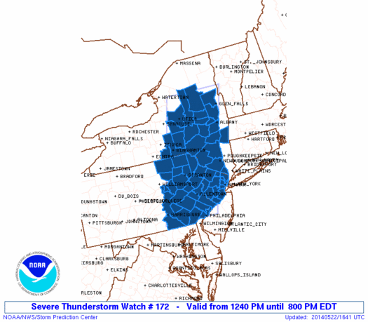
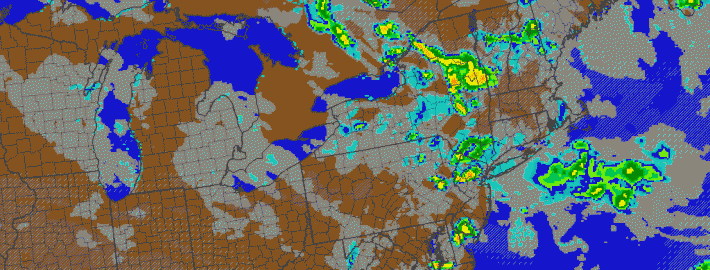
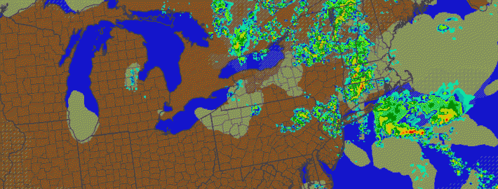
In the wake of a severe weather event which produced multiple reports of large hail in New Jersey and New York on Thursday, showers and thunderstorms are once again expected on Friday afternoon. The culprit is a developing upper level system, which will meander near the area (and the entire Northeast US) through this weekend.  Although the storms on Friday won’t be severe (we’re lacking many ingredients including moderate to strong instability and wind shear), they could still bring periods of heavy rain and thunder.

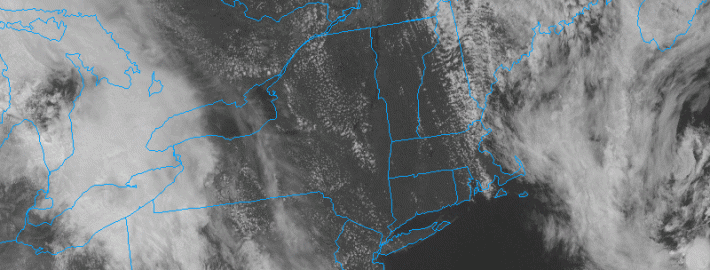
To start, however, Friday will be characterized mostly by low clouds and fog. Drizzle should continue into the late morning hours with the marine air entrenched in the region. But as it begins to burn off in the early afternoon, some peaks of sun are expected to filter in and out of the clouds, and daytime heating will help to trigger some storms within an environment favorable for shower and non-severe storm development. “Self-destructive sunshine” is a term used by meteorologists for days like this — the appearance of the sun just fuels additional showers and storms.

Read more

Strong to severe thunderstorms possible this afternoon

1:00pm Update: The NWS Storm Prediction Center has issued a Severe Thunderstorm Watch for Northern New Jersey and Southeast New York until 8:00pm tonight. Thunderstorms are expected to develop over the next few hours and shift southeastward through New Jersey and New York. The combination of developing instability, a nearby frontal zone, and a disturbance aloft will aid in organization of storms. Thunderstorms will be capable of producing frequent lightning, hail, and strong winds.

Severe Thunderstorm Watch graphic from the Storm Prediction Center. Blue highlighted counties are included in the watch.

Severe Thunderstorm Watch graphic from the Storm Prediction Center. Blue highlighted counties are included in the watch.

The Storm Prediction Center has placed much of the area in a Slight Risk for severe weather on Thursday, including much nearly all of New Jersey. The Slight Risk area runs to about New York City and Western Long Island northward through Southeast New York and near the Connecticut border. A Slight Risk is issued by the Storm Prediction Center when organized severe thunderstorms are possible, in this case there is a 15 percent chance of gusty winds or hail within 25 miles of any point within the Slight Risk area.

Read more

Thunderstorms with gusty winds, downpours Thursday

Update: The Storm Prediction Center has placed our area in a Slight Risk for severe thunderstorms today (Thursday). Stay tuned for further updates and information including a live blog post.

As a mid level disturbance moves toward the area on Thursday, a frontal boundary and convergence zone will shift near the area during the late morning to afternoon hours. The combination of the two, when juxtaposed with daytime heating and some instability, will lead to sufficient lift to develop thunderstorms during the afternoon hours. Accordingly, the Storm Prediction Center has placed parts of the area in a “Slight Risk” for severe thunderstorms.

The threat for strong to severe thunderstorms is likely to be focused west of the area beaches and shores, but heavy downpours and thunderstorms are still possible there. Farther west, over the interior parts of New Jersey and New York, more focused instability and southerly winds are more likely to work with marginally favorable wind fields to help develop thunderstorms. These storms will be capable of producing very heavy rain, frequent lightning and possibly even some small hail and gusty winds.

Read more

Beautiful this afternoon, thunderstorms midweek, delightful Memorial Day weekend

This afternoon and tonight: The large upper level cold pool which triggered clouds on Sunday and Monday afternoons has scooted out to sea, allowing a ridge to build in. This has resulted in warmer temperatures, and will also preclude any significant cloud formation. The rest of this afternoon looks great, with temperatures in the upper 70s and sunny skies. Continued downsloping westerly and northwesterly winds will prevent any seabreeze from forming, so an evening trip to the beach should be a great idea. There will be a few moderate breezes from time-to-time, but nothing that would ruin going outdoors or going for a walk on a beach boardwalk.

Moving forward to tonight is when the weather will start to change, as a shortwave and area of vorticity will be running along the top of the ridge and head towards us from the north and west. This will allow for an increase in clouds tonight, keeping our low temperatures a bit warmer — generally in the upper 50s. Any rain, however, should hold off until tomorrow, and perhaps even as late as tomorrow afternoon.  Read more