-2")
Winter storm likely Tuesday into Wednesday
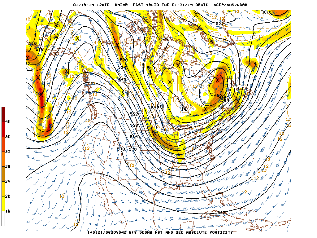
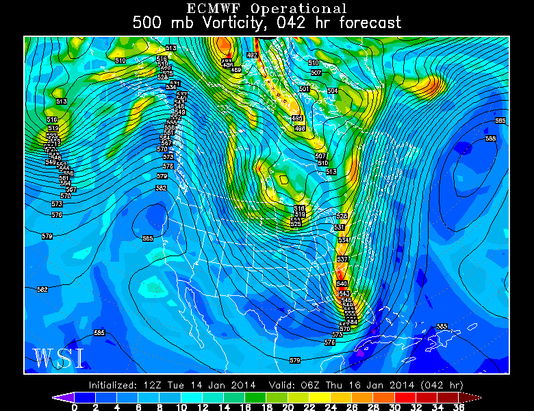
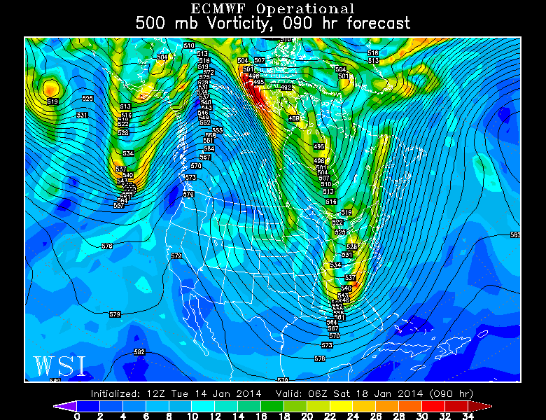
Forecast model guidance has come into good agreement on the eventual track and intensity of a winter storm which is forecast ot impact the area from Tuesday through Wednesday. The system was initially forecast to develop well seaward, but guidance over the last 24 to 48 hours has trended more amplified, slower and stronger with the storm system. The result is a moderate impact winter storm which is expected to begin during the afternoon on Tuesday and continue into Wednesday morning. A mid level disturbance dropping south from the Northern Plains will eventually amplify in the Mississippi Valley before moving off the East Coast, helping to develop a surface low and a nor’easter overnight into Wednesday morning.
It is the exact track and intensity of this low pressure which forecast models have struggled with. But newer guidance agrees that the placement and development of the system will support widespread snowfall through the area. Heavier bands of snow and wind are likely from the I-95 corridor south and east, with highest snowfall totals expected near the area coasts of New Jersey and Long Island. These bands, however, remain unpredictable and can often wind up impacting other areas despite what forecast guidance suggests. Below, we have included our 411 on the storm system including expected totals, timing, and information as well as a snowfall forecast map. Later tonight, we will issue a new set of products including hazards briefings and other information.
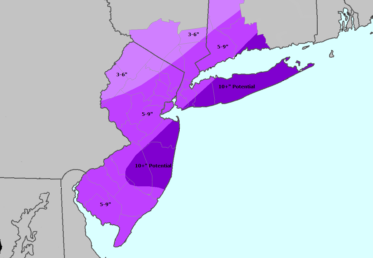
Storm Total Snowfall Forecast from Jan 20 2014