-2")
Slow thaw will lead to warm weekend
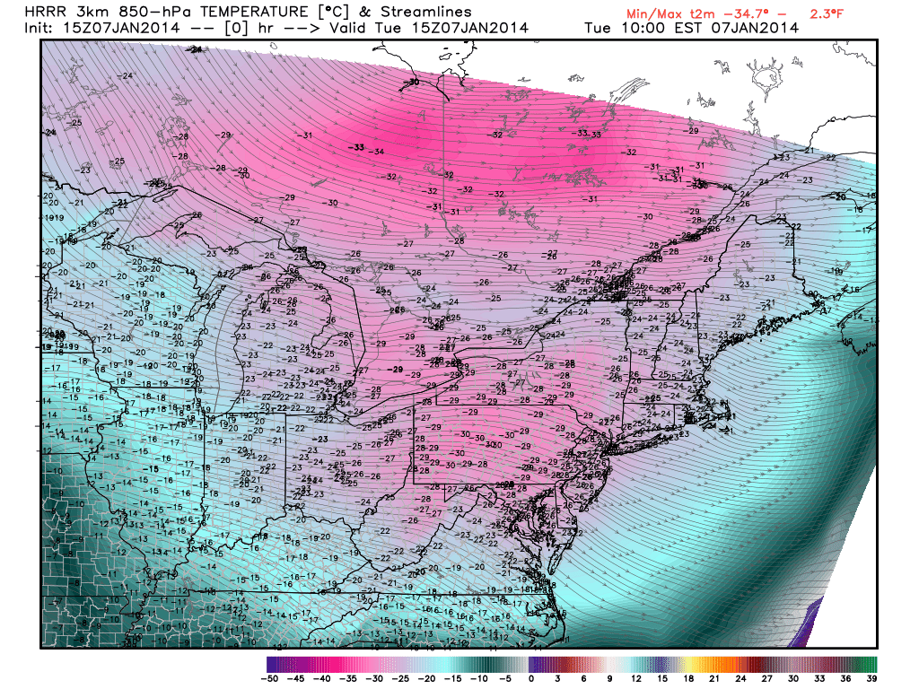
There is much still to be said and analyzed about the actual impacts of the polar vortex’s pass through our area early this week, but for now – the main story will become its exit and the ensuing warm up. High temperatures on Wednesday have already rebounded several degrees, and less aggressive wind gusts have allowed wind chills to warm up as well. Don’t get us wrong — the airmass remains downright frigid — but the record breaking cold is moving out of the picture. The polar vortex is already retreating well to our north and will continue to do so through Thursday and Friday.
Temperatures in the mid levels of the atmosphere will respond, and warm, as the week comes to a close. Forecast models are in good agreement that surface temperatures will, as well. Highs should slowly warm into the 30’s by the end of the week. The pattern, then, will begin to change. The first sign will be a weak storm system which will slingshot towards our area from the Mississippi Valley on Friday, and may provide a period of light snow. Minimal accumulations are expected. But by this weekend, a stronger storm system will be organizing over the Central United States and the southerly flow ahead of it will begin pumping warmer air into our area.
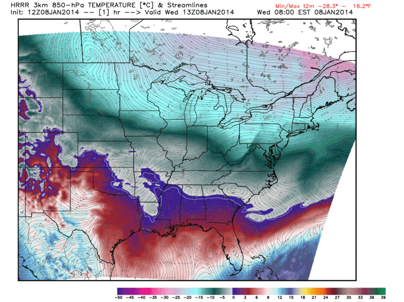
GIF image animation showing rising temperatures at the 850mb level on Wednesday.