Prolonged stretch of pleasant weather expected

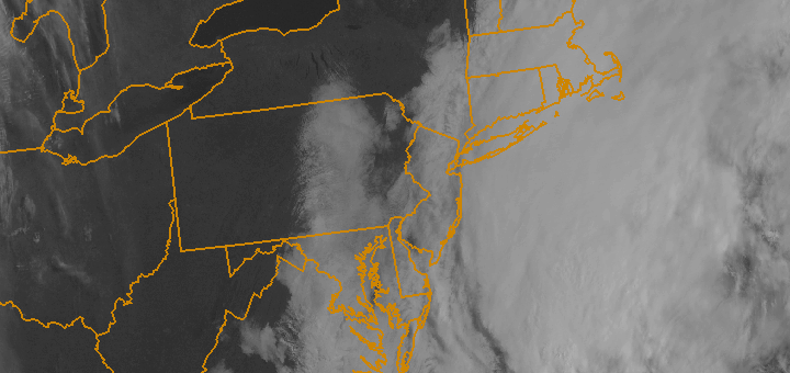
Spring started off cooler than normal, but since has been a roller coaster ride with temperatures fluctuating between above normal and below normal. Rather typical for Spring — with cold fronts and swings in temperatures. Missing, however, has been the presence of any widespread heavy precipitation. This April, so far, falls under the top 10 driest of all time in New York City. Over the next week, we will make a run for history..and likely will reach it given the forecast for pleasant and dry weather.

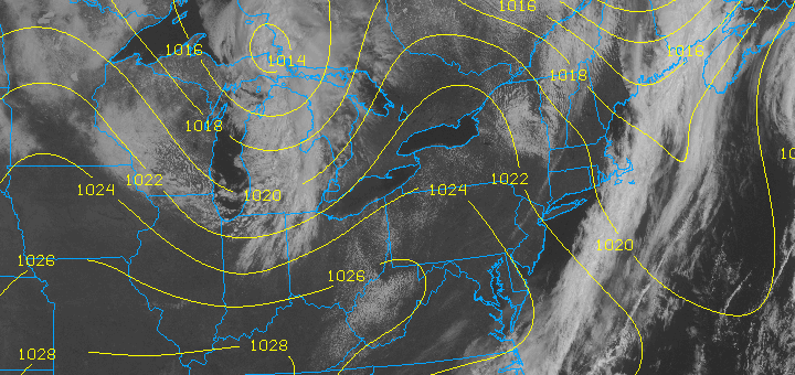
A high pressure system will take control of the weather pattern beginning on Thursday — and will hold a firm grip into the early and middle part of next week (no, that’s not a typo). Temperatures will rise into the lower to middle 60’s for highs — but will moderate each day moving forward. For example, by Sunday, many areas could see highs into the 70’s. Light winds and the lack of any precipitation will make this one of the more prolonged stretches of pleasant weather in recent memory. Isolated showers and thunderstorms will begin to become a possibility during the afternoon (typical pop-up storms) this weekend into early next week, but no widespread rain threats are expected in the near future.

Today: Sunny with a high near 64. Northwest winds around 10 miles per hour.

Tonight: Mostly clear with a low in the lower to middle 40’s. Light west-southwesterly winds.

Friday: Sunny with a high near 66. Northwest winds around 5 miles per hour.

Saturday: Mostly sunny with a high approaching 70. Light west-northwest winds.

Dreary Tuesday, brief warmth follows

A weak storm system off the Mid-Atlantic coast will shift northward Tuesday afternoon, eventually hooking northwest a bit towards Cape Cod and the Gulf of Maine by Wednesday. Although steady rain should avoid the area for the most part, forecast models agree that clouds and drizzle will be in the forecast for Tuesday especially across eastern portions of the forecast area. Along the shore and on Long Island, periods of drizzle are possible throughout the day into Tuesday Night. The clouds will stick around through the evening for most of the area — with northeast winds keeping the air feeling damp and cool. High temperatures will run a few degrees below seasonable averages.

Warmer air is on the way, however brief, on Wednesday. As the weak storm system lifts north and east of our area, winds will briefly turn southerly and temperatures in the mid levels of the atmosphere will warm. With a cold front still lingering back to our west, high temperatures should approach the upper 60’s to lower 70’s especially in New York City and New Jersey. As usual for this time of year, southerly winds off the cool ocean waters will keep the coast several degrees cooler. A cold front, with showers and isolated thunderstorms, will move through the area by Wednesday evening — bringing back some cooler air once again.

Today (Tuesday): Mostly cloudy, damp, and relatively cool. Highs in the mid 50’s. Northeast winds 10 to 15 miles per hour. A chance of drizzle or showers, especially near the coast.

Tonight: Mostly cloudy. Lows in the mid 40’s. A chance of showers or drizzle, especially near the coast.

Wednesday: Partly cloudy and warmer. Highs in the upper 60’s to lower 70’s. Warmer in New Jersey, cooler near the coast. A 40% chance of showers and thunderstorms late. Southwest winds around 15 miles per hour.

Wednesday Night: A chance of showers and thunderstorms, then becoming partly cloudy. Southwest winds turning west-northwest around 15 miles per hour.


Forecast: Warm start to Friday, stormy finish

[alert type=”error”]We are upgrading to a more advanced theme. Please pardon our appearance as we work out some bugs over the next few days. Feel free to contact us if you experience any problems.[/alert]

Temperatures will warm up to close out the work week ahead of an approaching cold front on Friday, and although the day may be marred by some clouds early, it is expected to generally end up a good one. Winds at the surface, which were previously out of the south and east, will flip to southerly — ushering in warmer air and taking away the marine influence from the cooler ocean waters. Low clouds and fog are possible Friday morning into early afternoon, but clearing is expected by afternoon as southerly winds strengthen. High temperatures will range from the upper 60’s to mid 70’s — with coastal locations remaining much cooler and interior locations of New Jersey potentially approaching 80 degrees when the sun breaks out.

NAM model showing a line of heavy rain and thunderstorms approaching the area late Friday night. Clearing ahead of the storms and cold front should allow temperatures to warm into the 70's Friday afternoon.

NAM model showing a line of heavy rain and thunderstorms approaching the area late Friday night. Clearing ahead of the storms and cold front should allow temperatures to warm into the 70’s Friday afternoon.

The forecast takes a bit of an ugly turn after sunset on Friday, however, as a line of showers and thunderstorms rapidly approaches in association with a strong cold front. A period of heavy rain and gusty winds is likely overnight Friday into early Saturday as the front crosses the area. Winds will rapidly shift from south to west-northwest behind the front, and a new cooler airmass will be ushered in. Temperatures on Saturday night, for example, could drop into the mid 30’s throughout much of the area…and may even get near freezing across parts of the interior. Enjoy the warm air while it’s here! Your forecast at a glance is below.

Friday: Mostly cloudy early with areas of fog. Becoming partly cloudy with highs in the upper 60’s to lower 70’s. Warmer across New Jersey and cooler across the shore, especially on Long Island. A chance of showers and thunderstorms late. South wind around 20 miles per hour.

Friday Night: Mostly cloudy with showers and thunderstorms likely. Some storms could produce gusty winds. South winds around 25 miles per hour turning west around 15 miles per hour.

Saturday: Partly cloudy and cooler with a chance of isolated showers. Highs in the upper 50’s to near 60. Northwest winds around 15 miles per hour.

Forecast: Briefly cooler, cloudier ahead of approaching front

After a warm two day stretch during the middle of this week, southeast winds have returned this Thursday morning and will continue into early Friday. The result will be plenty of clouds and the potential for isolated showers and drizzle as cool marine air moves in off the still colder ocean waters. A cold front, which remains well to our west on Thursday afternoon over the western Ohio Valley, will eventually approach by late Friday night. For the remainder of Thursday, however, damp and cloudy weather will be the main theme. Despite warm temperatures aloft, the aforementioned developments will keep temperatures in the upper 50’s to lower 60’s. The higher temperatures should generally be confined to Central and Southern New Jersey.

NAM model showing forecast radar and cloud cover on Thursday afternoon. Southeast winds will usher in plenty of clouds and drizzle, keeping temperatures in the upper 50's to lower 60's.

NAM model showing forecast radar and cloud cover on Thursday afternoon. Southeast winds will usher in plenty of clouds and drizzle, keeping temperatures in the upper 50’s to lower 60’s.

By late Thursday night, forecast models are consistent in developing additional clouds and fog. The fog should stick around into Friday morning, but will eventually lift as winds shift to southerly and things begin to really warm up. After some clearing Friday afternoon, the southerly winds will usher in warm air once again — and temperatures are expected to climb into the 70’s. If the sun sticks around, some areas in Central New Jersey could reach near 80 degrees. The cold front will approach late Friday with showers and thunderstorms and a period of heavy rain.

Today (Thursday): Mostly cloudy with a chance of drizzle and showers. Highs in the upper 50’s to lower 60’s. Southeast winds around 10 to 15 miles per hour.

Thursday Night: Mostly cloudy with fog developing. Low temperatures in the mid 50’s. Southeast winds around 10 miles per hour.

Friday: Mostly cloudy early with fog. Clearing by afternoon with highs in the upper 60’s to lower 70’s. South winds around 15 to 20 miles per hour.  A chance of showers and thunderstorms late.