All Zones Mid-AM Update: Cooler Early Week, More Unsettled, Wetter Weather Late Week

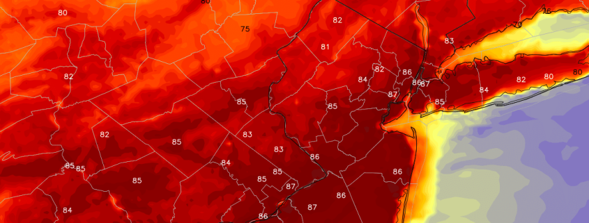
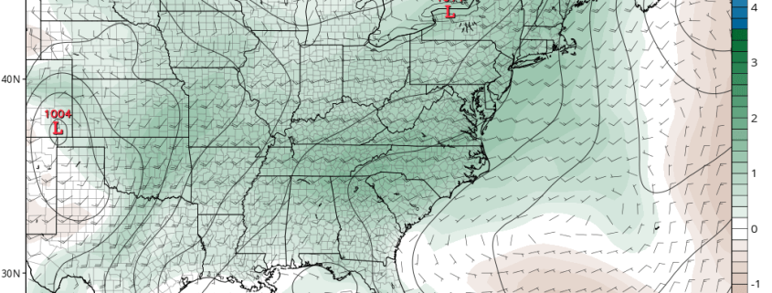
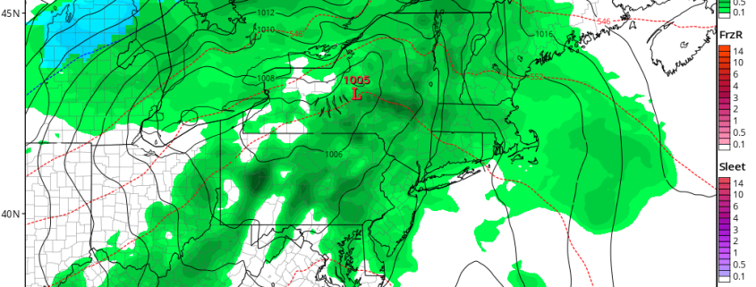
Happy Monday! Today will begin a cooling trend after a summer-like day on Easter Sunday! More clouds than sunshine are likely through at least the early afternoon hours, as cold front approaches. A weak mid-level disturbance moving through the Mid-Atlantic region, is also producing some showers over Southeast PA and Southern NJ this morning. A few scattered showers or sprinkles are possible further north into Northern NJ, NYC and Long Island. But most of these showers should stay to south.

Read more

Midday Zones: Summer warmth today, unsettled late week

Happy Easter to this who celebrate! We hope you’re able to enjoy the day with the family, friends, and loved ones who are most important to you. Regardless of whether you celebrate or not, we’re all being treated to summer-like warmth today. A deep west/southwesterly flow became rooted at the low levels of the atmosphere this morning and will continue through the afternoon. This has helped to advect a very warm airmass into the area and this air will remain over the region.

The west/southwesterly wind component to the airmass is probably the most critical (and meteorologically fascinating) aspect to the airmass which settles into the area. You may remember last week, much of the interior experienced warmth very similar to today. Temperatures rose into the lower and middle 80’s on those days as well. But near the coast, the cold ocean waters had their say — marine air shifted inland by 25 miles or so and kept coastal locations (and much of Long Island) very cool compared to their surroundings.

Read more

PM Zones: Summer like weather on Easter, unsettled beyond

While Easter often marks the beginning of the Spring-like weather throughout the area, this year’s holiday will end up feeling more like a mid-summer day. An anomalous warm airmass, driven by west-southwesterly winds and warm air aloft, will surge over the region on Sunday after the passage of a warm front tonight. This will lead to very warm temperatures with highs in the upper 70’s and lower 80’s throughout the area.

Some areas may even climb into the middle 80’s by the afternoon hours as the warmth moves overhead. The best part of the airmass, for those near the shore, is the westerly wind component. This will act to inhibit the westward movement of marine air and sea breezes, keeping the effects of the cold ocean waters at bay (no pun intended). In all seriousness, it will be a very warm day.

Read more

Active and Wet Pattern to Return Middle of Next Week and Beyond

Good afternoon, everyone! We hope you are enjoying this lovely Friday. For more information on the general day-to-day weather including the slight chance of strong thunderstorms on Easter evening, please refer to the main dashboard or the AM Zones Article. This article is going to be focused on the pattern moving forward.

After a winter with really not much in the way of high-latitude blocking, that has changed in March and to some extent this month. While it has not been a 100% constant, it has been persistent, and after a brief break, will return next week and help shunt an active Pacific Jet a bit further south. This initially further south position of the Pacific Jet will allow storms to traverse the country a bit further south than usual for this time of year, which should be southward enough to give us synoptic forcing for heavy rain.

Read more