-2")
Public Analysis: Anomalous Warmth Gives Way to Cooler Weather Once Again
Good afternoon!
The entire Northeast is enjoying temperatures well-above average once again today and tomorrow, as highs soar into the mid to upper 70’s, with even some readings of 80 degrees possible in southern locations. A brief return to more seasonable weather is expected later in the week before another chance for warmer temperatures sets up once again later in the period.
——
Today Into This Evening
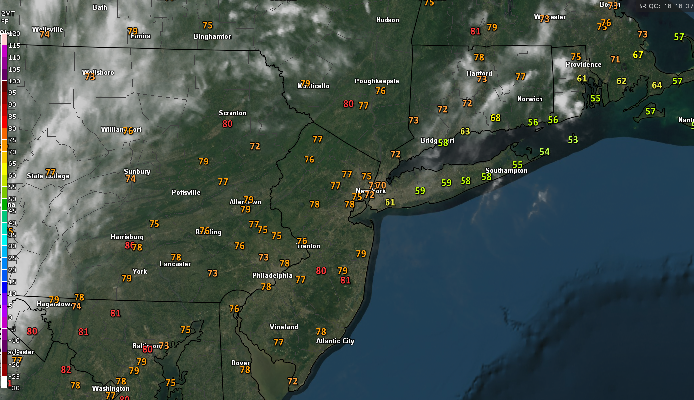
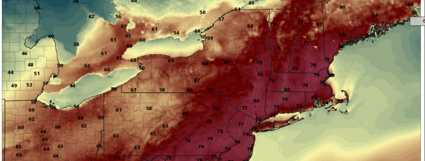
The ridge of high pressure that we talked about last week has indeed set itself up over the East Coast this afternoon, with light southerly winds overspreading the region today’s highs have surged into the middle to upper 70’s across portions of New Jersey and southern New York, with much cooler conditions noted on the coasts of Long Island and Connecticut. Offshore winds have really limited temperatures this afternoon, with some locations stuck in the middle 50’s due to the cool water just offshore. For the areas currently experiencing the warmer weather in New Jersey and inland areas, these temperatures are 20-24 degrees above the average temperature for this time of year, which is quite impressive considering most locations were at least 30 degrees cooler last week!
As we move through the afternoon and into this evening, only very wispy, high cirrus clouds are expected, so it should remain a rather beautiful Spring day as dew points remain low which allows this early warm weather to remain bearable. Once we get to around sunset, light south to southwesterly winds will keep temperatures in the 50’s for lows this evening, with coastal areas possibly dropping down in the mid to upper 40’s as southerly winds bring in a cooler and more dense air mass from the Atlantic.
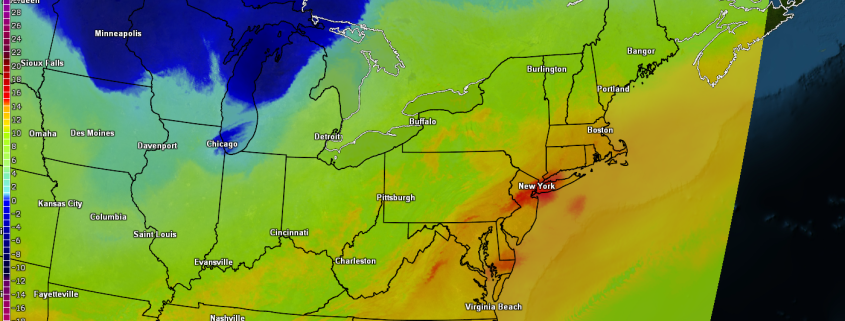
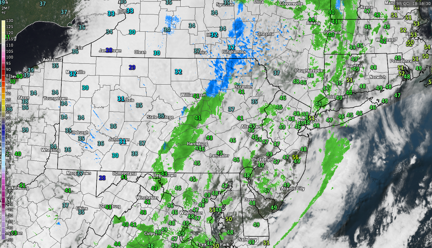
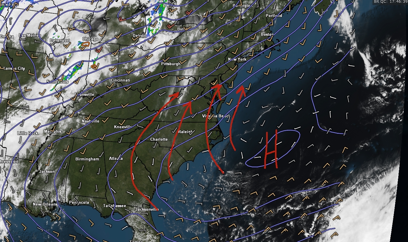
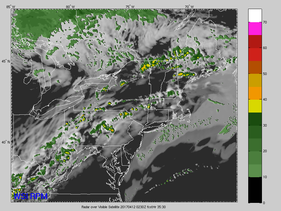
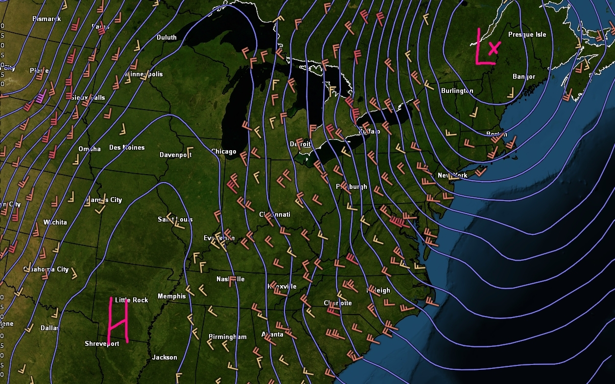
Current surface temperatures, regional radar, and visible satellite imagery over the region showing a relatively pleasant Spring afternoon (Courtesy of GREarth)
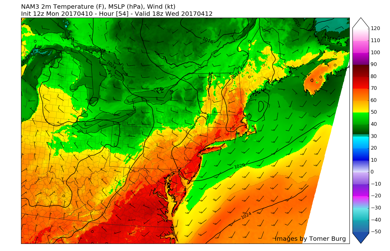
Tuesday into Wednesday
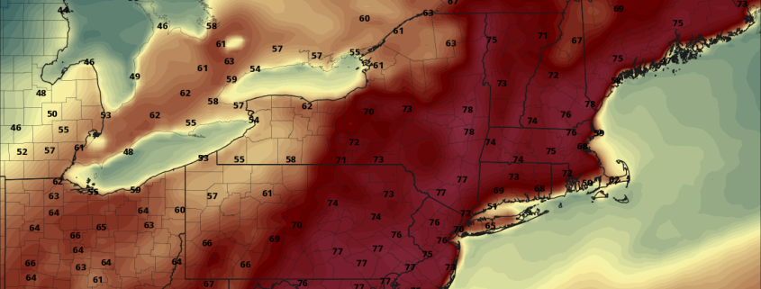
The area of high pressure off of the Mid Atlantic coast will be examining our dominant weather force tomorrow, and will in fact strengthen a bit tomorrow morning. This will allow warmer temperatures in the lower and middle layers of the atmosphere will be brought north early on in the day, which will mean yet another day of well-above normal temperatures for the entire Northeast. These warmer mid to low-level temperatures may actually allow surface temperatures to be slightly warmer than today as stronger southwesterly flow at the surface will act limit offshore flow. With low dew points, clear skies, and the aforementioned warmer temperatures throughout the mid to lower levels of the atmosphere, tomorrow should be another very nice day with highs once again in the mid to upper 70’s, with some locations possibly exceeding 80 degrees. Tomorrow has the potential to be around 24-30 degrees above normal tomorrow (!) and may actually see some records fall in parts of Massachusetts as some areas may get as high as 36 degrees above normal!
Later in the day and towards the evening on Tuesday, a very weak cold front looks to pass over portions of Pennsylvania and New York, possibly reaching the NYC metro area late in the evening or very early hours of Wednesday. Clouds will gradually increase ahead of this front as it makes its way eastward, with a chance of some showers possible. Any shower activity looks to be on the light to moderate side right now as the best dynamics with the front look to be located over Pennsylvania, where a few nighttime thunderstorms are possible. Even though the front will be passing through the area Tuesday night, the enhanced cloud cover may work to “cap” the atmosphere and allow low temperatures to stay in the upper 50’s, which may break records across some inland locations.
Wednesday may start off with some clouds and lingering showers in the early afternoon, but depending on the timing of the cold front and whether or not it is able to move quickly enough to our east during the day, we may actually have a chance at burning away the cloud cover and warming temperatures back up into low to mid 70’s. The main area of cooler air looks to be delayed by 12-18 hours with this weak front, so by Wednesday evening or very early Thursday morning, temperatures should finally cool down once again.
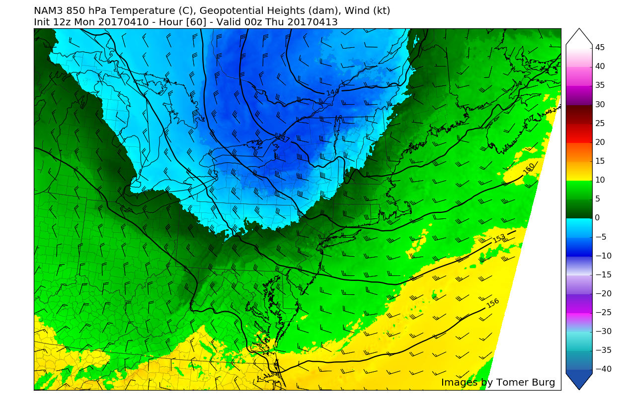
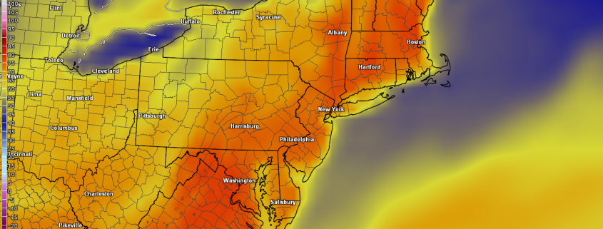
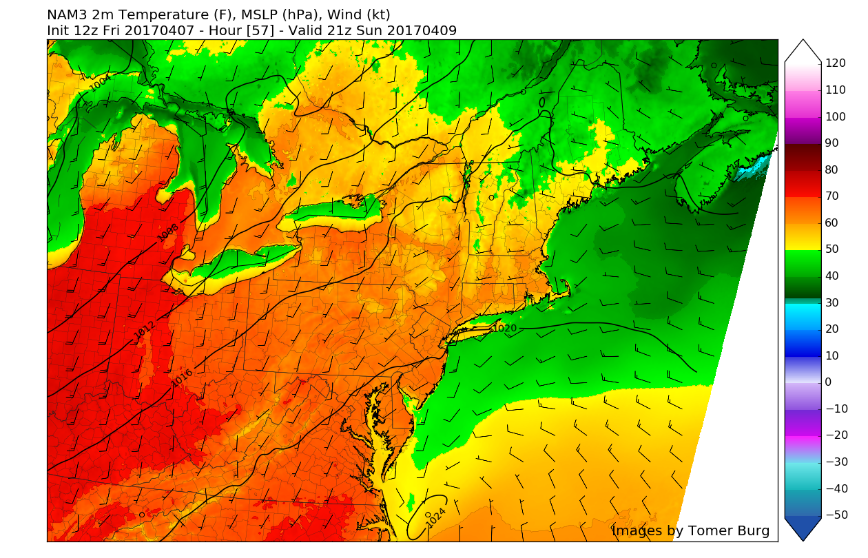
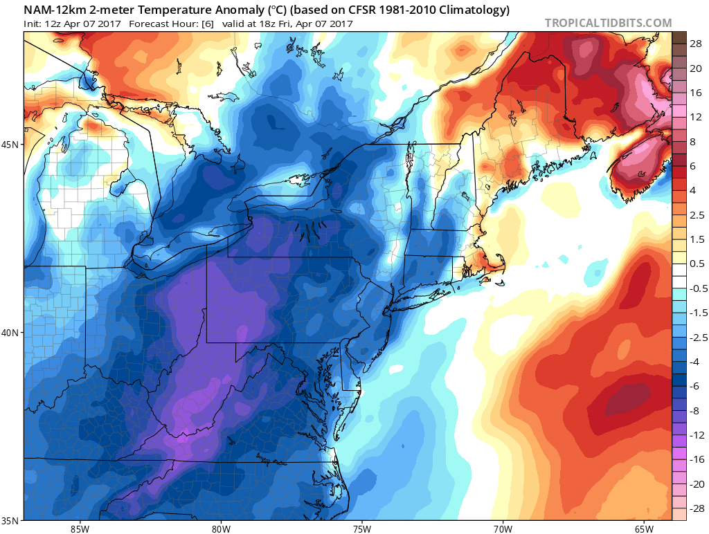
12z 3km NAM showing much cooler temperatures just 5000 feet above the surface working their way into the region by Wednesday evening (Valid 8pm Wednesday)
Thursday and Beyond
The cooler air behind the front will be delayed, but not denied as temperatures on Thursday look to sink back down into the lower to mid 60’s across much of the area, with coastal locations seeing the typical 5-10 degree adjustment downward. This will be much closer to normal, with temperature departures only reaching around 2 degrees above normal for the warmest locations on Thursday, but with a stout northwest flow coming in from Canada and winds around 10-15 mph may make it feel a little cooler than usual.
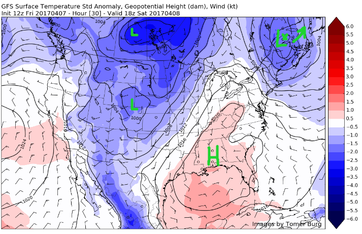
Current indications are that an area of high pressure will drop down from Canada on Thursday evening and center itself over portions of Upstate New York on Friday, which should lead to temperatures hovering right around normal for this time of year. However, as that area of high pressure begins to get shunted off to our east, we may see southwesterly flow return once again just in time for Easter Sunday. This would bring the potential for above-normal temperatures to once again return to the area, but models diverge on the exact timing and duration for this at the moment.
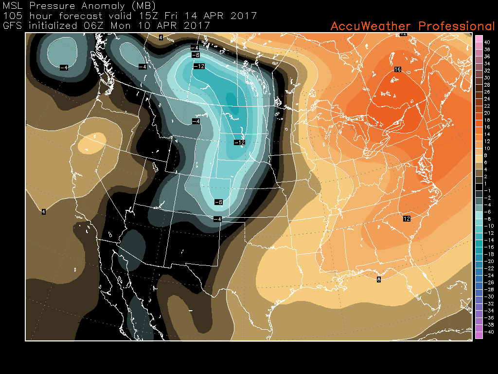
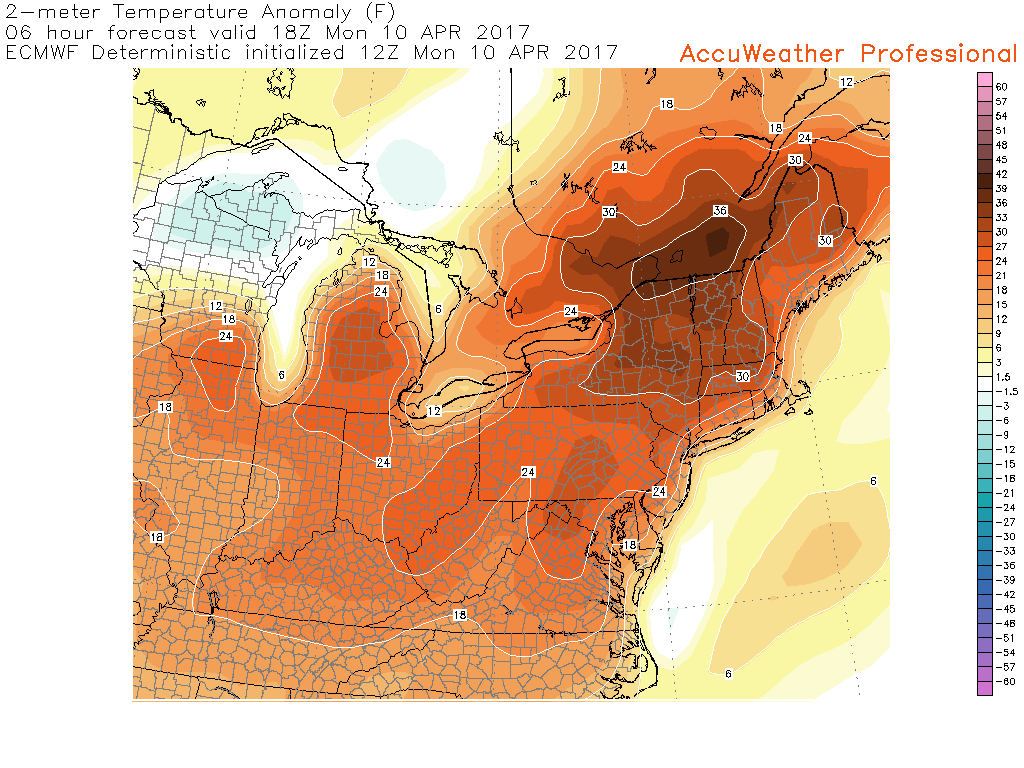
12z GFS mean sea level pressure anomalies, showing an area of high pressure dropping out of Canada and into the Northeast on Friday morning and into Saturday (Valid 11am Friday)
With the Holiday Weekend coming near, make sure to check back for further updates!
For more information and posts like this one, make sure you sign up for Zone Forecasts — where multiple detailed articles, videos, and interactives are posted each day. Also, come interact with our staff and many other weather enthusiasts at 33andrain.com!
Have a great day!
Steve Copertino