Snow returns tonight to the interior, higher elevations

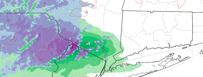
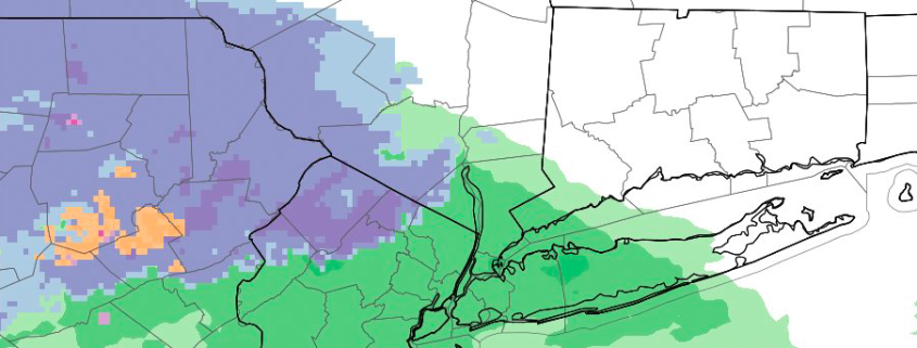
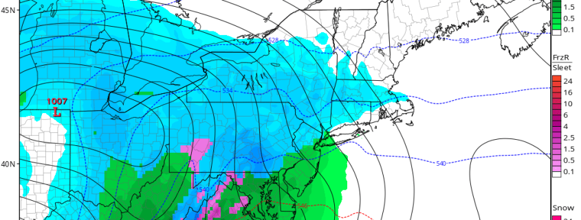
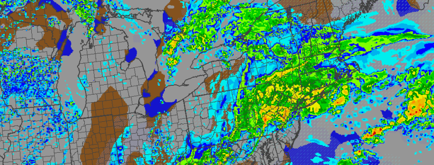
The second snow event in the Interior Northeast in as many days will unfold later this afternoon and evening, likely lingering through Wednesday morning, as a storm system develops into the Ohio Valley and eventually off the Mid Atlantic Coast. The primary surface low will drive northward into the Ohio Valley, helping moisture surge northward into the Northeast United States with a southwesterly flow.

Meanwhile, the secondary surface low will develop off the Mid-Atlantic coast which at least in some small scale will aid in cold air filtration into the system from a cold high pressure to the north. The main process allowing snow to fall in Northeast Pennsylvania, Northwest New Jersey, and Southeast New York, however, will be dynamic cooling, which occurs when precipitation falls heavily enough to cool the air around it.

Read more

Another interior snow event likely Tuesday evening

Light snow fell throughout much of the interior on Monday morning, with higher elevations in Northwest New Jersey and Southeast New York reporting nearly 2″ of snow as of 9:00am.While this lighter and weaker disturbance moves away later on Monday, a second and more notable disturbance will be approaching from the southwest. Increasing moisture and lift, as well as warm air advection, will approach the area on Tuesday — allowing most areas near the coast and even in the suburbs to warm up enough to support rain.

But farther inland, in the higher elevations and mountains of Northwest New Jersey and Southeast New York, the atmosphere will remain just cold enough as this moisture and lift approaches. In fact, the dynamics of the storm system itself will help to cool the atmosphere in an aptly-named process called “Dynamic Cooling”. Forecast models are in good agreement that this moisture will overrun cold air — allowing snow to fall later Tuesday afternoon and evening into early Wednesday morning before an eventual changeover to rain.

Read more

Premium Video Discussion: Multiple snow threats December 8th and onward

While there are a couple of light snow opportunities on Sunday night into Monday morning and again on Tuesday, the pattern will truly begin to evolve to one that’s much more favorable for accumulating snow potential for the Northeast. It all starts on December 8th with the passage of an Arctic cold front. From there, we’ll have a very active pattern with a number of disturbances attempting to run into the cold air. The lack of true high-latitude blocking on the Atlantic side is why we are currently favoring the interior over the coast for these snow threats. However, the pattern easily has the potential to produce accumulating snow for everyone. Our latest video discussion details each snow threat moving forward.

https://www.youtube.com/watch?v=NDPfHYFB0tg

Wednesday Overview: More Heavy Rain and Possible Thunderstorms Through Tonight

A large complex storm system continues to impact the region today. Some patchy and dense fog from early this morning has now given away more rainfall as another warm front moving slowly northward over the region this afternoon. Rain will likely fall heavy at times, leading to some minor flooding in poor drainage or low-lying areas. Despite the rain, temperatures will gradually rise into upper 50s to middle 60s over the region this evening, winds becoming more southerly.

Then a cold front will begin approaching the region early tonight. Models show more lift and instability increasing ahead of this front the during the evening hours. This might a support a line of  thunderstorms that could contain very heavy downpours and some gusty winds later this evening. Rainfall totals could exceed over 1.00″ again. Currently the Storm Prediction Center has issued a marginal risk for a few thunderstorms with isolated damaging wind gusts over Central and Southern NJ this evening. Some other highlights over the next few days:

Read more