-2")
Winter Storm Likely Wednesday for Portions of the Northeast
Good evening!
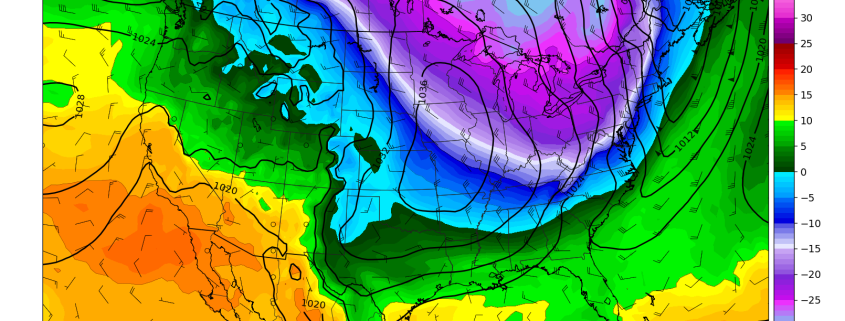
Today has been a rather cold and blustery day across the entire Northeast as a cold front quickly blasted across from west to east early this morning. This cold front ushered in a fresh blast of cold air from Canada, causing temperatures to drop a few degrees this morning before peak daytime heating. As the cold front moved offshore, dry air filtered into the region which allowed for mostly sunny conditions to persist throughout the rest of the day. Despite the clear skies, the cold mid level temperatures only allowed for temperatures to rise into the lower to middle 30’s for the immediate NYC metro area. Highs were a bit lower to the north and west with temperatures staying in the middle to upper 20’s-which is only slightly below normal for this time of the year. The main story today was actually the winds that arrived immediately after the frontal passage, which gusted at around 30-35 mph at times. These winds really helped to make conditions feel quite a bit colder than they actually were, with wind chills in the middle to lower teens. Additionally, any residual standing water left over from melting snow quickly froze this morning, leading to some very slippery conditions across the entire Mid Atlantic and Northeast.
Conditions will remain quite clear, with winds gradually abating by around midnight. A weak area of high pressure will work over the Mid Atlantic this evening and provide rather favorable conditions for radiational cooling to take place tonight. Highs should drop down into the middle to lower 20’s for most of the NYC metro area, with locations to the north and west getting down into the middle teens for lows.
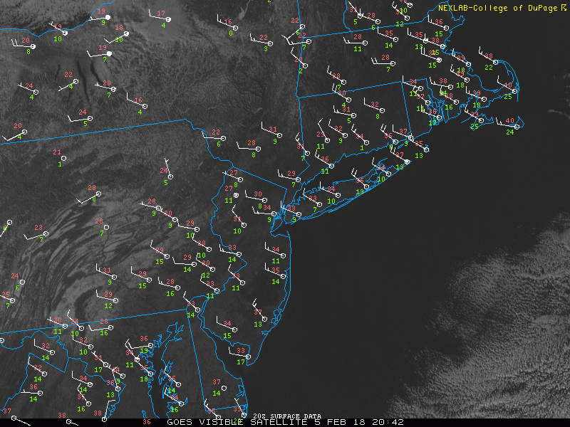
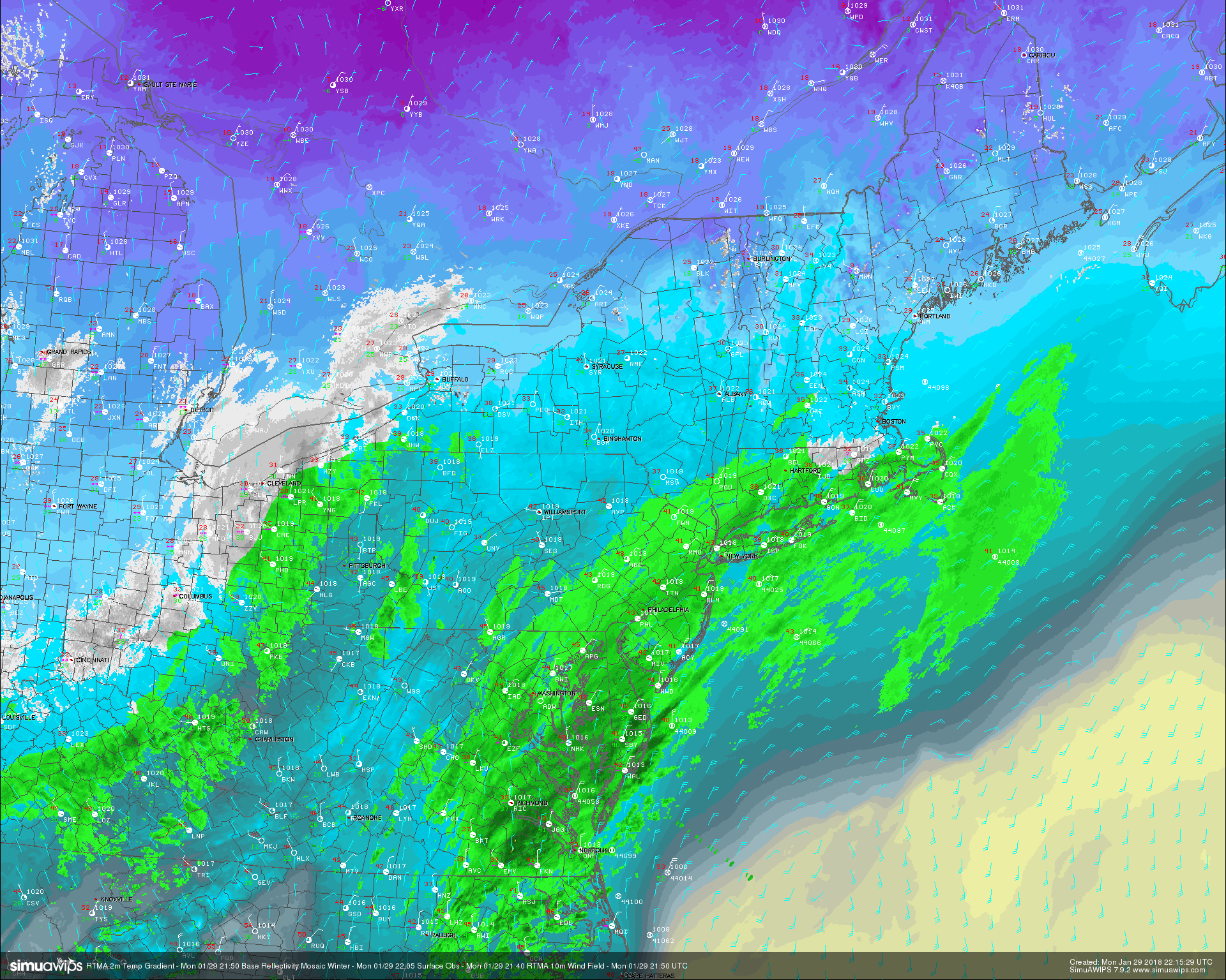
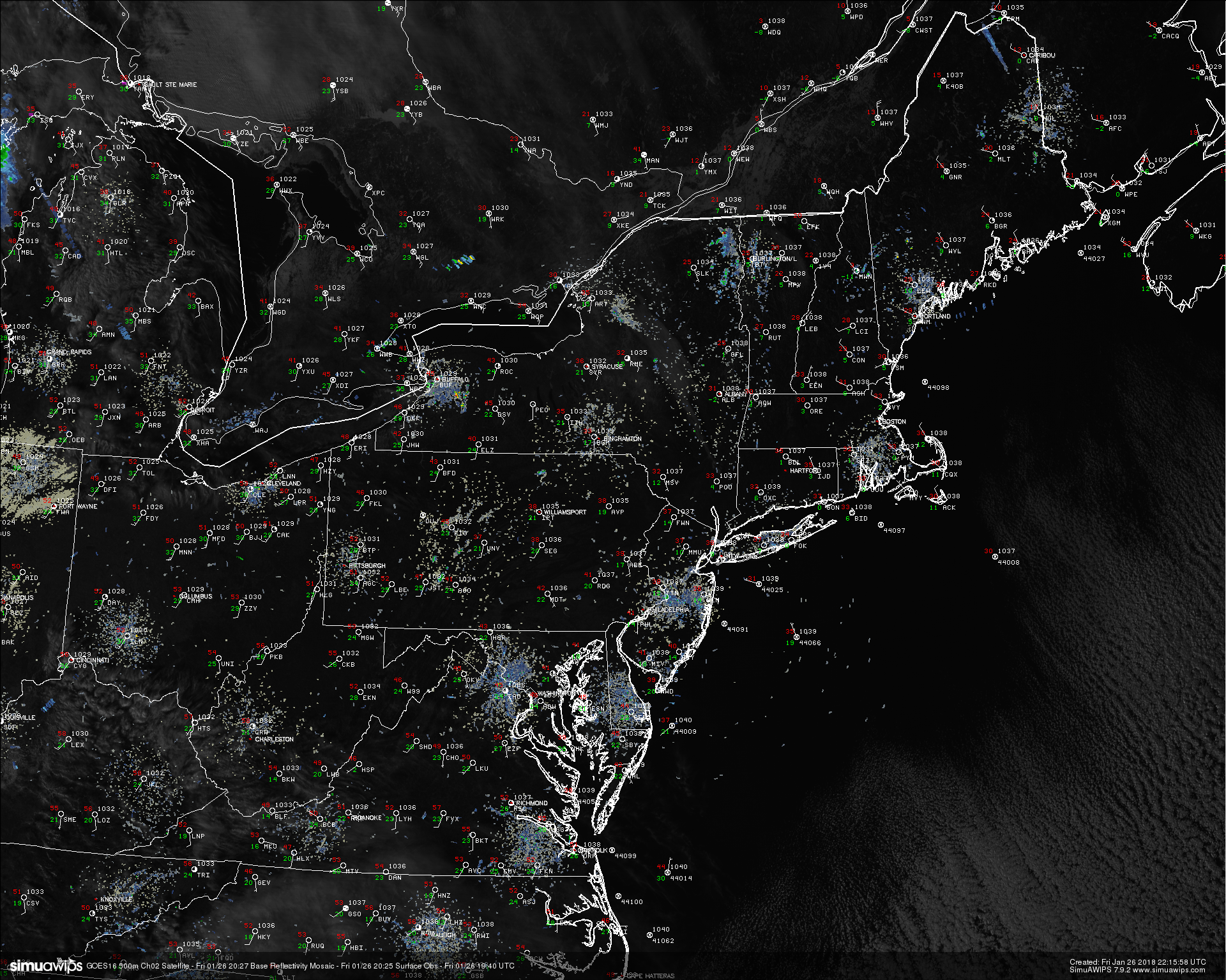
This afternoons high resolution satellite imagery and surface observations over the Northeast
Calm Tuesday, Winter Storm Likely Wednesday
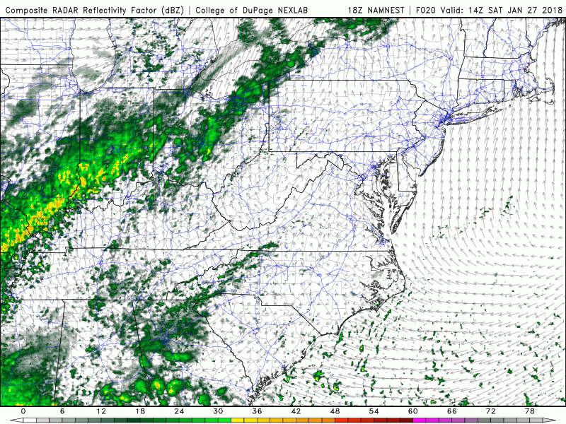
Tuesday: A weak area of mid level energy will be racing across the Ohio Valley and into portions of the Northeast tomorrow morning, which will have to be closely monitored for possibly being able to produce some areas of light snow in the morning. This area of energy, being so weak, will not have a reliable source of moisture and will also be running into dry air. This will cause the threat of snow to be greatest over western locations of the Northeast. Any snow that does fall will very light in nature and should only lead to accumulations of around a trace to an inch. This area of energy will likely move off the coast by the middle afternoon hours, gradually giving way to clearing skies from west to east. Despite the threat for some isolated snow, the rest of the day should be mainly calm and cool, with highs staying in the low to middle 30’s across the immediate NYC metro area. These calm and conditions will last through the evening hours, with lows ranging in the middle to upper 20’s.
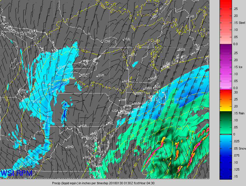
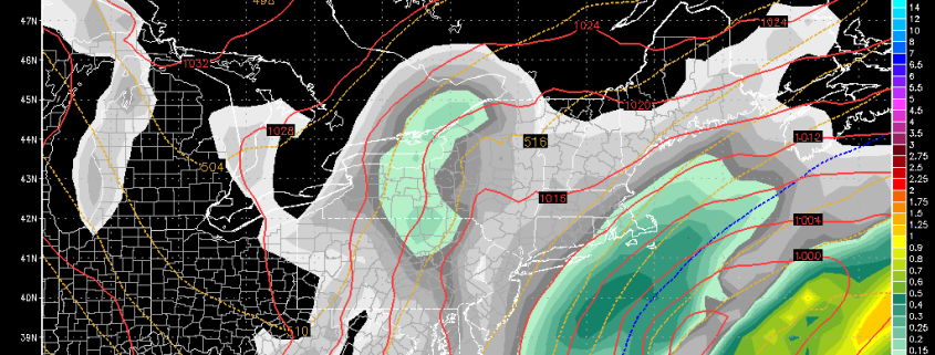
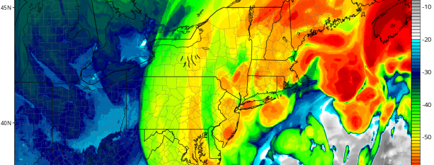
By Wednesday morning, two areas of energy will begin to interact over the central Plains states, leading to a very weak surface low developing over the Tennessean valley. As this low develops Wednesday morning, it will drag up a moderate amount of moisture with it that will likely cover the majority of the eastern US. The area of high pressure that is currently dominating our weather will be retreating to the east by this time, leaving some residual cold air behind over the Northeast. Precipitation will likely expand further to the north and east during the morning commute on Wednesday as an impressive upper level jet streak strengthens overhead. Since the surface high will be displaced to the east, the cold air will only be able to stick around for so long as warmer air begins to rise up from the south. This will likely lead to a quick-hitting period of moderate to heavy snow propagating from south to north , that will gradually change to rain over time as warmer air moves north. The further north and west you get from New York City, the better chance you have at more wintry precipitation. At this time, points south and east stand to get maybe a coating to an inch before the changeover to rain, but locations over NW New Jersey and SE New York have the best chance to see at least a couple of inches before a mix and eventual change to rain sets in.
It is important to note that the hi-res models have been waffling quite a bit over the past day or so, and this is mainly due to the handling of the extent of the low level cold air. If the cold air sticks around longer, there will be a greater threat of snow lasting longer in addition to more substantial frozen precipitation accumulations. These types of events usually do tend to be colder than forecast, which is why we feel that those traveling Wednesday morning keep an eye on the weather and stay tuned for further updates, as travel may be at least moderately impacted across the region.
Precipitation will gradually end from southwest to northeast as the low quickly heads off to sea during the evening hours on Wednesday.
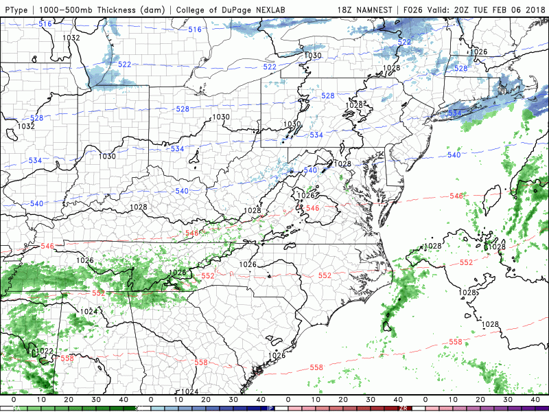
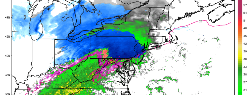
This evenings NAM model showing the evolution of the winter storm over the Northeast on Wednesday
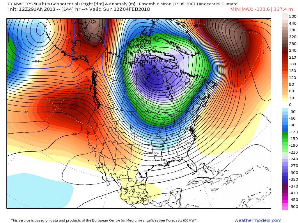
Another Storm Possible Next Weekend
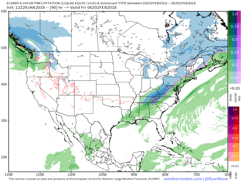
The computer models continue to depict another area of low pressure developing over the Tennessee valley Saturday and into Sunday as yet another area of high pressure exits to our east. This system will likely be quite large and disorganized in nature as the upper level pattern remains quite unfavorable for a strong surface cyclone. Additionally, there does not look to be a reliable source of cold air over the east, therefore any chance at significant snowfall through the weekend remains low at this time. There is still a lot of time for this to change over the next couple of days so make sure to check back for updates as they become available!
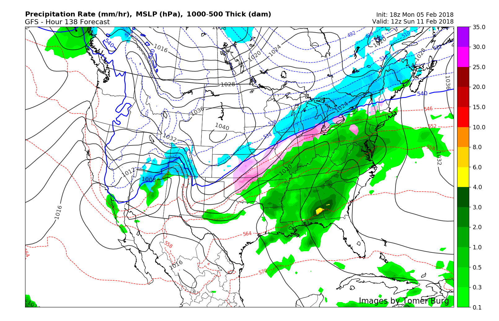
This afternoons GFS model showing the potential for another system to impact the east this weekend
Have a great night!
Steve Copertino