-2")
Quick-Hitting Snowstorm Likely for Portions of the Northeast Saturday Night
Good evening!
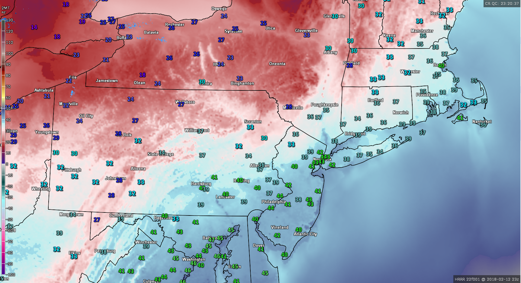
Today has been yet another in a string of warmer and unsettled days across the Northeast, with light to moderate rainfall training over portions of the Mid Atlantic and Northeast. Today’s rain was part of the same strung-out and progressive upper level energy that was responsible for the heavy rain and flash flooding that occurred over portions of the Ohio Valley and Mid Atlantic states last evening. The heavy rains last evenings moved quickly along a frontal boundary that remained stationary over the same areas, causing showers and even some embedded thunderstorms to train over the same locations. While the vast majority of these showers and thunderstorms very quite weak in nature, there were some stronger storms over the Ohio Valley and Northeast that produced some damaging wind gusts, along with an EF-1 tornado just to the south and east of Pittsburgh. Regardless, today was a rather dreary day across the entire region as the mid level energy over the Ohio Valley quickly moved east and caused numerous showers to break out once again. The showers have since moved offshore as the majority of the mid level energy moves off to our east, leaving behind mostly cloudy conditions. Despite the mostly cloudy and rainy conditions today, temperatures were able to rise to above-normal levels once again across the Northeast. Readings varied from the lower to middle 50’s over the New York metro area, to middle 50’s to lower 60’s across portions of southern New Jersey. These mild conditions should last until the late evening hours as a cold front begins to approach the area from the west, bringing in cooler temperatures overnight along with Northwesterly winds. High pressure will begin to build in over the Northeast tonight, with lows likely falling quite a bit into the middle to upper 20’s over the majority of the area, with lower 20’s expected to the North and West of the city. Calm conditions will likely prevail through the overnight hours as the high pressure expands over the Northeast.
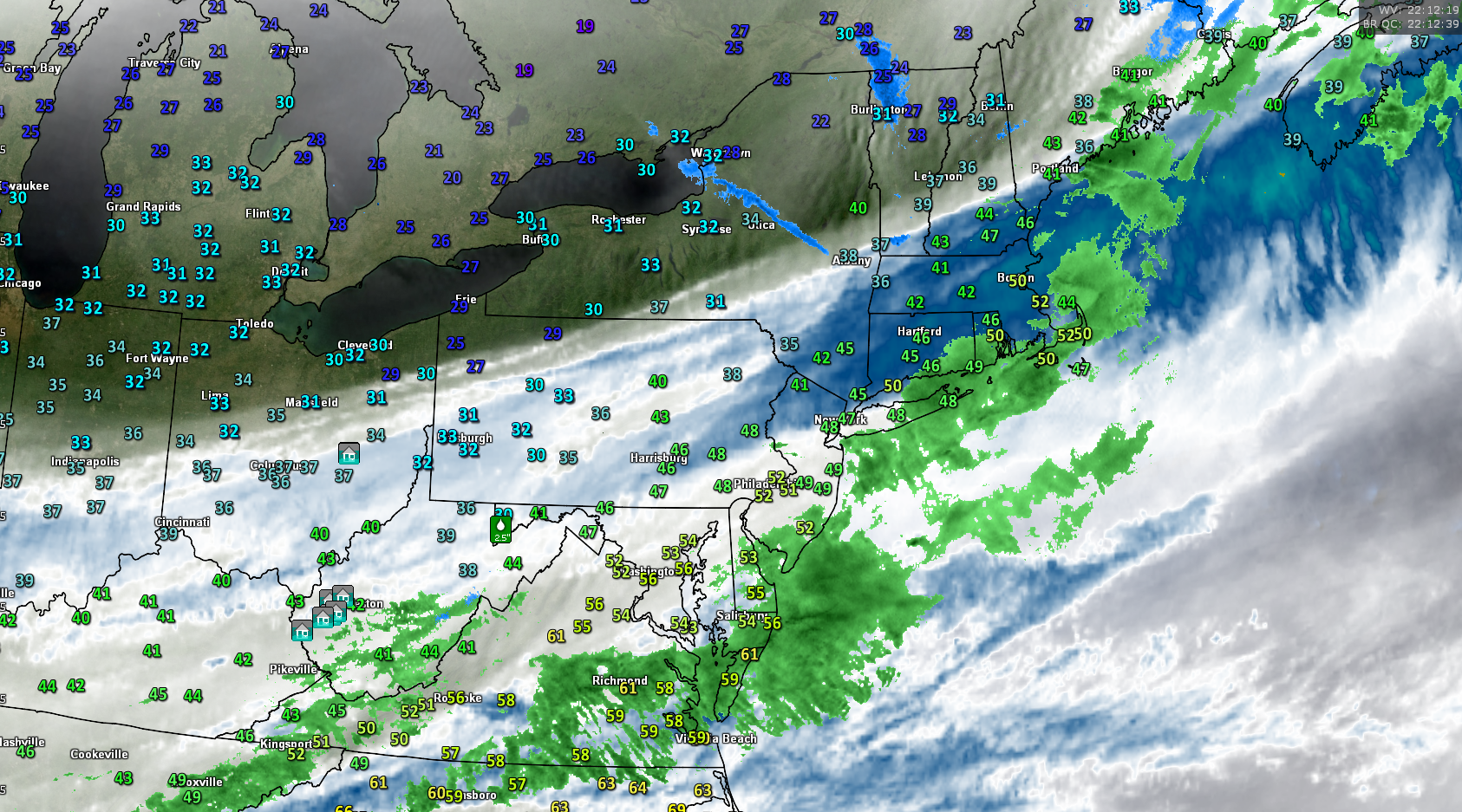
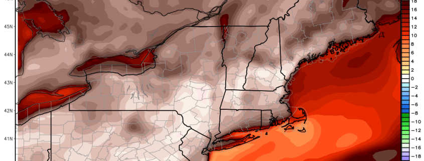
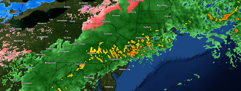
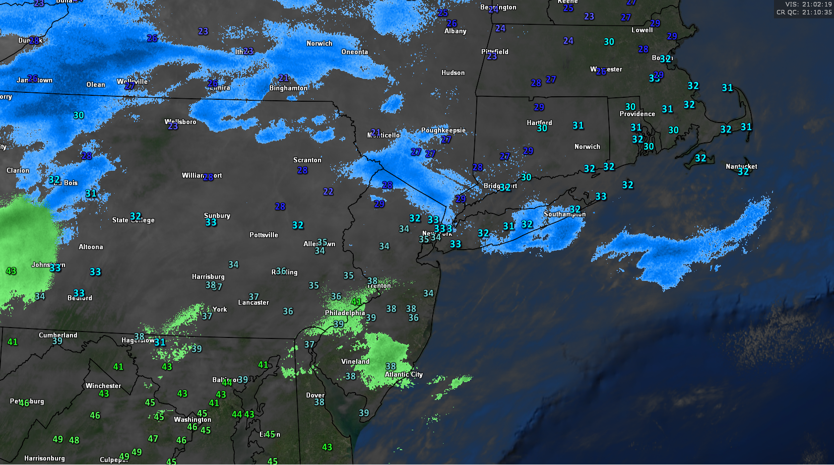
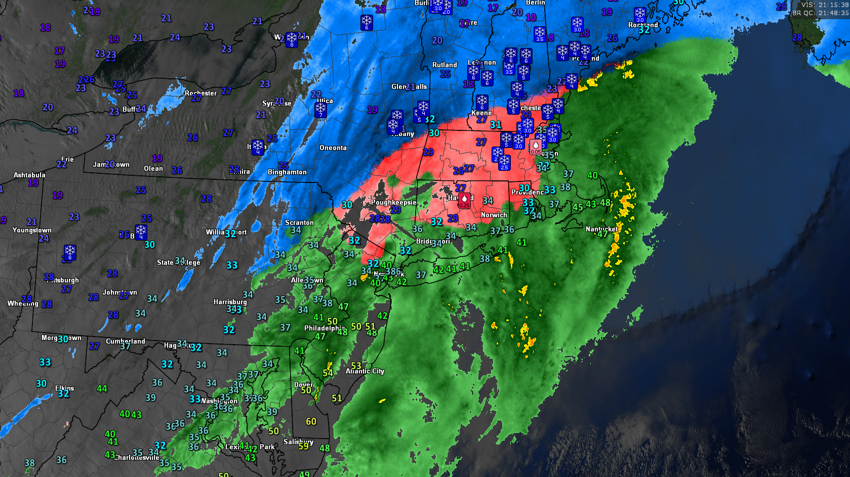
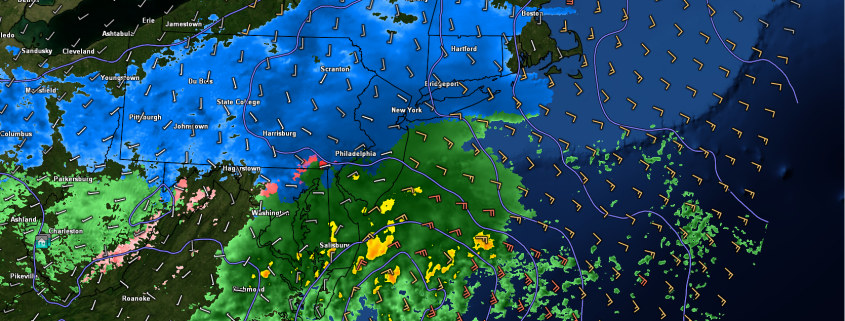
This evenings latest high restitution water vapor satellite imagery along with regional radar mosaic and surface temperatures from across the area. Note the clearer and more dry air over portions of northern PA and NY.
Quick-Hitting Snowstorm Likely Tomorrow Across Portions of the Northeast
Well, with the way this week has went the last thing you would expect is a snowstorm for this weekend, but that is exactly what looks to be shaping up for portions of the Mid Atlantic and Northeast tomorrow night into Sunday morning. A weak a relatively disorganized area of mid level energy will become trapped in the fast-moving west-to-east flow over the CONUS tomorrow morning and begin to race towards the East. As it reaches the Great Lakes region tomorrow afternoon, it will begin to meet up with some energy from the sub-tropical jet over the Southern Plains states, and this will likely cause numerous showers and some localized thunderstorms to develop over portions of the Tennessee valley. At the same time, the area of high pressure that will be over the region this evening will be moving off of the coast, leaving some stale cold air over the region. Winds will begin to shift to the south over the Mid Atlantic and Northeast, bringing in a slightly warmer low level airmass for tomorrows highs, but overall temperatures look to stay in the middle to upper 30’s. As we get deeper into the evening hours tomorrow, we should see the shortwave trough associated with tomorrows potential storm begin to amplify or strengthen a bit as the ridging over the southeast and western Atlantic causes the system to buckle.
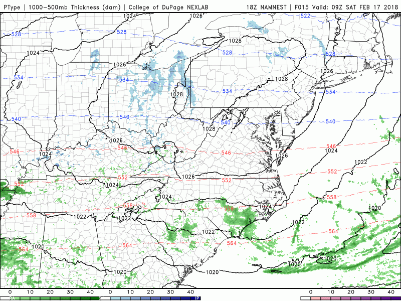
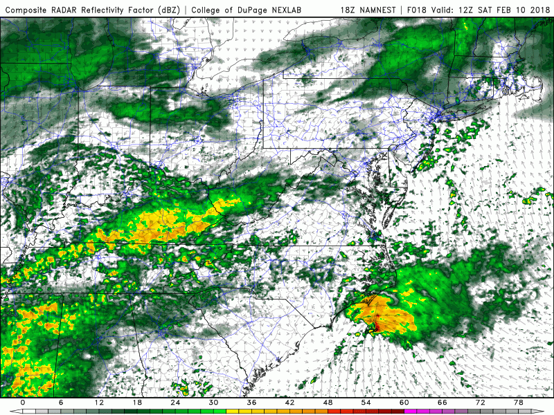
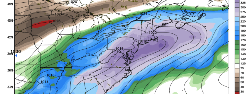
This afternoons NAM model showing the potential evolution of tomorrows snowstorm
As the mid level energy begins to strengthen tomorrow evening, we will also see the upper level jet streak associated with this system begin to expand, allowing precipitation to break out farther north into portions of the Mid Atlantic by sunset. Surface low pressure should then begin to develop over the Mid Atlantic coast tomorrow night, with snow quickly expanding from southwest to northeast over the Northeast. This afternoons model guidance still shows a reasonable amount of uncertainty with the strength of this system, which will be crucial to this forecast. Depending on how deep this low gets will determine how much dynamic cooling will take place as the precipitation is falling. A weaker storm will be warmer at the surface with less precip, and therefore less snow. A stronger system will be able to overcome marginal surface temperatures and have increased snowfall rates, yielding higher snow totals. At this time, a healthy compromise of the two seems plausible. Precipitation may start off as a mix of snow and rain over southern portions of the Northeast, but should turn to all snow by 8-10pm or so with the exception of immediate coastal areas. The snow will quickly become moderate to heavy over portions of Pennsylvania, New Jersey and New York, with an enhanced chance at mixing over Long Island due to easterly winds. Moderate to heavy snow should continue through the overnight hours, likely until 3-5am as the system quickly accelerates to the north and east and moves offshore. Totals will likely vary by location and elevation over the region, but right now we expect a general 3-6″ from southeastern PA through northern NJ, and into SNY and CT. Portions of Long Island may see less than shown here due to prolonged periods of mixing. Travel conditions will likely be quite hazardous if you plan on driving tomorrow evening, so please stay up to the date with your local NWS for any watches or warnings in your area!
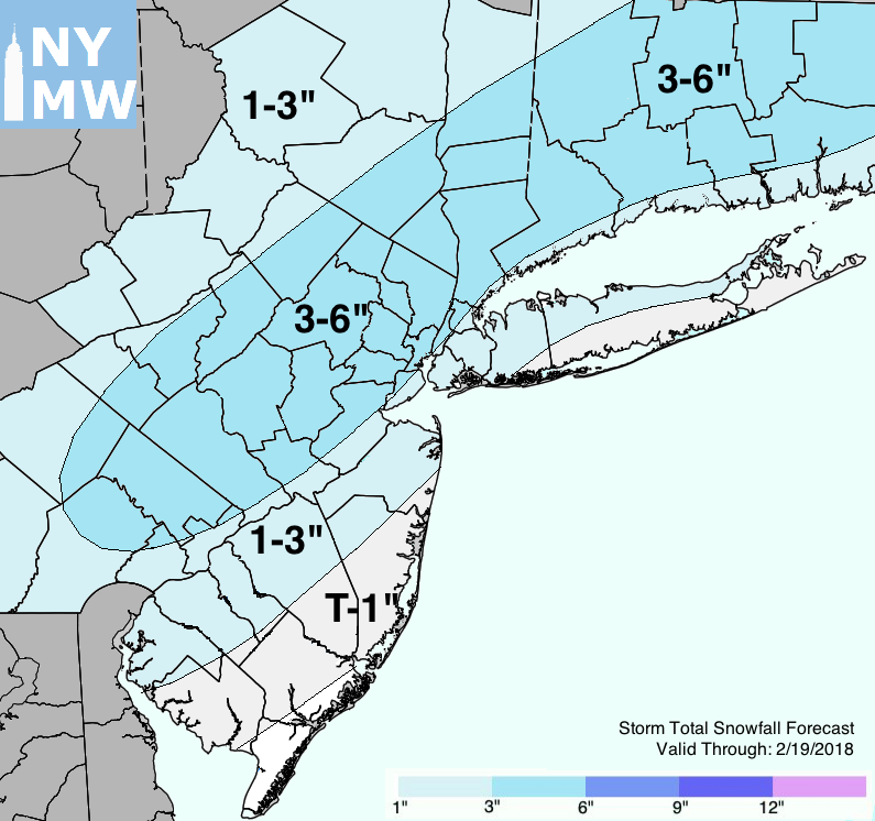
Our latest storm total snowfall map
We will have updates tomorrow on this system including a new snowfall map!
Have a great weekend!
Steve Copertino