Good evening!
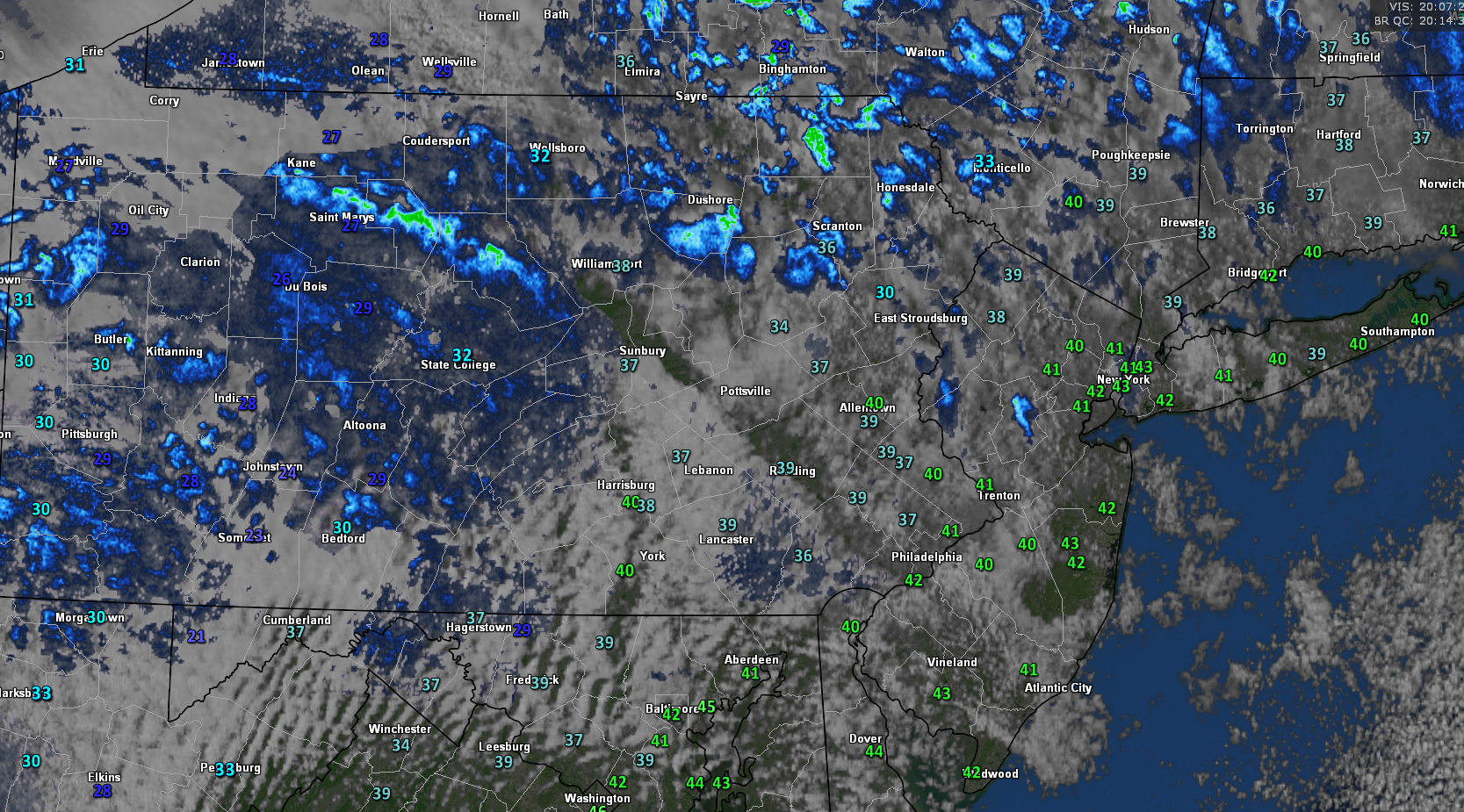
Today has been a relatively cool and calm day across the Northeast as the large area of low pressure that produced very heavy snowfall over a good chunk of the Northeast continues to pull away. Despite this surface low pulling away, a large upper level low over Canada continues to shift to the south and east, bringing in some weak mid to upper level energy. This weak energy over the region has produced some isolated snow showers and mostly cloudy conditions this afternoon, with some more impressive snow squalls located over the northern portions of New York and New England. As the day winds down, these snow showers and squalls should gradually die down, but a quick coating to an inch of snow cannot be ruled out over the aforementioned locations. Back towards the New York city area, westerly winds and cloudy conditions continue to persists with some very light snow showers present over southern New York and Northeast PA. Due to the large surface low pressure to our northeast, northwesterly/westerly winds have been prominent over the region. In addition to these surface winds from Canada, we also have a relatively fresh airmass coming in from southern Canada that has allowed for a relativity cool day across the Northeast. Highs were only able to make it into the upper 30’s to lower 40’s, with occasionally gusty winds making conditions feel a bit colder than they actually are. Winds will also gradually die down as the pressure gradient over the region continues to weaken. Low to mid-level clouds over the area should persist as the upper level low over New England continues to meander, so expect lows to range from the middle 20’s to lower 30’s across much of the Northeast tonight.
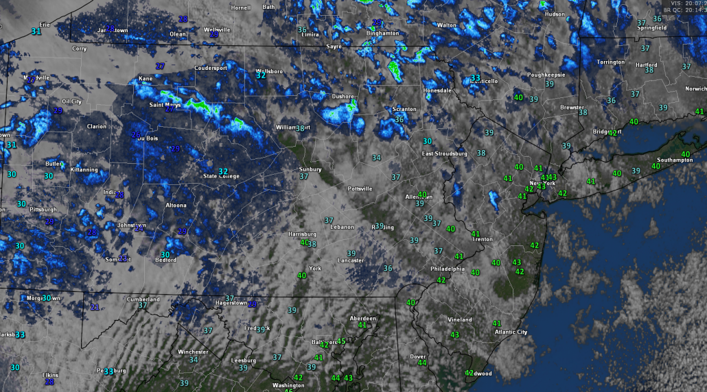
This afternoons latest surface temperatures, regional radar mosaic, and high resolution visible satellite imagery
Calm and Cool Weekend Shaping Up
The large upper level system over New England will continue to slowly meander to the east tomorrow morning, leading to continued partly cloudy conditions. Mid level energy will continue to rotate around this large system, leading to a slight chance at some scattered shower/flurries during the afternoon hours, but all in all, tomorrow should be a relatively calm and less windy day than today. In addition to the partly cloudy conditions, we will still have an active northwesterly flow coming out of southern Canada, so expect highs tomorrow to range from the middle 30’s to lower 40’s across much of the Northeast tomorrow afternoon. Conditions appear to grow slightly more stable by tomorrow evening as the surface low and upper level low continue to have much less of an influence on our sensible weather. Clouds should generally dissipate tomorrow night, giving way to mostly clear skies. This will set the stage for ripe conditions for radiational cooling to take place over the Northeast, which will lead to a steep drop in temperatures overnight. We should see lows drop into the lower to upper 20’s, with some locations closer to the coast just staying below freezing. This may create some slippery conditions overnight as any melted snow pack will quickly refreeze on most untreated surfaces.
Sunday will likely start off quite calm and cool across the Northeast, there will be bigger and more important things happening off to our west over the Plains. Ridging will be present over the Western US, which will allow for multiple disturbances to drop south from Canada. The first of these disturbances should be located over the central Plains by Sunday morning, with precipitation breaking our over much of the South by the afternoon hours. Conditions back over the Northeast will remain tranquil and cool as a surface high pressure system over the Great Lakes provides rather cool temperatures in the upper 30’s to lower 40’s across much of the Northeast. The tricky part of the forecast begins on Sunday evening as the main disturbance over the Plains begins to move south and east into the Tennessee River Valley region. The models continue to struggle with the evolution of this system, varying their outcomes with just how consolidated the mid level energy can get by Sunday night. The overall evolution of this piece of energy will be crucial for the potential for another coastal system on Monday, which we will discuss in the next section.
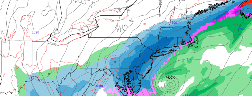
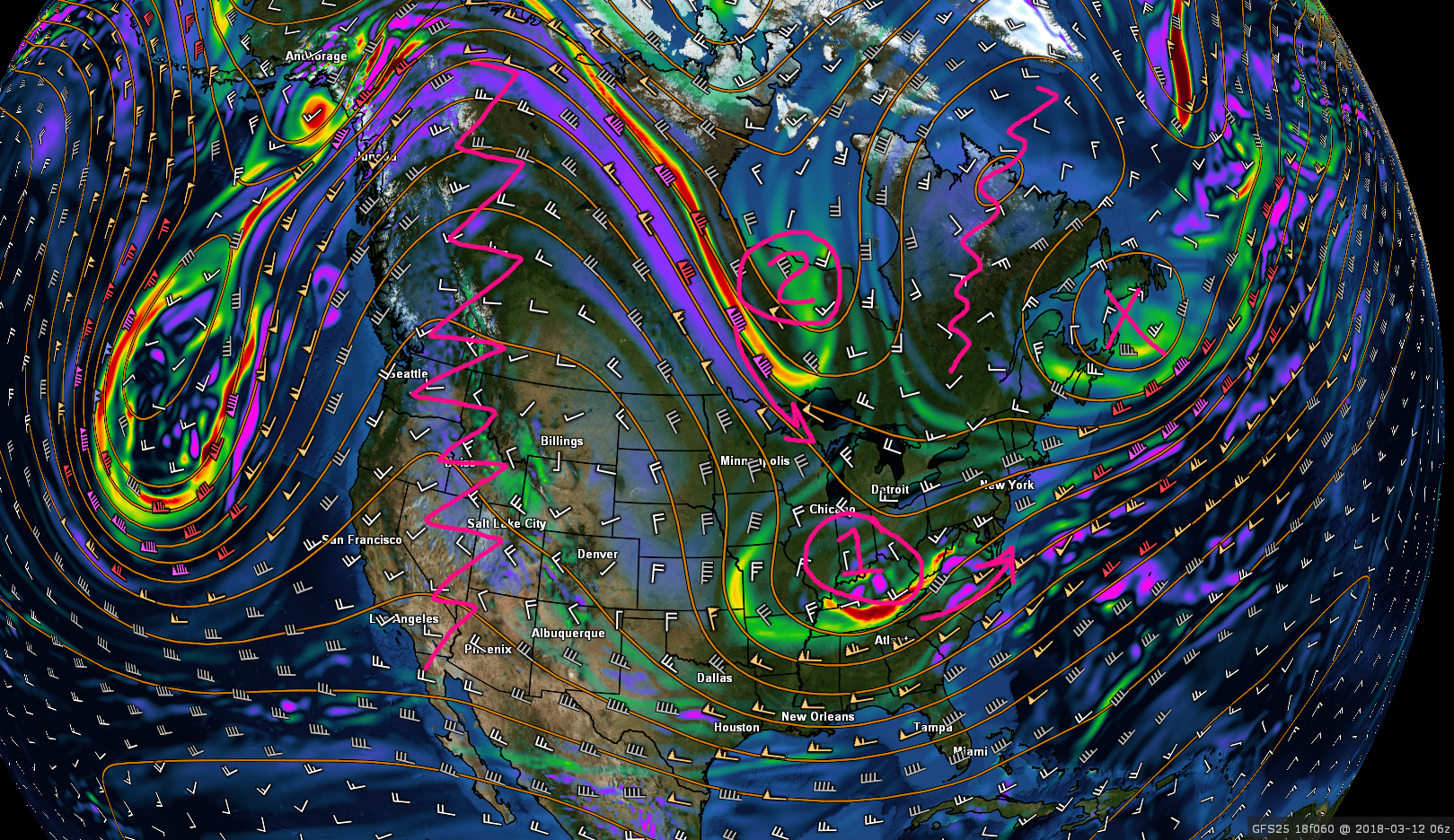
This afternoons NAM model showing the very complex evolution of the various pieces involved for the potential coastal system on Monday.
Watching for a Potential Coastal System Monday
As mentioned above, we will have a vigorous piece of energy diving into the Plains Sunday, as ridging in the West amplifies and allows heights to become more north-to-south oriented over the Plains. This piece of energy alone has been poorly modeled over the past couple of days with significant run-to-run variance even on this afternoons runs. However, there is another piece of the puzzle that is arguably just as important, if not more important than the first piece. This “second” piece originates from a large trough over the Gulf of Alaska, and gets “chopped off” from the main trough once the ridging in the west begins to reach its peak amplification. With a large upper level low to the east of the system over Nova Scotia, this piece of energy has nowhere to go, but south. However, the point at which this piece begins to head south into the CONUS is crucial, as it will dictate how organized, and how much interaction (if any) occurs between the first and second pieces of this potential system. If the second piece diving down from Canada is quicker than what the models have at this point in time, more interaction and favorable height fields will exist along the east coast for a potential coastal storm. If the second piece is held up in Canada for too long, OR the first piece of energy is too disorganized, than we will likley see the mjority of the energy slide harmlessly out to sea.
As of right now, the overall chance of a major snowstorm along the east coast is low, but it would not take much to have this system develop closer to the coast and pose a much more significant threat to the east.
Stay tuned for further updates on the latest model data and updates to our thoughts on the systems progression!

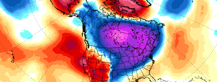
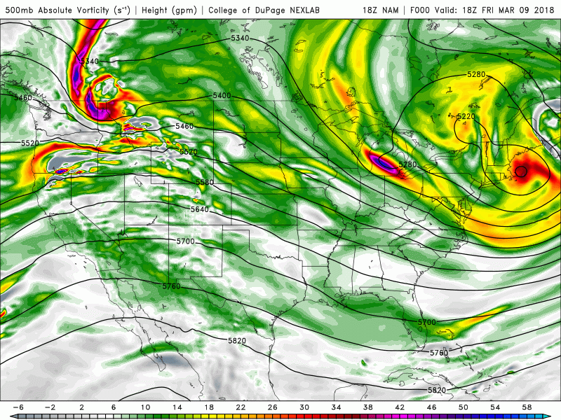
A very rough synoptic breakdown of the upper level pattern expected by Sunday. Each feature will play a key role on the overall potential for a storm on Monday
Have a great weekend!
Steve Coeprtino
-2")