Some Snow Likely in the Northeast Tuesday & Wednesday

Good morning! Very cold temperatures are again starting this week. A mixture of sunshine and clouds are expected for today. Highs will be in the mid-upper 20s. Cold and dry conditions will continue into tonight. But clouds will be increasing, as the next storm system approaches the Northeast. Temperatures will near steady for most of the night.

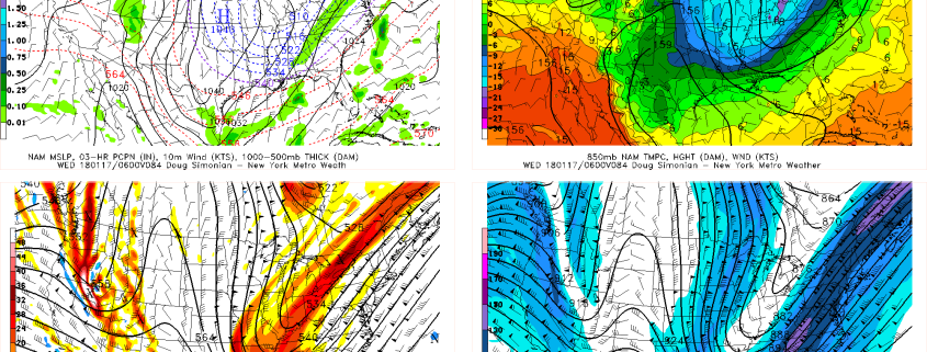
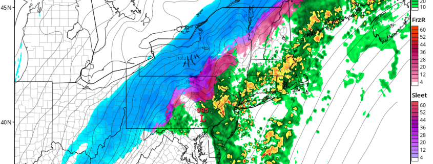
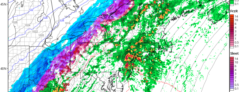
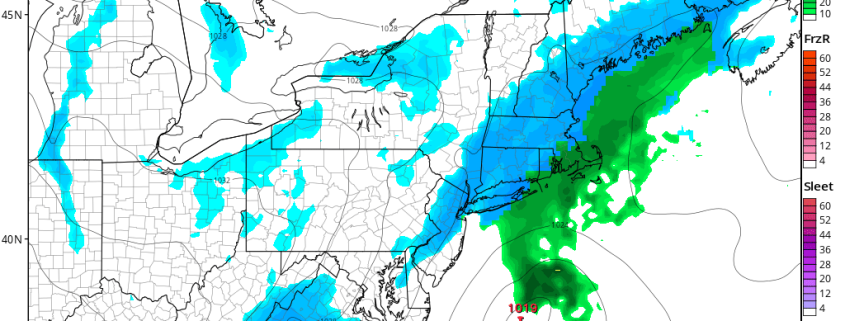
A large positively-tilted trough will begin moving into the Eastern US on Tuesday. A clipper low associated with northern stream shortwave energy along this trough will drag a cold front into the Northeast and Mid-Atlantic region tomorrow. Moisture will be initially limited with this system overall. But some bands of light snow will be developing, over the Interior areas morning and midday hours. Then these bands will be moving into the coastal areas during mid-late afternoon or early evening hours.

Read more

VIDEO Analysis: What to Look For in Tracking Next Week’s Potential Snow

Good evening! Now that the latest storm has cleared the area, we can now turn our focus to next week’s potential snow event. While some models still show a potentially impressive coastal low pressure developing, and thus giving the area a significant accumulating snow, there have been plenty of models that are backing off.

In this video, we explain why these models are backing off, and why they may be correct in doing so. But we also analyze what we’d like to see evolve in the atmosphere to bring the snowier solutions back on the table, and how we are still pretty close to returning to a snowier solutions on many of the model runs.

Northeast Storm With Heavy Rainfall and Wintry Mix into Tonight

Happy Friday! The rest of today may not in fact be so “happy,” as a large storm system impacts the Northeast, making the day quite soggy. Periods of rain will continue, becoming heavy at times for the rest of this afternoon and into tonight. Warm-air advection will continue to support very mild temperatures and high dewpoints. This will continue to cause some areas of patchy fog to linger into this afternoon, as the ground may remains colder. In fact, some record high temperatures could be broken by early this evening.

Read more

VIDEO Analysis: Heavy Rain & Flash Freeze This Weekend, Potential Snow Event Next Week

Good evening! Our latest video goes into a bit more depth regarding the large storm system for Friday into Saturday. We explain how the low-level jet, high precipitable water values, and instability aloft may all lead to heavy downpours and even thunderstorms on Friday. We also explain how on Friday night and Saturday, cold air will quickly advect into the area in the low-levels, but remain warm aloft, so the interior may end as some sleet and freezing rain (not snow!) before precipitation ends. Much of the area may receive around 2″ of rain.

The warm layer and instability show up in a classic manner in forecast soundings, so we take an in-depth look at that as well. It also illustrates the juxtaposition between the warm air aloft and the very cold air in the low-levels that is advecting into the region on Saturday morning.

We also take a look at some of the model data regarding a snow event next week. It looks very impressive in some elements aloft, but some smaller details may prevent the storm from reaching its true potential.