Tuesday Briefing: Interior winter storm on the way

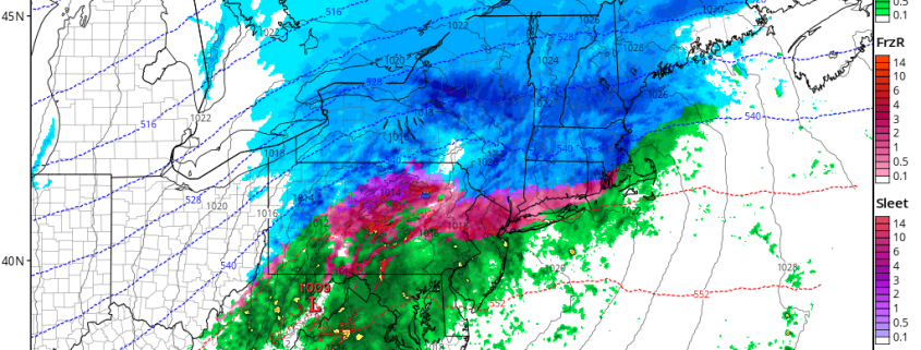
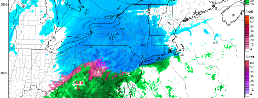
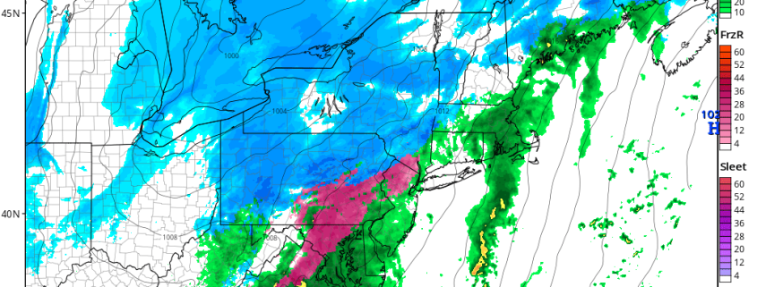
Good morning and Happy Tuesday! We’re continuing our Daily Briefing series, where we provide free public weather updates for various parts of the country. Thanks for reading! A significant winter storm is expected to develop later today and Wednesday across the Northeast states, particularly in the interior areas, where snowfall amounts upwards of 6″ are possible.

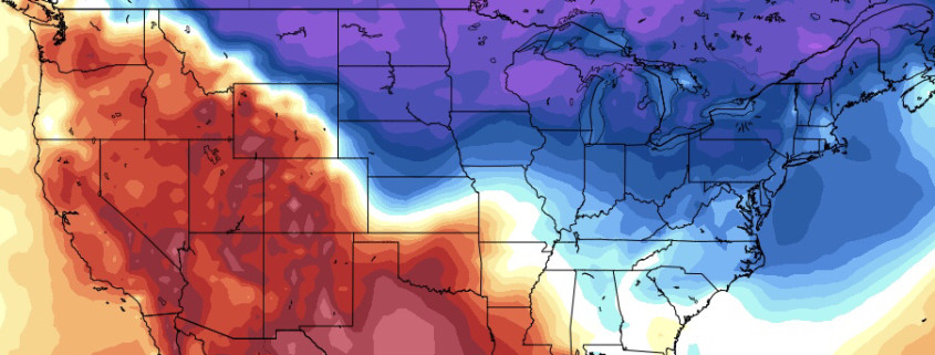
The airmass in place ahead of the storm system is not particularly cold, and without any high latitude blocking there is no mechanism to hold in a cold high pressure to the north. All of this will aid in warm air surging northward as the storm develops, allowing precipitation to quickly change to rain along the coast. Inland, and in the higher elevations, colder air will hang on a bit longer and more impactful snow and wintry precipitation is likely.

Read more

Monday Briefing: Winter Storm in the Northeast Wednesday

Happy Monday! High pressure from the west, builds into the Northeast today, behind our departing storm system on Sunday. Mostly sunny skies and breezy conditions are expected.  Cold air advection with northwest winds behind a cold front early this morning will keep temperatures nearly steady in the mid-upper 30s most of the day. A tighter pressure gradient could cause winds to gust up 30 to 35 mph at times.

Skies will remain clear and winds diminish early tonight. Then some mid-high clouds will be increasing, as a weak upper-level disturbance approaches from the west. Overnight low temperatures will range from the upper teens to middle 20s in many areas. However, some of the Interior Valleys and Pine Barrens may drop into the lower to middle teens, with some radiational cooling occurring, before more clouds arrive.

Read more

Friday Briefing: Arctic Cold Then Northeast Winter Storm Threats Sunday & Wednesday

Happy Friday! Rain overnight ended as some snow across over the region, early this morning. Interior locations, including parts of Northwest NJ, the Poconos and Catskills saw few inches of snow. Little or no snowfall accumulations occurred elsewhere, as the best dynamics and moisture moved quickly offshore, with the cold front. As a result, snow was mostly light and ended after hour or two, with temperatures still above freezing.

However, there is threat for a flash freeze, as much colder air rushes in behind the cold front today. Temperatures will be mostly in the middle or upper 20s for the rest of the day. So any standing water could freeze into some this morning. Some patchy black ice will also form on any wet, untreated roads. So use more caution driving roadways, especially during this morning.

Read more

Thursday Briefing: Wintry pattern approaches, interior focused

Good morning, and Happy Thursday! A well discussed change to the weather pattern is underway, and the overall atmospheric flow throughout the United States is changing. Warm, Pacific air is on the way out and colder, arctic air is on the way in — especially in the Northern Great Plains and Great Lakes. You can thank this large, anomalous ridge to the Northwest of Alaska for that, as it acts to dislodge arctic air south into Canada and the USA.

The weather pattern that develops as a result of the reshuffling Pacific Ocean will have impacts on everyone – including the Northeast States, as an active weather pattern ensues. Think of it this way – the pattern changes in the Pacific is now “opening the doors” for multiple disturbances to shift eastward into the United States, as energy flows freely into the country.

Read more