-2")
Extremely Dangerous Maria Eyes Dominica
Good Evening!
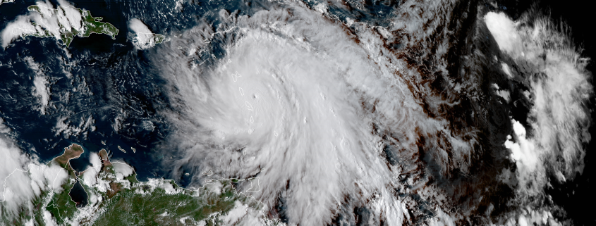
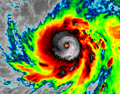
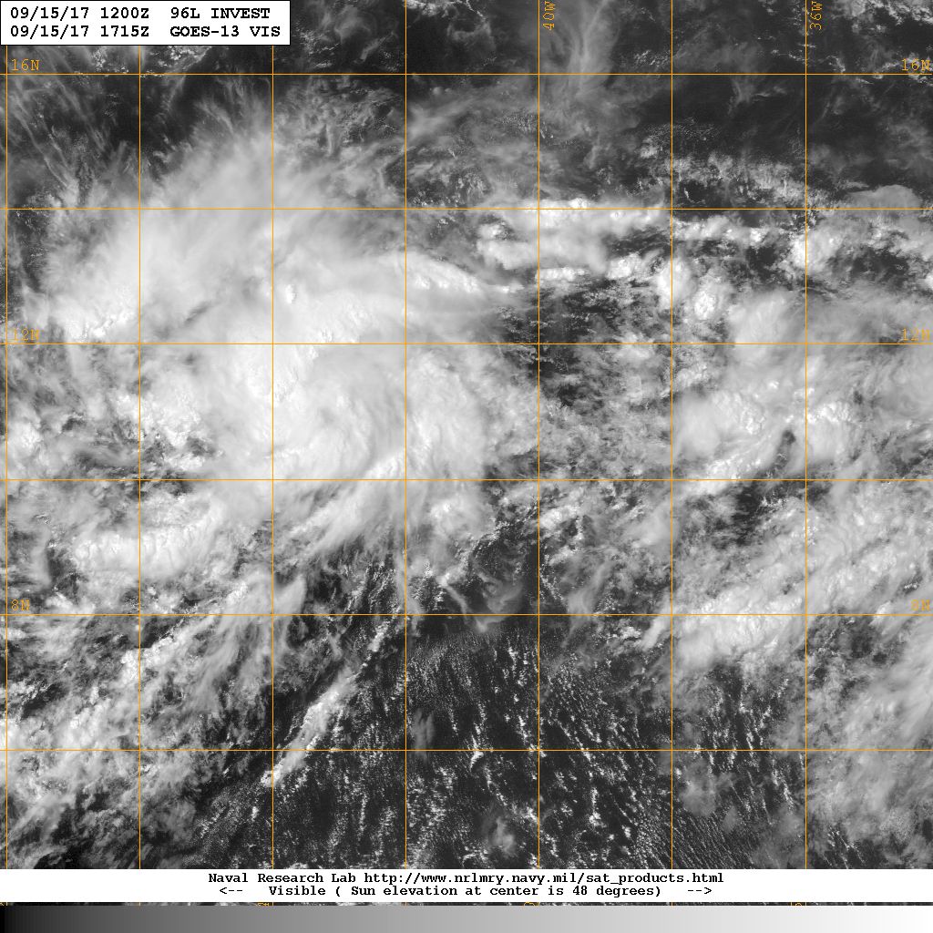
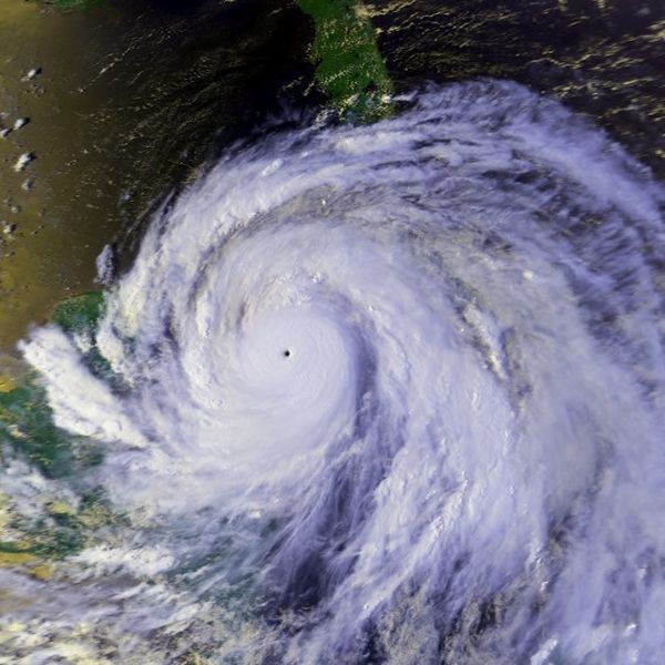
Back on Friday we were talking about a vigorous tropical wave that was designated Invest 96L. Since that time, the disturbance became a tropical depression on Saturday, battled with some moderate shear and dry air, and was upgraded to a hurricane yesterday afternoon. We mentioned that the storm would have excellent conditions to intensify once it was nearing the islands, and that’s what Maria did, but to a whole different level. Since this morning, the storm has intensified into an extremely dangerous Category 4 hurricane with winds up to 130 mph as of the 5pm advisory by the National Hurricane Center. The storm has an incredible satellite presentation, characterized by a small pinhole eye, extremely deep convection surrounding the center, and good to excellent outflow in all quadrants. Earlier reports from a reconnaissance plane showed that the pressures within the storm were falling quite steadily, but the plane finished its mission just before Maria’s eye began to clear out an warm. Since that time, the eye continues to become increasingly defined, and satellite estimates are indicating that the storm may be stronger than the 130 mph intensity that it was given.
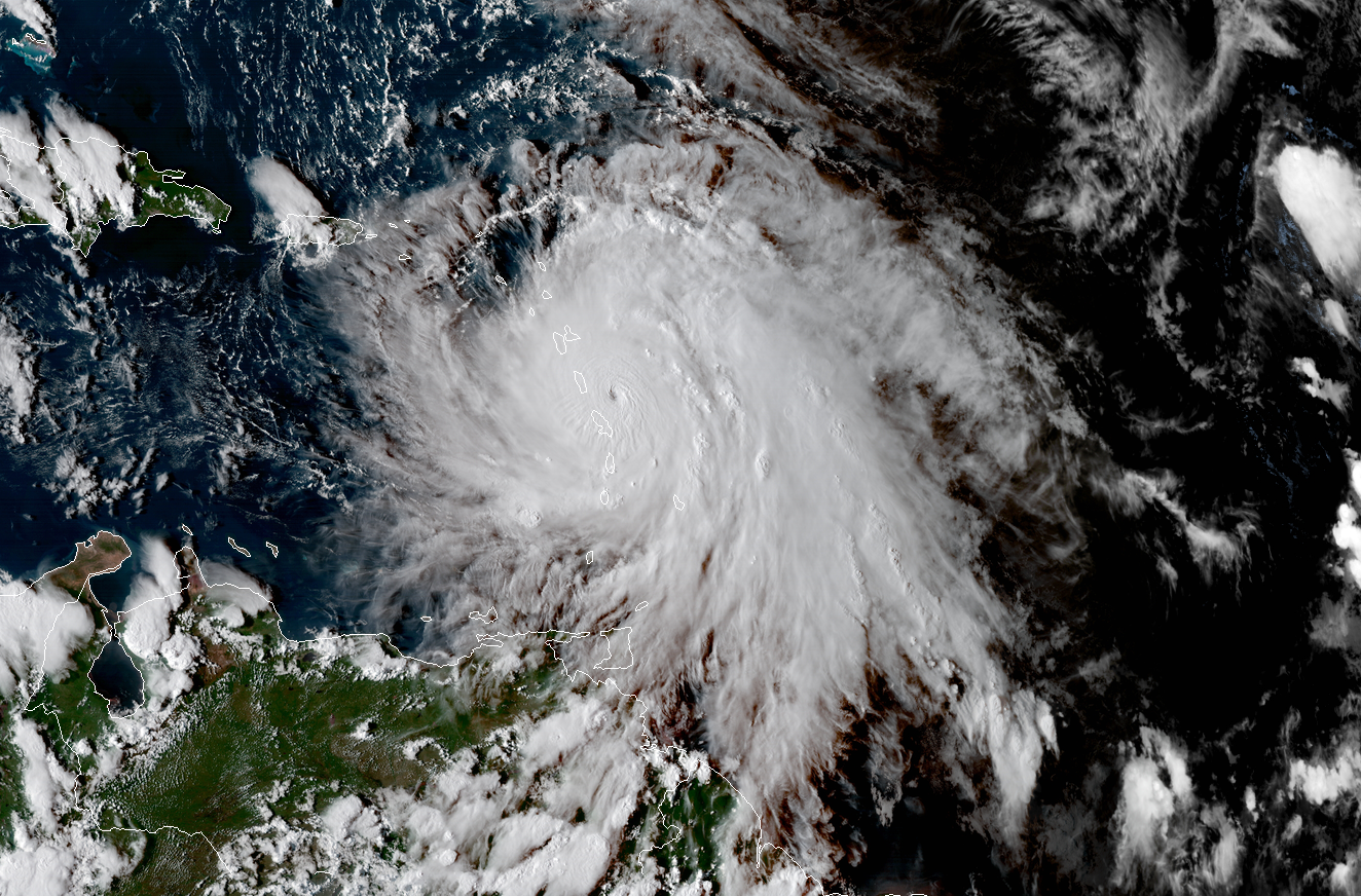
Natural color imagery provided by GOES 16 and CIRA Colorado State
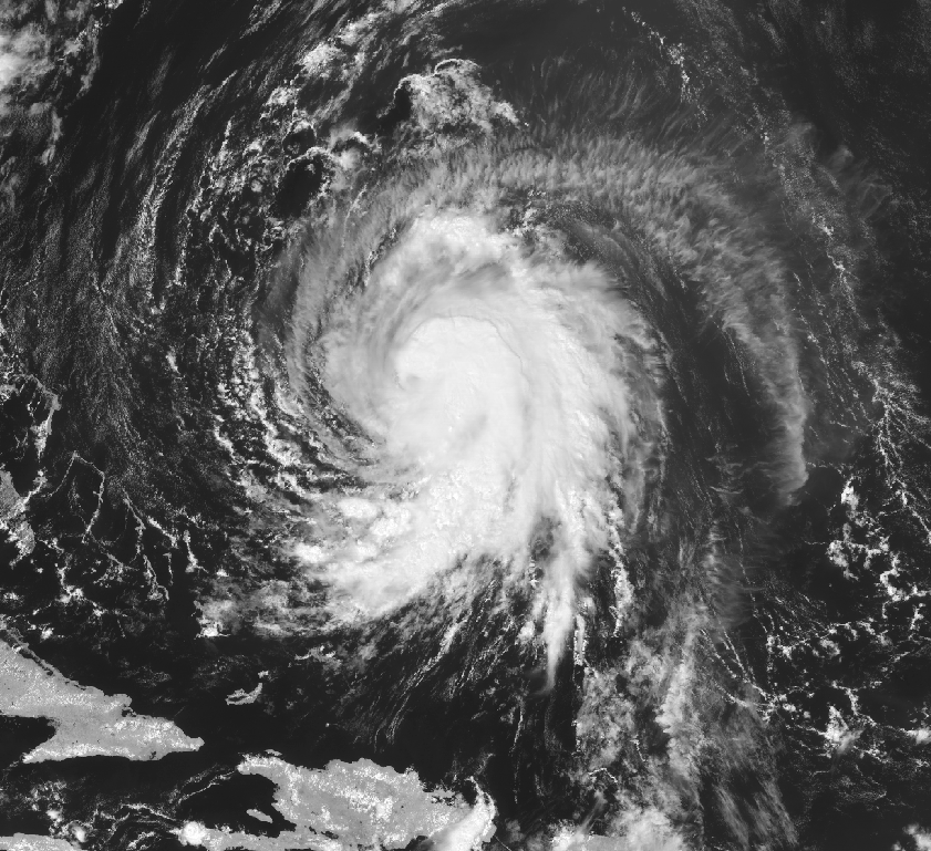
At the time of this post, Maria is only about two hours or so from making a direct landfall on the small island of Dominica, which is home to some 70,000 people (2016 estimate). The last time the island saw a similar threat from a hurricane was way back in 1979 when Hurricane David made a direct landfall, which devastated the island, leaving nearly 75% of the population homeless, and wiping out a majority of the Banana and Coconut crops which the islands relies on for profit. With Maria having such a tight and intense core (8-10 nm miles), this will make the next few hours of watching the radar out of Martinique crucial. If the center goes right over the island, we could see a catastrophic scene similar to what happened on Barbuda with Hurricane Irma just about two weeks ago. We will have another reconnaissance plane within Maria by 7-8pm eastern time, which should give us an exact estimate on the intensity of the storm as well as any wobbles it may take. It is quite likely that Maria will be at least somewhat stronger than the 130 mph estimate by the time the mission arrives, and I would not be surprised to see the storm near 150-160 mph by 11pm eastern time.
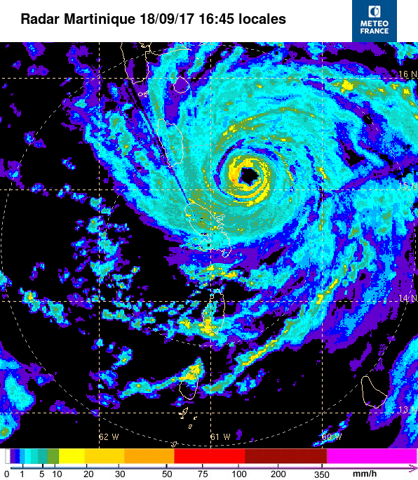
Radar loop out of the island of Martinique showing the motion of extremely dangerous Hurricane Maria with 130 mph winds (MeteoFrance)
After Maria moves through the islands, we then look to the US virgin islands and Puerto Rico for likely impacts from the storm. While the peaks of the islands may briefly disrupt Maria if it does indeed make a direct landfall, Maria will still have all of Tuesday and a good portion of Wednesday to reorganize or restrengthen over the very warm water of the Caribbean. The storm has a very powerful upper level anticyclone, which is allowing massive amount of air to be evacuated from the system, which should keep the system healthy over the next 48 hours. If Maria does not weaken due to the islands this evening, than it is possible that it could continue to strengthen until the tiny eye that it has collapses and has to undergo an eyewall replacement cycle. This could temporarily weaken the storm, but as we saw with Irma, it also expands the windfield of the storm quite a bit, which then leads to even greater surge concerns.
The people of Puerto Rico and the Virgin Islands should be preparing for an intense hurricane to impact the area as soon as Wednesday afternoon with sustained winds up to 150mph, rainfall in the 10-16″ range, extremely dangerous storm surge, extreme wave action, and the potential for deadly mudslides. This is an extremely dangerous storm, and it should not be taken lightly. A hurricane warning is in effect for the entire region, and the track over the next 24 hours will determine whether or not Puerto Rico sees a direct impact from this system, but should be preparing for one regardless.
***Please monitor all information from your local weather service, the National Hurricane Center, local officials and news outlets over the next few days as this extremely dangerous storm enters the Caribbean.***
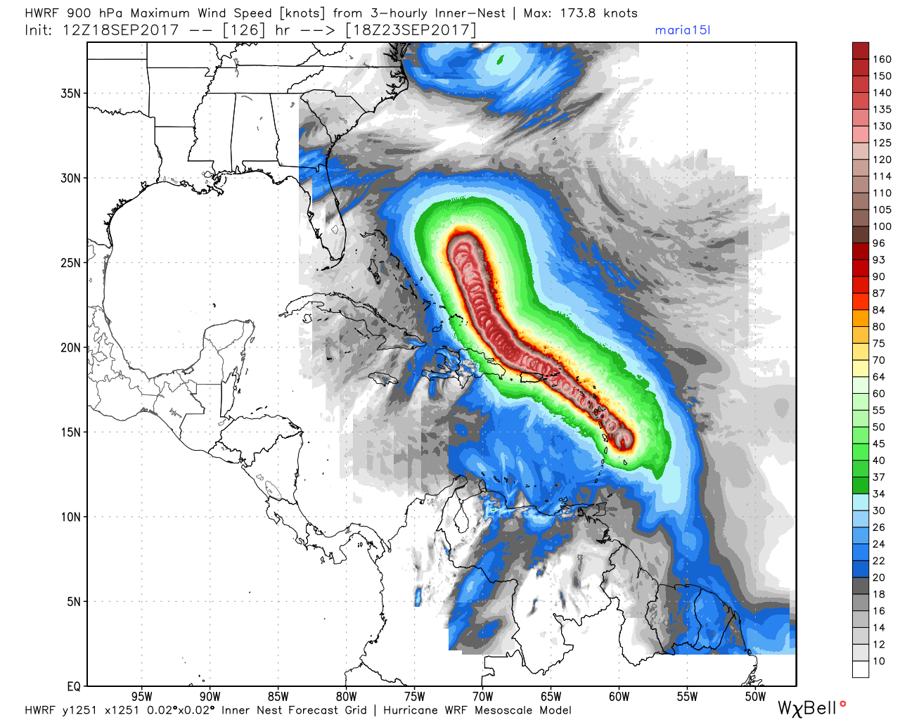
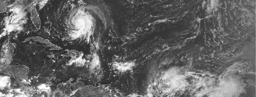
This afternoons HWRF model showing Maria impacting the US virgin islands and coming extremely close to Puerto Rico
The long term forecast for Maria becomes quite complicated after the storm passes north of Hispaniola, as the remnants of Jose will likely make another loop after being deflected off a a building ridge to its north. This will likely create a weakness for Maria to continue moving north, but the extent and duration of this northward movement will be highly dependent on the strength of Jose as well as the ridge to its north. Additionally, this afternoons global models as well as their ensembles have showed Maria making it closer to the US mainland as the remnants of Jose weaken considerably faster, which allows the potential weakness to close up much quicker. We likely will not know what Maria’s fate will be until after it impacts the Virgin islands/ Puerto Rico in the coming days, so make sure to check back on Wednesday when we’ll have a full update on Maria!
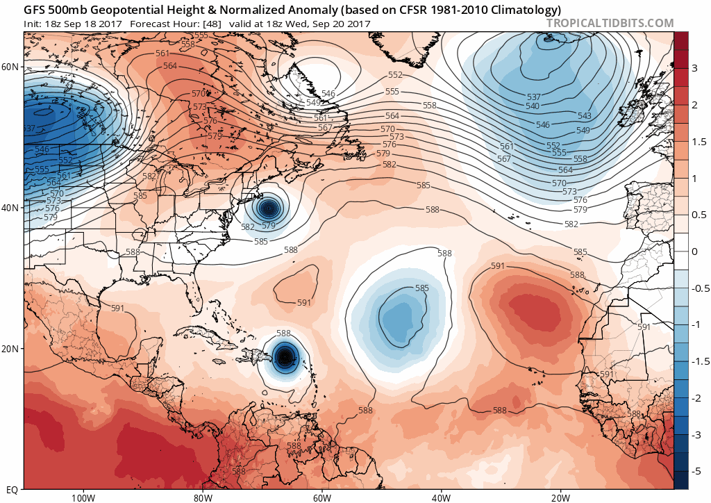
The afternoons GFS model showing the leftover weakness caused by Jose eventually determining the track of Maria
For more information and posts like this one, make sure you sign up for Premium Forecasts — where multiple detailed articles, videos, and interactives are posted each day. Also, come interact with our staff and many other weather enthusiasts at 33andrain.com!
Have a great evening!
Steve Copertino
