-2")

Public Analysis: Soaking Rain Today, Very Active Pattern Continues
Good afternoon and happy Friday!
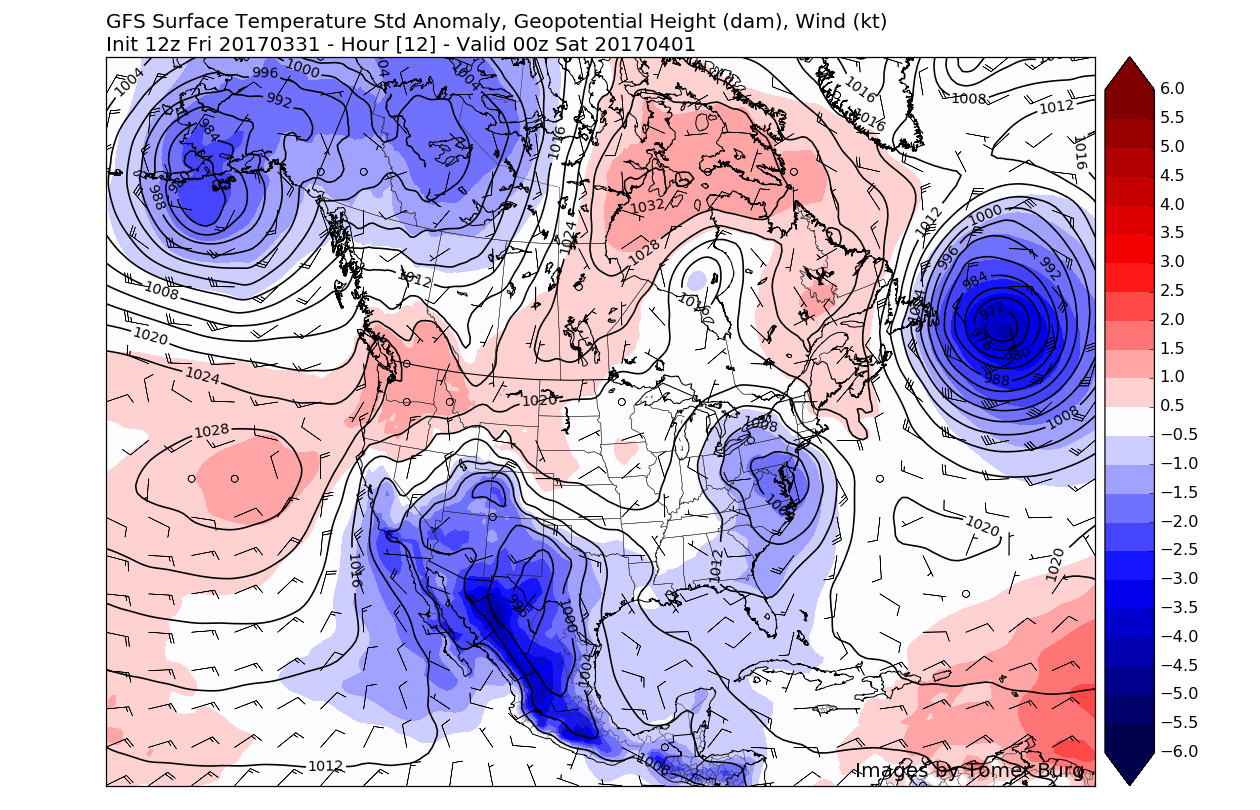
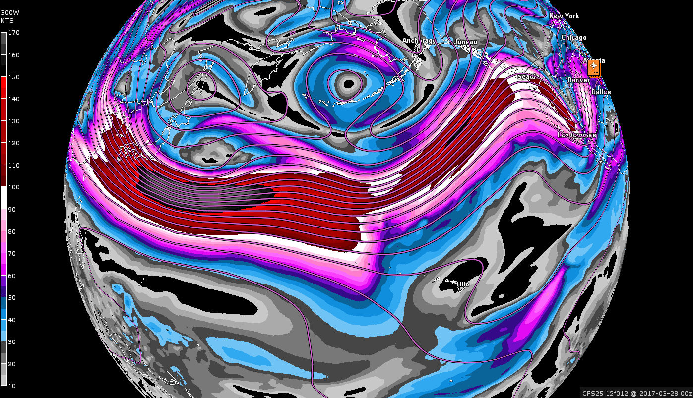
As promised, today has been a washout so far for much of the area as a large and impressive upper level system located in the Ohio Valley continues to move on east underneath an area of high pressure located to out north east. As this system continues to move east later this afternoon and evening, a low pressure system will form off of the NJ coast and move just south of the south shore of Long Island. This should ensure that dreary conditions last into tomorrow afternoon before finally clearing up tomorrow evening. A very active and energetic Pacific jetstream will provide yet another chance at some more heavy rains as another low pressure system races eastward from the Central US by Tuesday.
Today and This Evening
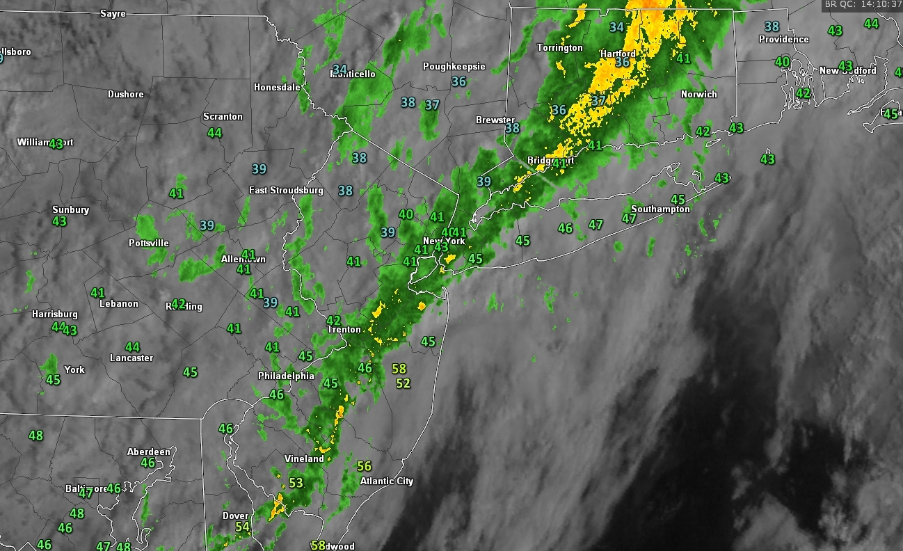
As of 2pm, the entire NYC metro area was experiencing moderate to heavy rainfall with the heaviest rains currently located over Southeast Pennsylvania. This rain is attributed to the low pressure system that traversed the central US over the past three or so days, dragging up very warm/moist air from the Gulf of Mexico in the process. Despite all of this warmer air being advected into the low pressure system, the high pressure to the north of us in Canada supplied the region with some very stubborn cold air yesterday that refuses to move much at all at the lower levels of the atmosphere.
This colder air at the surface even allowed a few select locations to see some brief mixed precipitation this morning in the form of sleet and freezing rain. Temperatures outside this afternoon, coupled with the heavy rains are really making it feel quite raw outside as temperatures struggle to break out of the upper 30’s and low 40’s. As the low pressure to our west continues on east, a band of strengthening low level winds at around 5000 feet in the atmosphere, along with an advancing warm front will bring in some more moderate temperatures for central and southern locations. Temperatures may reach the upper 40’s to low 50’s, but the combination of heavy rains and increasing winds will negate any possible comfort from the warmth.
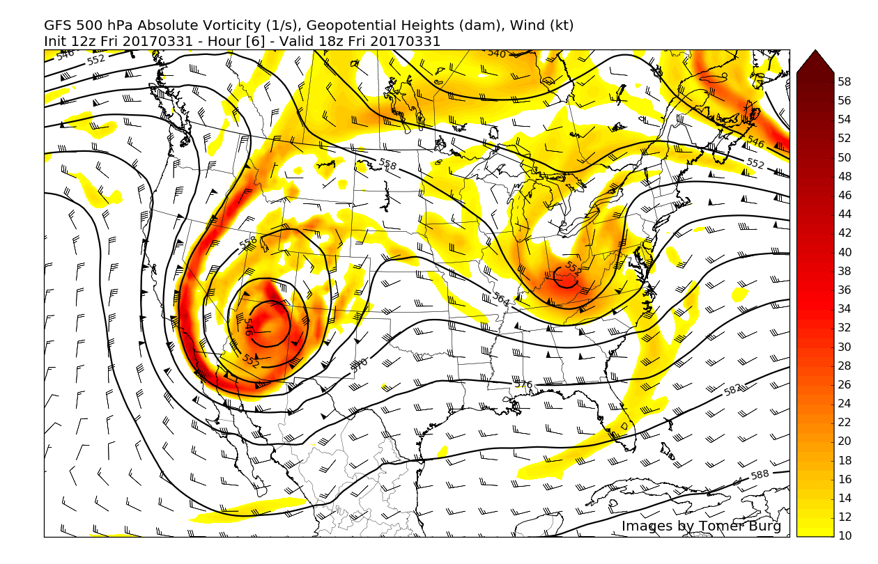
Today’s low pressure is in the perfect position to provide sustained heavy precipitation as the upper level configuration is reminiscent of something that we would look for in the winter to produce a very significant snowstorm for the area. However, the lack of a sustained/fresh cold air source will ensure that the overwhelming majority of this storms precipitation falls as plain rain. This upper level pattern configuration with a closed upper level low being forced east underneath an area of high pressure strongly suggests that a secondary low pressure system will form off of the coast, and this is exactly what will happen late this evening. As this low pressure begins to strengthen late this evening, the aforementioned band of very strong winds just above the surface, or low-level jet, will help to funnel in very moist air from the south. This will increase rain rates for NJ/NY/CT/ and also bring some gusty winds, especially for the LI and CT coasts.

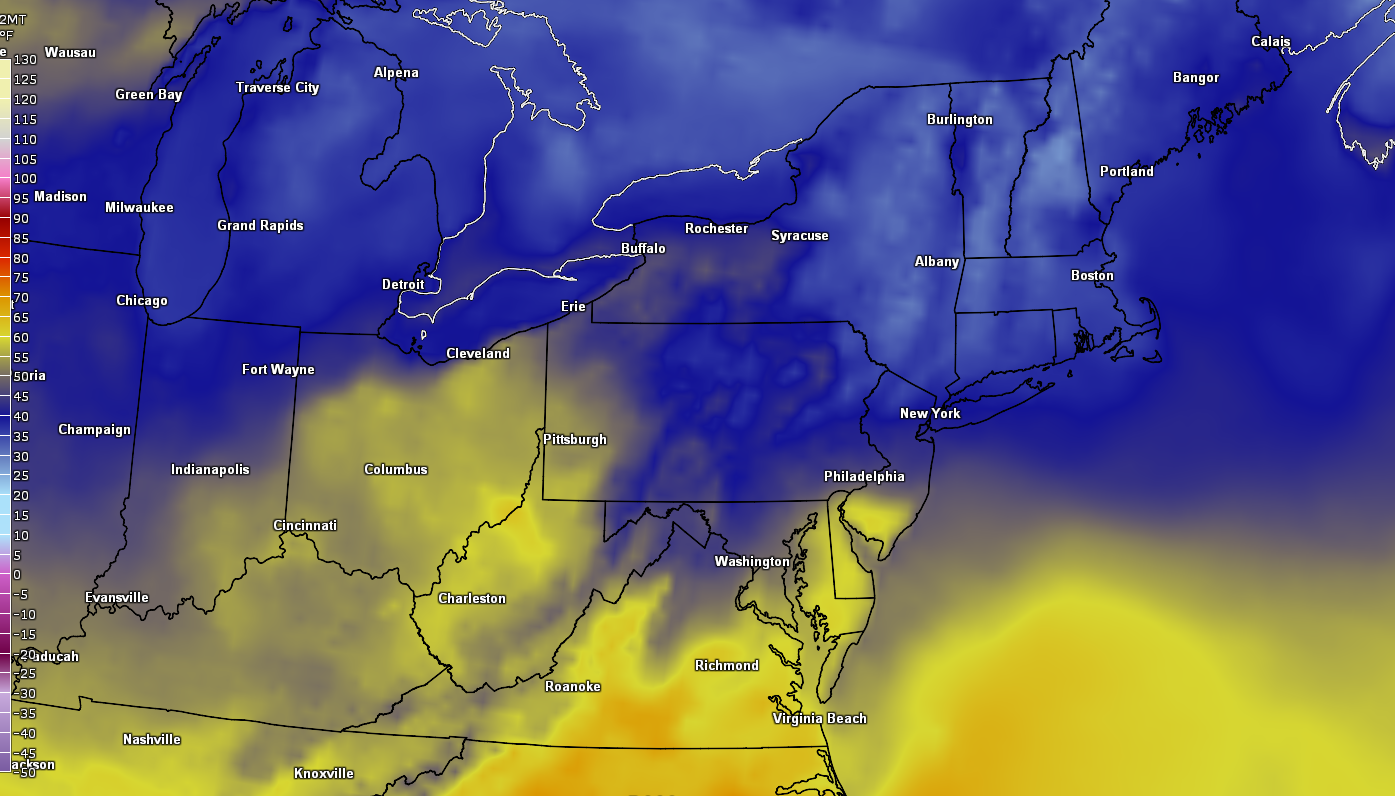
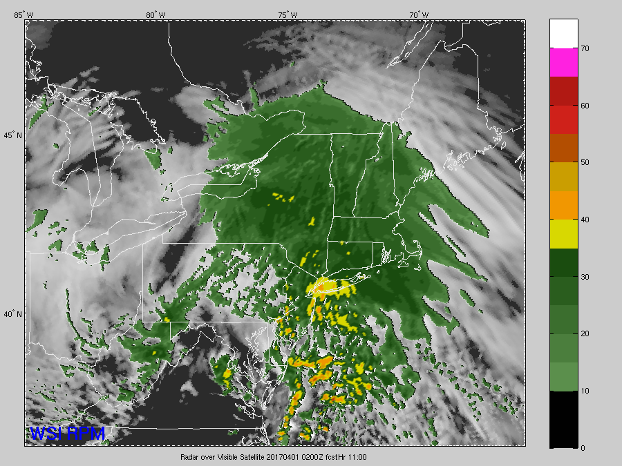
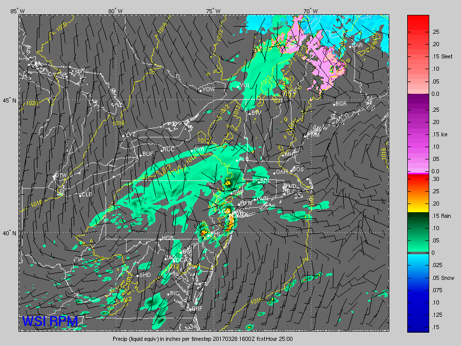
Current look at surface temperatures and the regional radar mosaic which is showing the entire Northeast engulfed in this storm system (Courtesy of GREarth)
Tonight Into Tomorrow Afternoon
As we mentioned on Wednesday, this deep tropical moisture will be quite abnormal for this time of year, so when combined with the impressive low-level jet streak and lift in the atmosphere, rainfall rates of .5″-1″ an hour may be possible in some of the heavier areas of precipitation. All of this rain will make the already saturated ground reach their absorption limit, with flash flood guidance indicating that only 1″ of rain within 6 hours would be needed to cause localized flooding. People should remain aware this evening as some low-lying and poor drainage zones may experience at least minor flooding, with minor to moderate flooding also possible on roadways. If some of the more intense solutions are realized this evening, limited instability may cause tropical-like downpours with a few rumbles of thunder possible. Please remain vigilant for any possible Flash Flood Watches/Warnings issued by the National Weather Service and be prepared to take action, if necessary.
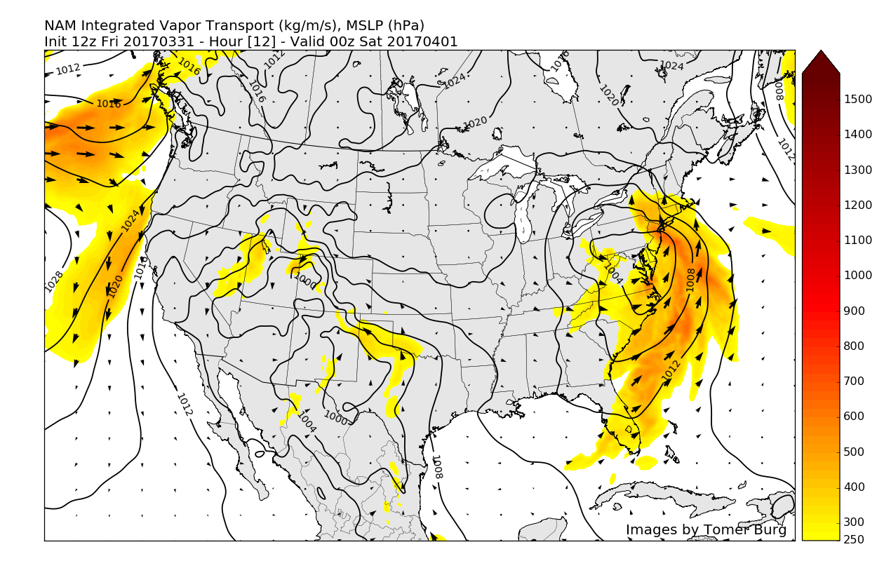
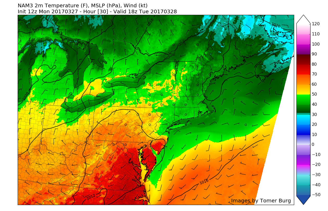
As the low pressure develops and begins to mature off of the NJ coastline late this evening and into tomorrow morning, rain should intensify over NENJ/SNY/NYC/CT/LI, with some embedded convection still possible, especially to the east. Winds will also begin to increase once more very early in the morning as gusts of up to 40-50 mph are possible in some of the heaviest downpours, which may cause some damage to trees and localized power outages. Winds will also gust to 40-50 mph along the coast which could cause minor coastal flooding/erosion, especially for portions of Long Island’s south shore.

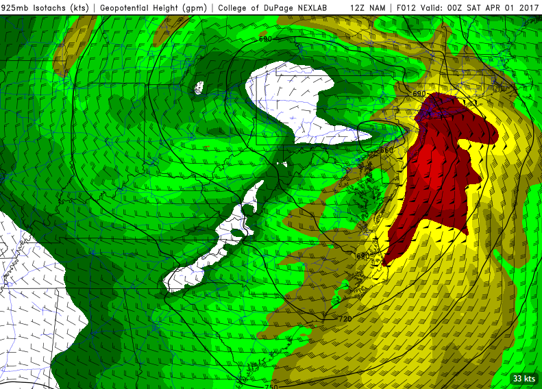
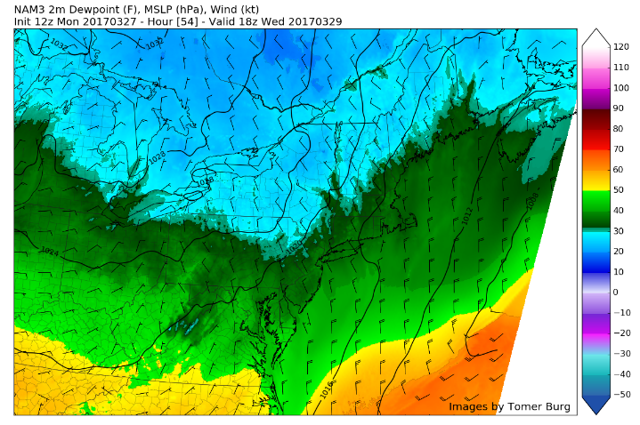
3km NAM showing intense winds of up to 80 mph just above the surface later this evening. Wind of 40 to 50 mph will be possible in the heaviest downpours (Valid 9pm)
As the area of low pressure continues deepen and track offshore, winds will take on a more northerly component later tonight and Saturday morning. This will begin to usher cold air back into region with possibly rain changing to wintry mix of sleet or freezing rain over far northern interior areas late tonight and Saturday morning. But mid-level dry air will cause precipitation begin to tapering off and ending on Saturday morning over much local region. So currently no significant impacts from wintry precipitation are still anticipated even for northern sections of our zones. However, further north over Upstate New York and into Central and Northern New England more significant snowfall is possible. -Miguel Pierre
Tomorrow Afternoon Into Sunday
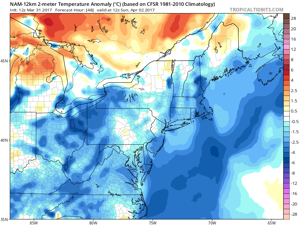
As the area of low pressure begins to move to the east, the rain should diminish and end from the west to east tomorrow afternoon. Some clouds and light showers may linger into the afternoon hours for eastern locations, but with clearing skies throughout the day, things should finally begin to dry out with final rainfall totals ranging from 1.5″-3″ in some isolated spots. Temperatures should be able to rise only into the mid-upper 40’s Saturday as northwesterly flow takes over during the afternoon hours. Due to the storm exiting to the east and another area of high pressure moving to our west, a tight pressure gradient should be present over the area, with gusty winds possible into the evening. Lows should range from the low to mid 30’s across the interior, with low to mid 40’s being more common across central and southern zones.
Sunday should be a fairly tranquil day as high pressure takes over our weather for a short period of time. Sunday morning should feature mostly clear skies, with some high-level cirrus clouds indicative of fair weather possible as we progress throughout the day. Temperatures should be a few degrees below-normal Sunday with gusty winds from the north west bringing in windchills in the 30’s to start off the mornings. As the day goes on, temperatures should warm up into the low to mid 50’s across the area and with steady winds from the north, it should feel somewhat bearable when compared to the past few days.
Extended Range
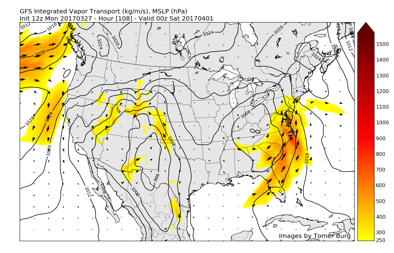
Drier and more seasonably cool weather should continue through Monday before another storm system rolls through the central US and begins to bring severe weather to the south central US and portions of the Southeast. This system unfortunately appears to have the potential to bring more heavy rainfall late Monday and Tuesday, so with the rains from this weekend’s storm and the possible rain from this event, we may have to watch for more flooding issues.

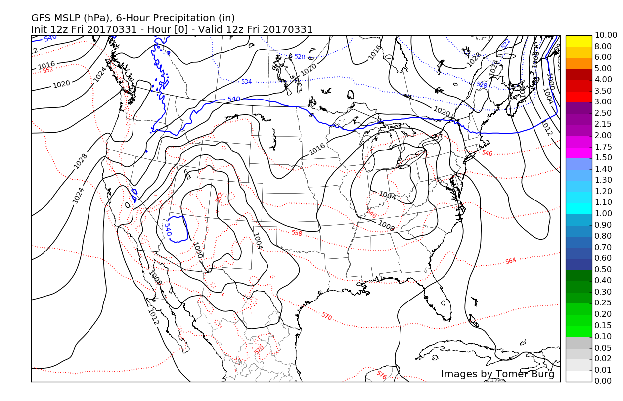
12z GFS for Monday evening showing another storm system with heavy rain and possible flooding concerns
With the continued active period looking to maintain itself into next week, make sure to check back on the evolving pattern and potential flooding issues!
For more information and posts like this one, make sure you sign up for Zone Forecasts — where multiple detailed articles, videos, and interactives are posted each day. Also, come interact with our staff and many other weather enthusiasts at 33andrain.com!
Have a great weekend!
Steve Copertino


