-2")
Windy, cooler behind major cold front
An energetic and powerful storm system moved through the Central and Eastern United States on Sunday, causing widespread severe weather. More than 50 reported tornadoes and 500 reports of damaging winds were received by the Storm Prediction Center behind powerful severe thunderstorms throughout the Great Lakes and Ohio Valley. The cold front moved quickly eastward through the Northeast states, bringing strong thunderstorms through the NYC Metro area just after 430am on Monday morning. Gusty winds were observed at many reporting stations as the storms moved through.
Monday will be a day of change to start the new work week, as the aforementioned cold front slides off the coast. Westerly winds will begin in earnest, gusting over 25 miles per hour at times during the day on Monday. Warm sun will allow temperatures to climb into the mid to upper 50s, but the airmass aloft will be rapidly changing. Dropping humidity and strong winds will be the first signs of the change. By Monday evening into early Tuesday morning, temperatures will fall into the 30s (colder inland). Highs on Tuesday will only reach into the 40s.
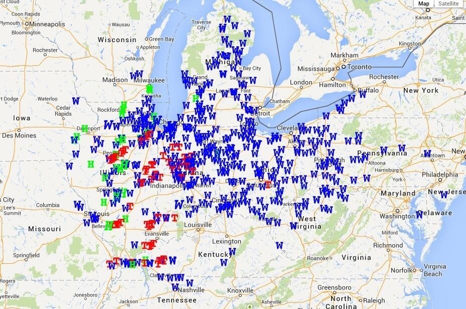
Severe weather reports (Tornado, Wind, Hail) from Sunday through early Monday morning.