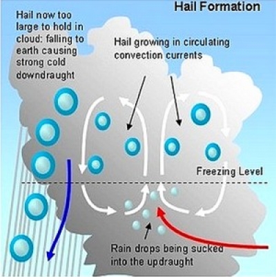
-2")
Cold Front to Bring Northeast Relief, Lee Becomes a Major Hurricane
Good Evening!
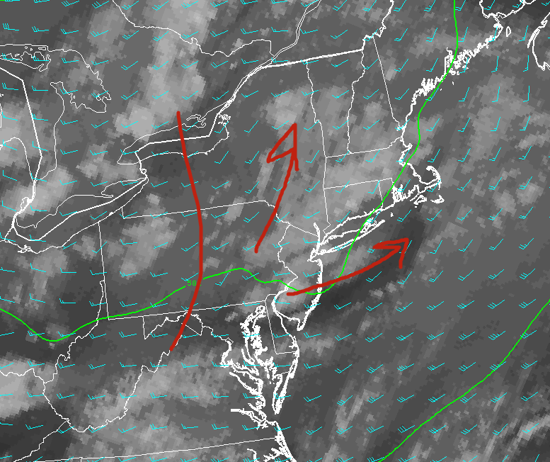
Today was yet another hot and humid day across much of the Northeast with highs reaching up into the middle to upper 80’s over much of the area. Coastal sections of New Jersey, Long Island, and Connecticut were able to see lower temperatures due to easterly winds off of the cool Atlantic where highs stayed in the upper 70’s and lower 80’s throughout much of the day. Much of the day today was quite sunny and clear, which further added to the “summer-like” feel in addition to dewpoints reaching up into the upper 60’s and lower 70’s. The good news is that a cold front is working its way into sections of western Pennsylvania and into portions of New York this evening, and will bring some welcomed change to the area as soon as tomorrow!
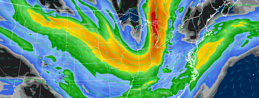
This front will continue to march along, but have little in the way of any precipitation associated with it due to a lack of deep moisture content from the south. There may be some small showers and brief downpours as this front continues east and interacts with subtle mesoscale features, but overall the evening should remain dry once again. As we head into the very early morning hours of Thursday, we have to watch for an increased chance of showers and some gusty winds along with Mid Atlantic and Northeast coasts. By this time, the cold front will be interacting with Hurricane Maria, which will be located to the southeast of the Delmarva peninsula. Widespread shower activity is not anticipated at this for the New York metro area as this front steadily chugs east, but the front could slow down a bit and bring in some additional moisture once it nears the Massachusetts and Rhode Island area.
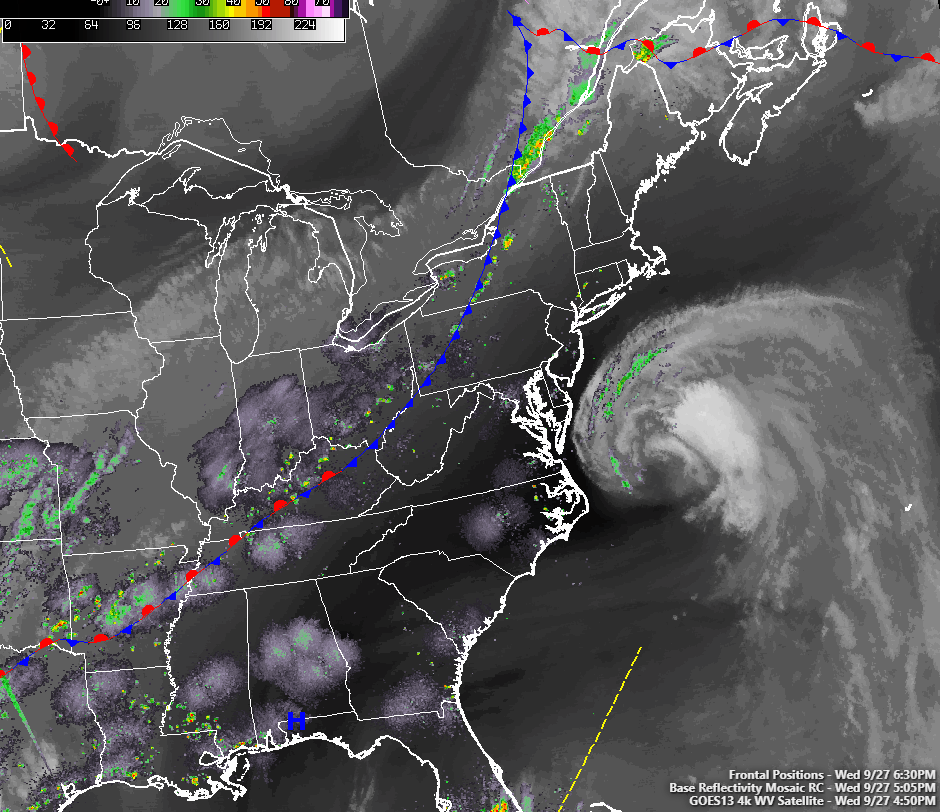
Loop of Hurricane Maria off the Mid Atlantic coast along with the cold front that will be steering it out to sea over the next few days (Simuawips.com)
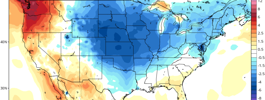
Thursday will be a much more comfortable day across the entire Northeast, with the mid level trough associated with the cold front moving into the region. Behind the cold front, we should see light winds out of the northwest, with mainly sunny skies. Dewpoints will also drop quite dramatically as well, so tomorrow should be quite a pleasant day compared to the past few. Highs tomorrow will range from the low to middle 70’s near the coast, with cooler temperatures in the mid 60’s to lower 70’s expected further away from the coast. Again, the area will remain rather dry due to a lack of moisture and this should last through tomorrow evening as well. Tomorrow night will be a nice change and certainly have more of a fall feel to it as radiational cooling takes hold and really allows temperatures to drop for the first time in a while. Lows tomorrow evenings should range in the upper 40’s to lower 50’s along the coast, with low to middle 40’s further north and west.
Friday and into the weekend looks to be much of the same, with much lower dewpoints, light winds, and mostly sunny skies with highs in the middle 60’s to lower 70’s through Sunday. The only real chance for showers looks to be on Friday evening and into Saturday morning as another cold front moves into the area to reinforce the cooler weather. The shortwave associated with the front will have limited energy and moisture to work with, so the threat of heavy rainfall seems quite low at this time. Overall, it should be a beautiful weekend for the area, but not quite fall weather yet!
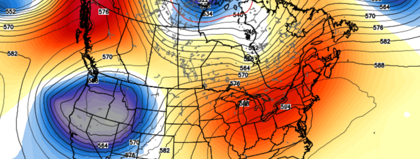
Farther out, medium range guidance continues to suggest that a very large area of mid level ridging will develop over the eastern third of the nation by the beginning of next week. However, do to the positioning of this ridge, we may be able to escape the heat and humidity like we had this week due to the potential for an area of high pressure to bring more onshore winds. This will allow temperatures to remain in the middle to upper 70’s with some increased moisture and a few rain chances, though nothing looks too significant at this time. We may see this pattern persist into next weekend as well, with potentially warmer temperatures once again taking over, but we will have further updates on that later in the week!
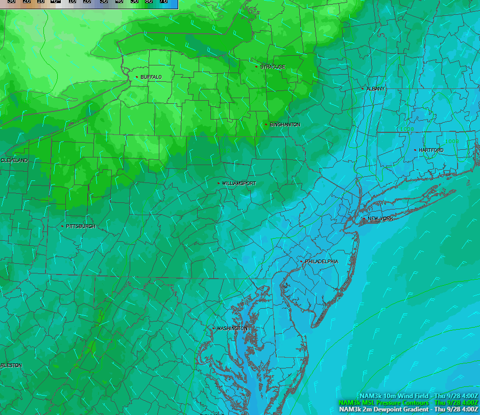
Loop of the cold front driving out the high dewpoints in the area and ushering a more seasonable airmass for the next few days
Lee Becomes the Fifth Major Hurricane of the 2017 Season-Watching the Caribbean
Hurricane Lee made a very impressive comeback from back when it died in the central Atlantic about a week ago now. Earlier this afternoon, the storm was upgraded to a Category 3 with sustained winds up to 115 miles per hour. Lee is thousands of miles away from land and will stay that way as it continues to accelerates to the north, but it may add to the amazing superlatives that this hurricane season has racked up so far. It could push 2017 ahead of 2004 for the most active 30-day period (ACE wise) in recorded history. Later in the day tomorrow, Lee will begin to feel the effects of higher wind shear, which should start to drastically weaken the cyclone until its absorbed by a larger system in the North Atlantic. Lee has had an impressive journey over the past week or so, and will be remembered as being one of the only major hurricanes to not affect land, thankfully.
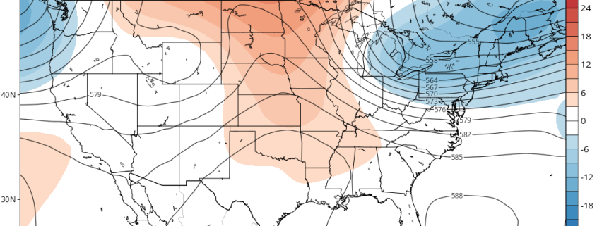
Unfortunately, our eyes will be turning to the Western Caribbean as we said they likely would be back in last weeks posts. The global models are starting to really hint on a large gyre of tropical moisture festering and eventually moving north, possibly into the Gulf of Mexico. This is all very far out, but systems like these tend to take days before becoming a named system, and sometimes they just remain disorganized masses of thunderstorms that can produce widespread flooding. Regardless, we will be closely following any developments over the next few days since the Caribbean is the climatological breeding ground for strong cyclones in October, and we currently have very favorable conditions for a system to take advantage of if one does wind up forming. As of right now, I would say that there is a medium chance of tropical cyclone formation in the NW Caribbean and Gulf of Mexico in the 7-10 day period.

Animation of the ECMWF model showing a large, cyclonic gyre taking shape in the Caribbean/Gulf of Mexico in 6-10 days (Courtesy Phil Pappin)
For more information and posts like this one, make sure you sign up for Premium Forecasts — where multiple detailed articles, videos, and interactives are posted each day. Also, come interact with our staff and many other weather enthusiasts at 33andrain.com!
Have a great evening!
Steve Copertino