-2")
Public Analysis: Heavy Rain Exits, Calm Weather Sets In
Good Evening!
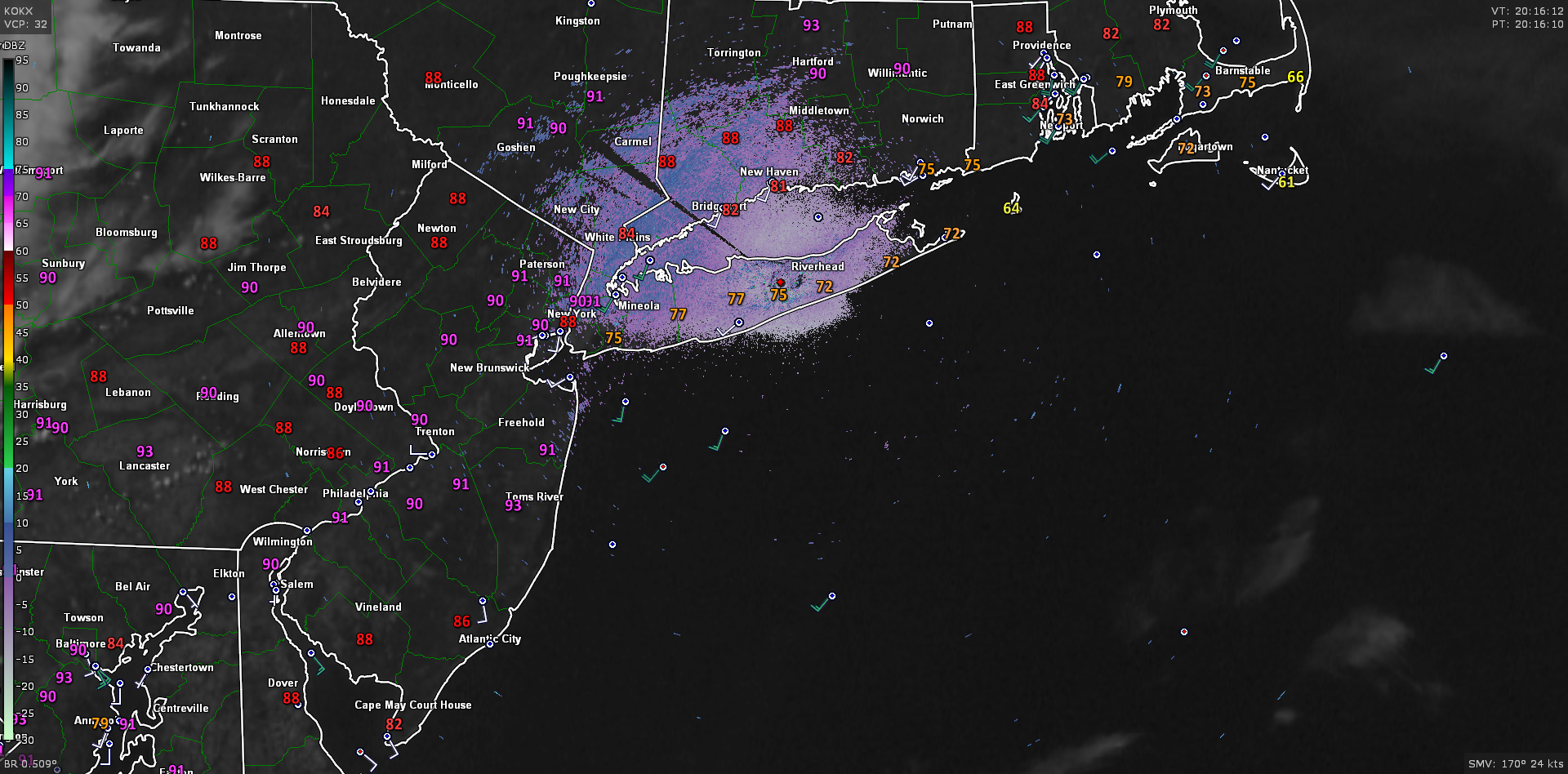
After a relatively calm few days, the area of low pressure that developed along the leftover stalled frontal boundary this morning sparked numerous showers and isolated thunderstorms that tracked over eastern Pennsylvania, New Jersey, New York, and portions of Connecticut. Deep tropical moisture ahead on the order of about 2.3″ of PWATs allowed for the overall complex to contain very intense rain rates, upwards of two inches per hours in some locations! To make matters worse, these storms were chugging along with a weak low level flow, so areas of heavy rain were rather slow and this allowed for some spots to experience flash flooding in areas of poor drainage. As the dynamics began to really ramp up as the low pressure intensified, some gusty winds began to be reported with a few embedded storms that tracked through northern New Jersey and into Long Island. There were some reports of small tree limbs being taken down with localized power outages, but due to the time of day, lack of greater instability, and weak mid level winds, these gusts luckily weren’t anything too serious.
As the low moved off the coast and began to intensify some more, the area of rain associated with the low began to accelerate, and this is what likely saved the area from seeing much higher rainfall totals that would have caused more widespread flooding. The rain gradually tapered off as the low pulled away and some more dry low level air worked its way in behind the system, which finally allowed for conditions to calm down. The cloudy, tropical air-mass gave way to mostly sunny skies, which allowed temperatures to rise into the upper 70’s and lower 80’s across the entire area, with light westerly winds. With daytime heating taking place, instability was able to build back to limited values, which promoted the development of some more showers and thunderstorms to our North and West this evening. These showers will gradually slide east/east southeast and likely diminish in intensity as the sun fades, and with it-the fuel they need to survive. The main threat with these storms will be some additional, brief heavy rain, but these storms will be moving at a decent pace, so the overall flood threat is low. Some patchy fog should develop this evening and into tomorrow morning as an inversion in the atmosphere traps the leftover humid airmass. With the inversion in place, lows should be quite mild with most of the area seeing temperatures in the mid 60’s to lower 70’s.
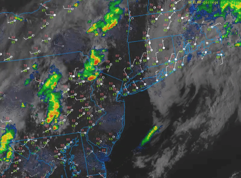
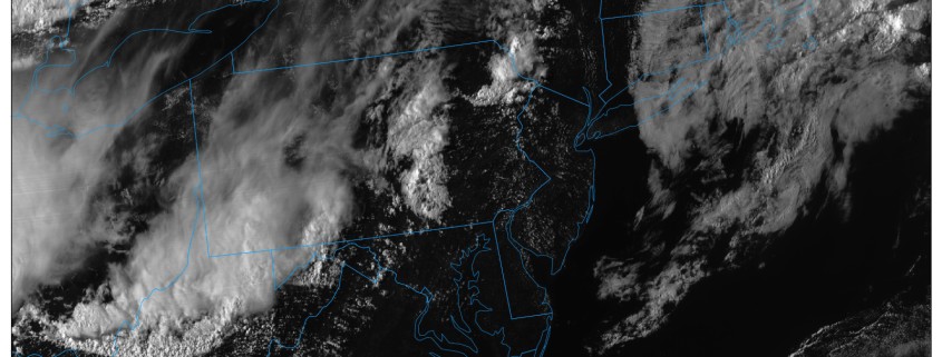
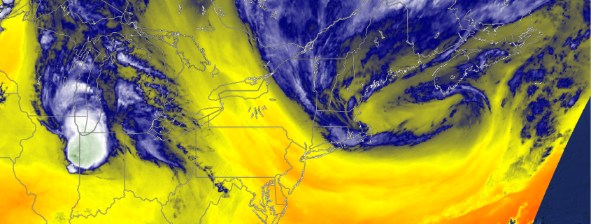
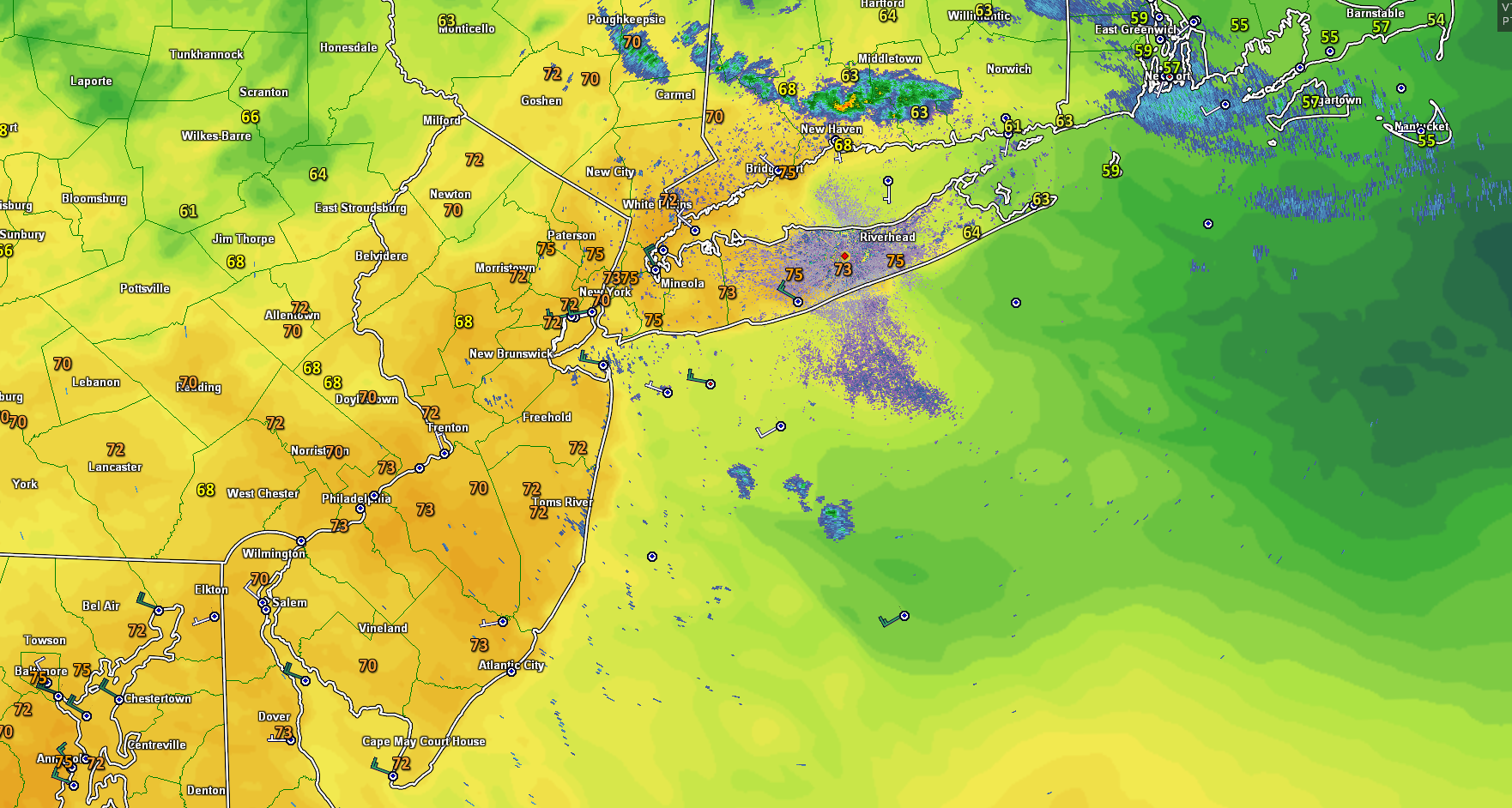
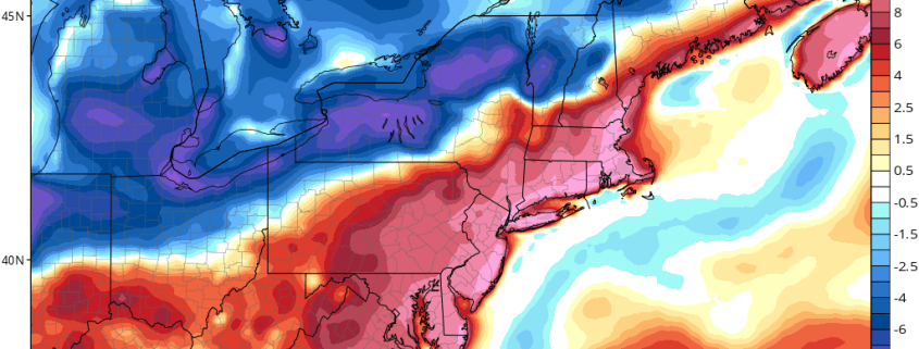
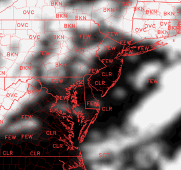
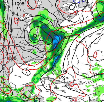
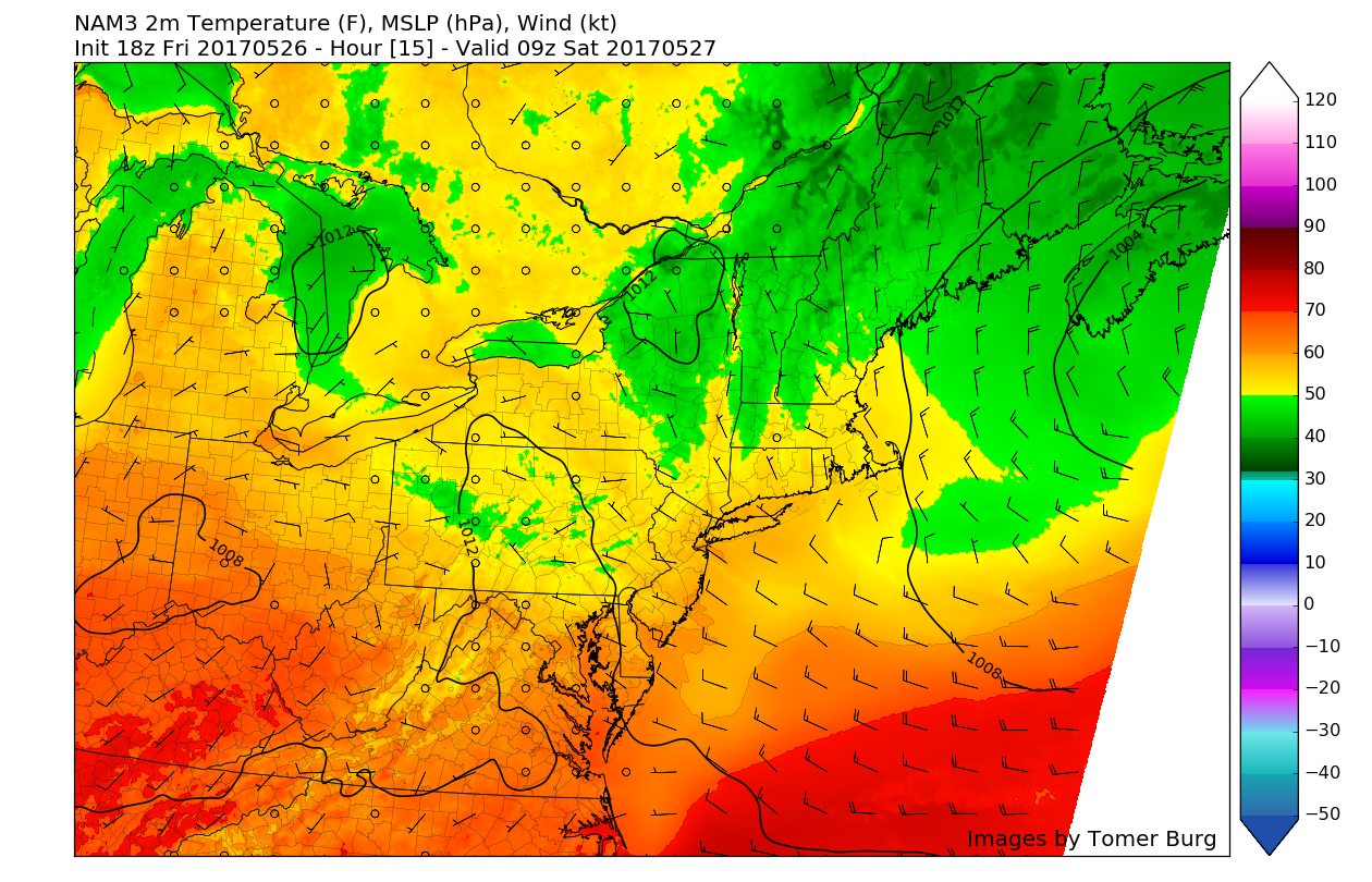
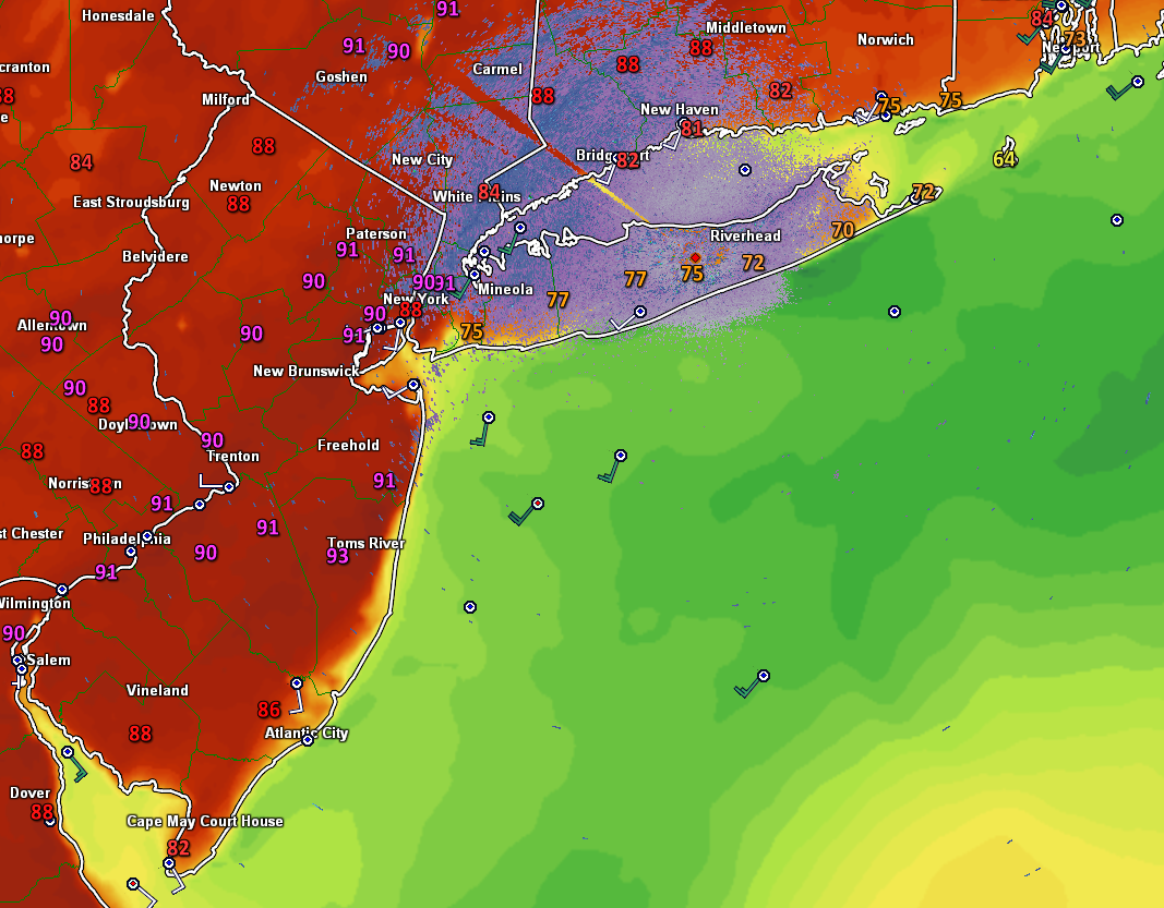
This afternoon/evenings latest regional radar mosaic, surface weather plots, and high resolution visible satellite imagery of the Northeast. showing the remnants of this mornings system exiting to the east.
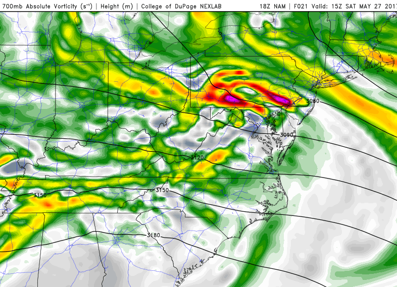
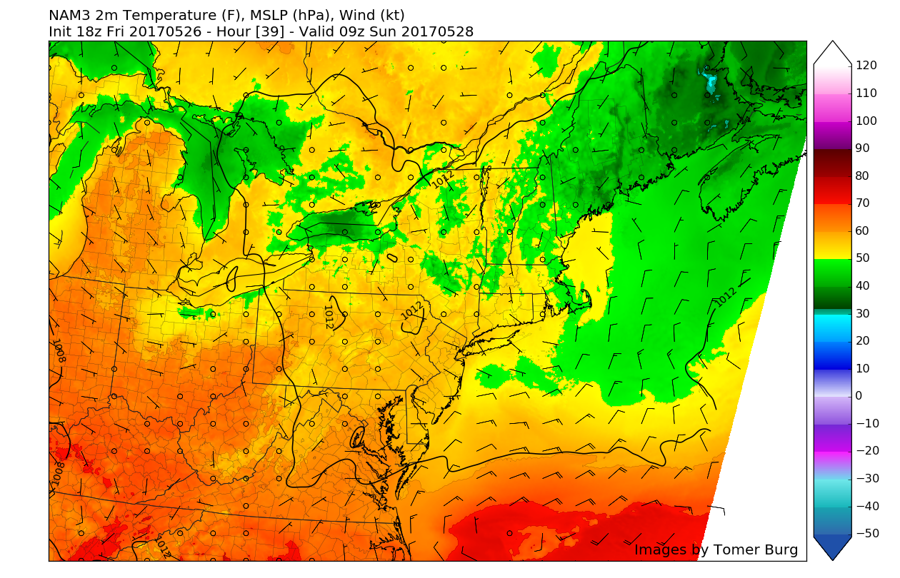
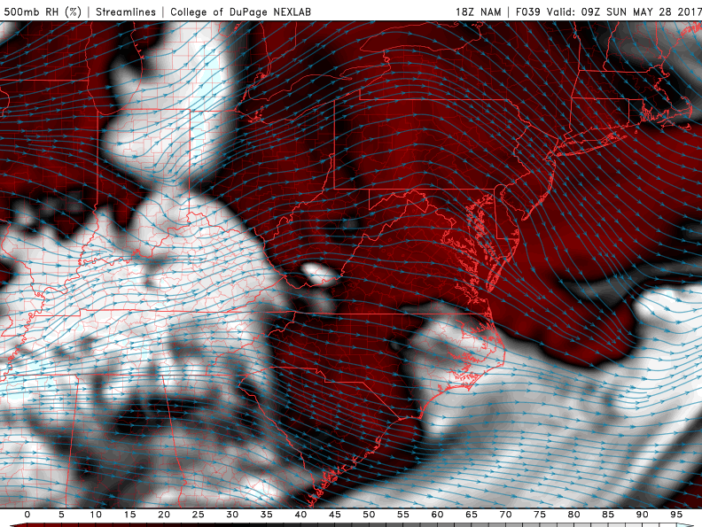
Saturday looks to start off rather clear despite some areas of patchy fog, which should quickly burn off as the morning progresses. This should allow skies to become mostly sunny, with some spotty clouds as we head into late afternoon. To our north and west, a large mid level trough will be progressing east with a disorganized piece of energy. As the energy from this trough nears the area by the afternoon hours, the leftover tropical airmass and sunshine will allow instability to build to modest levels, with some decent wind shear allowing for the potential of muti-cell thunderstorms to develop over the area. With the upper level jet streak and greatest energy for storm development located to our north over New England, the main focus for storms looks to be over that region, but we expect scattered development at the most, with the main threat being gusty winds, small hail, and heavy rains.
Otherwise, the afternoon will likely be a hot and humid one as temperatures likely reach into the upper 80’s and even to lower 90’s across the region. The area should gradually dry out during the late afternoon hours and early evening hours as the cold front to our west begins to push through. As the front moves through tomorrow evening, the humidity should drop a bit as more stout westerly winds develop, so it should be quite pleasant with lows dropping down into the upper 50’s and lower 60’s.
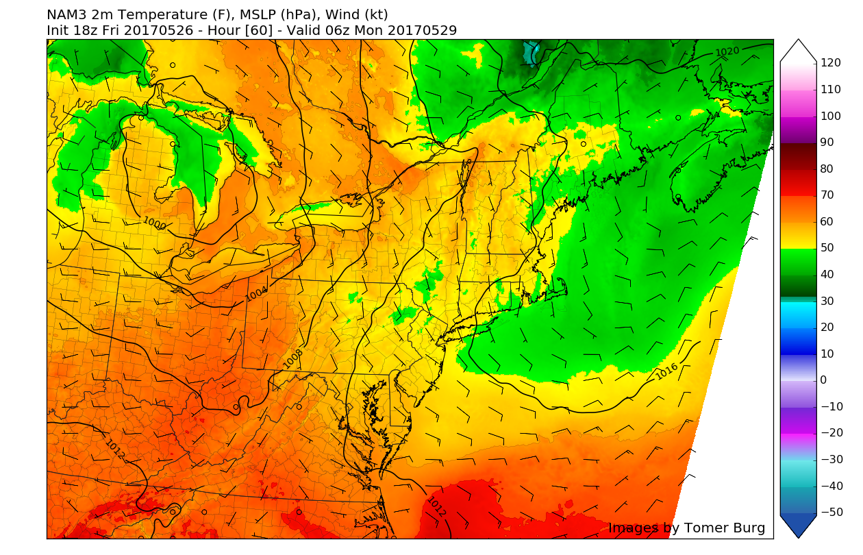
Sunday will likely be a good deal quieter than the previous day as the cold front moves well to our east and the dry air to the west really begins to work its way into the area. A surface high to the south will begin to build, which will likely allow for mostly sunny skies and low dew points. The overall drier atmosphere will work to negate any threat for afternoon thunderstorms over the entire area. High temperature s on Sunday should be near-normal, with highs likely reaching into the lower 80’s across the entire area. Sunday evening should also continue the theme of being rather calm, with clear conditions and light winds expected, lows should be able to drop into the upper 50’s area-wide.
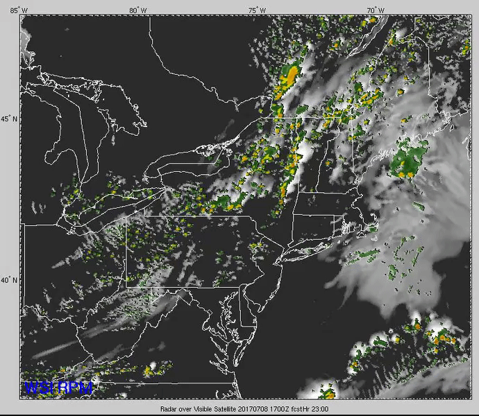
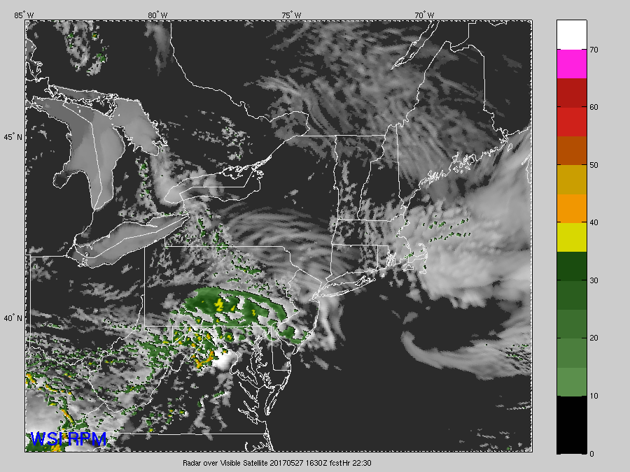
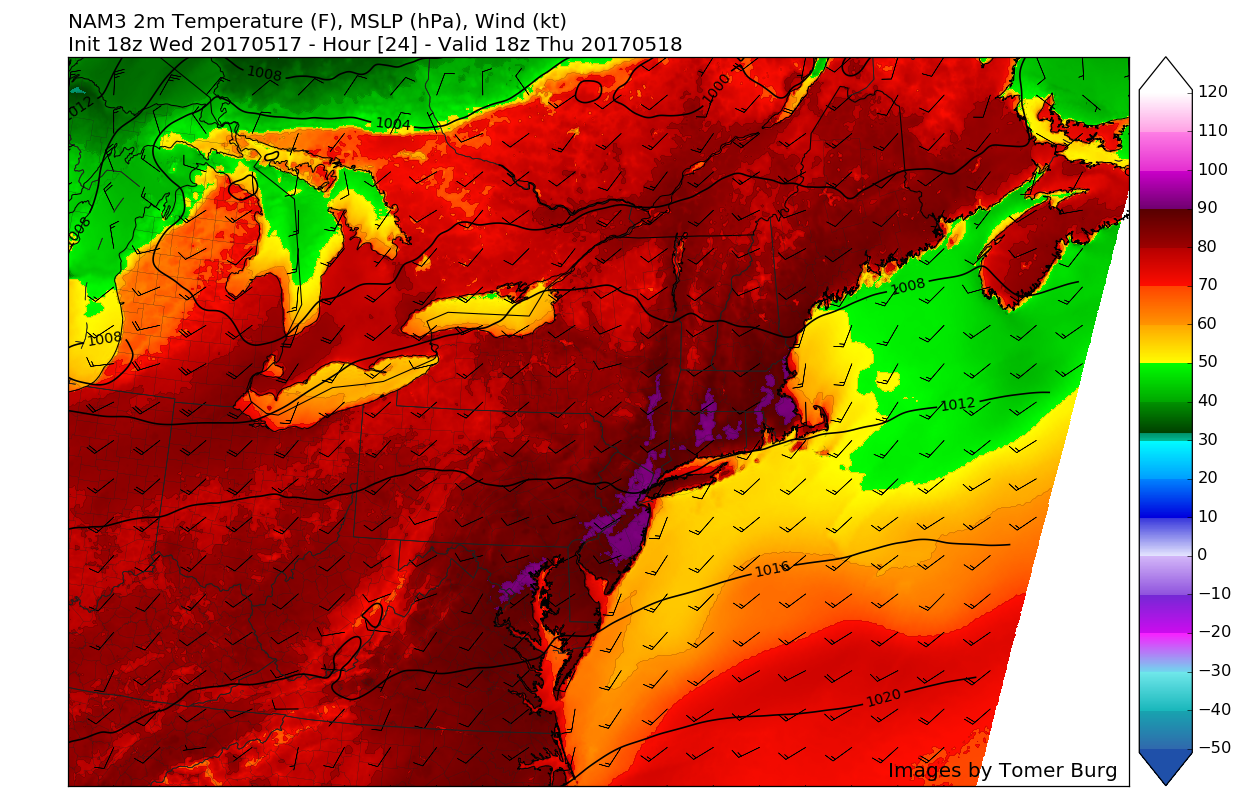
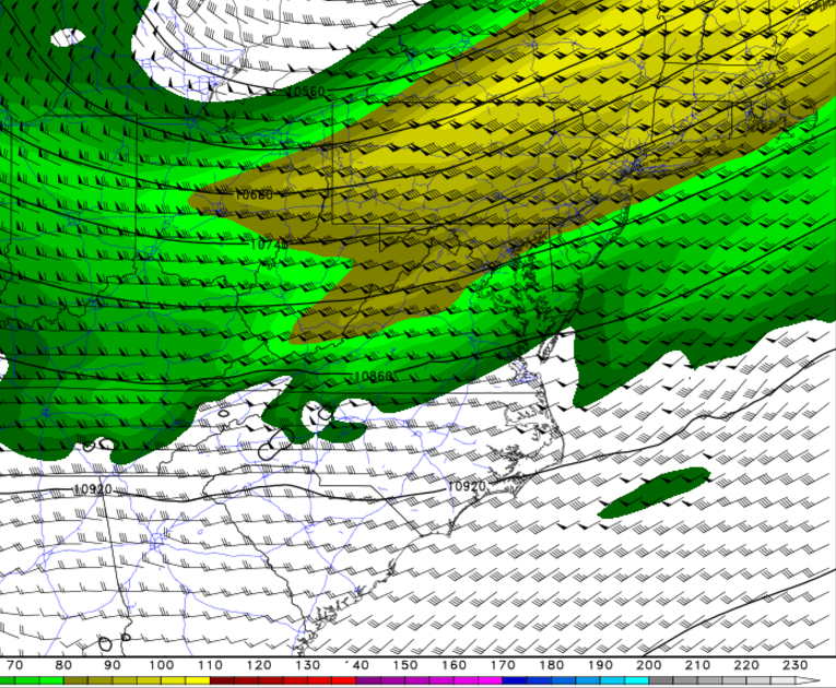
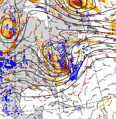
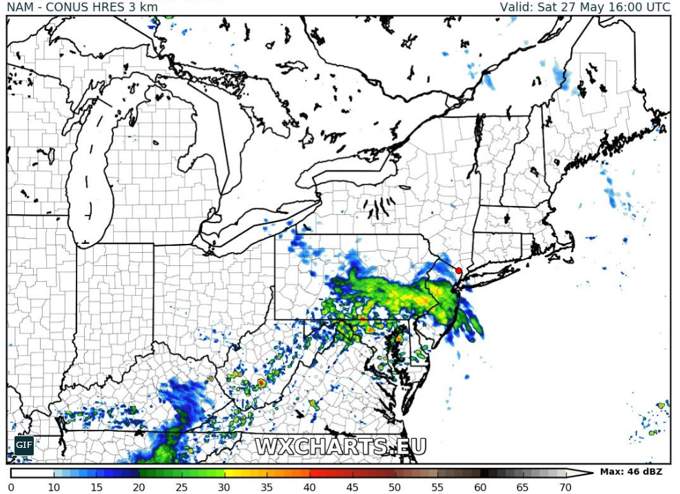
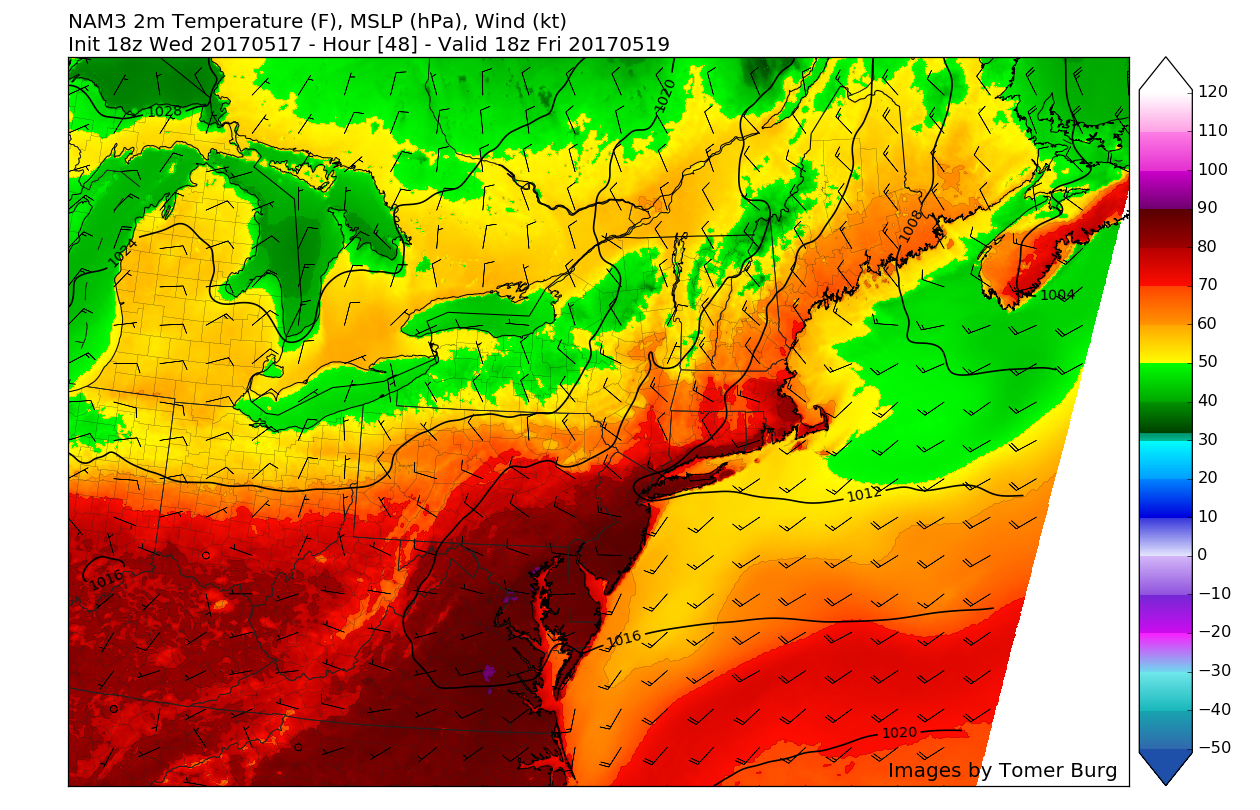
This evenings Rapid Precision Model showing the development of some afternoon thunderstorms tomorrow, followed by clearing conditions in time for the evening hours (Courtesy of WSI)
Extended Range
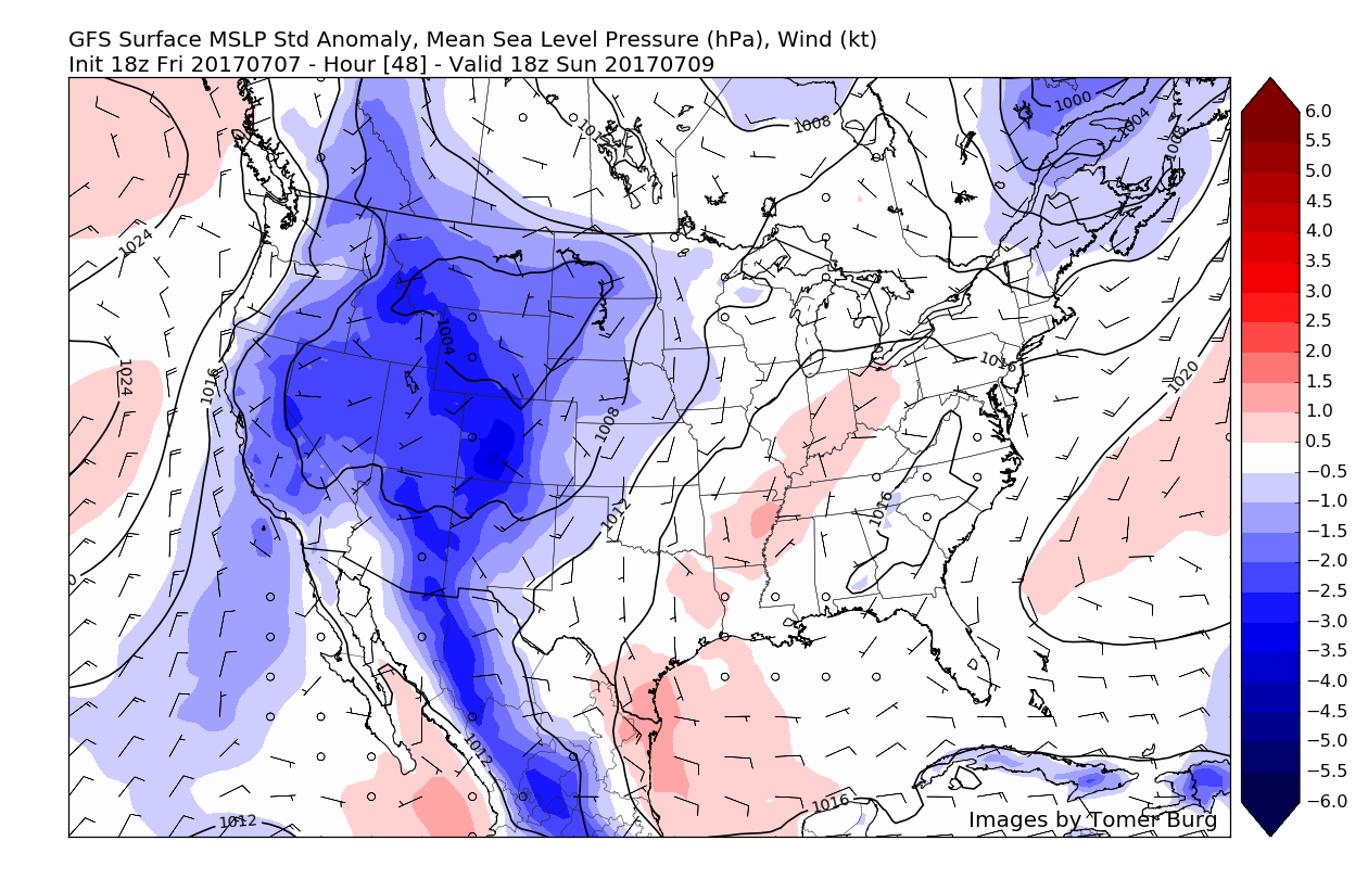
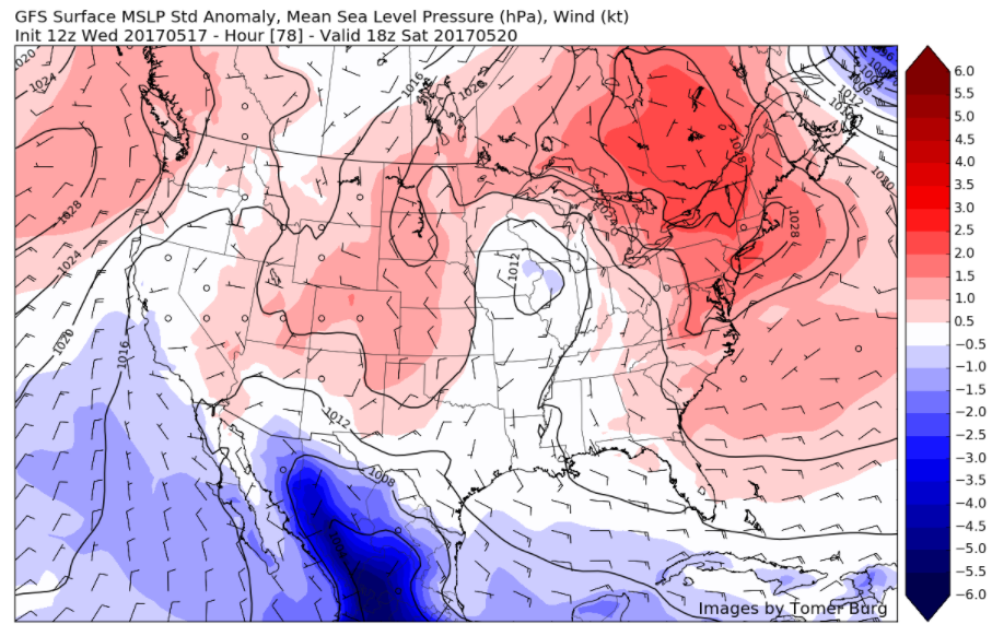
A strong heat ridge is expected over Western/Central parts of United States this weekend and into early next week. This will support a more longwave trough over much of the Great Lakes and Northeast with temperatures closer to normal overall. There are some timing differences on model guidance currently with individual disturbances embedded within the longwave trough could still produce some isolated-scattered convection over the region. But much of the time, just warm and dry with some sunshine each day, as high pressure gradually builds in from the Ohio Valley.
Later in the week, we may have another infusion of deep tropical moisture into the area, with increasing temperatures. Whether or not we see another period of heavy rain will be highly dependent on if we have a trigger mechanism to set off any showers and thunderstorms. At this time, the chance for anything outside of afternoon thunderstorms seems low, and a general increase in both temperatures and humidity seems likely at the very least. We will continue to monitor this period in case anything does try to take shape.
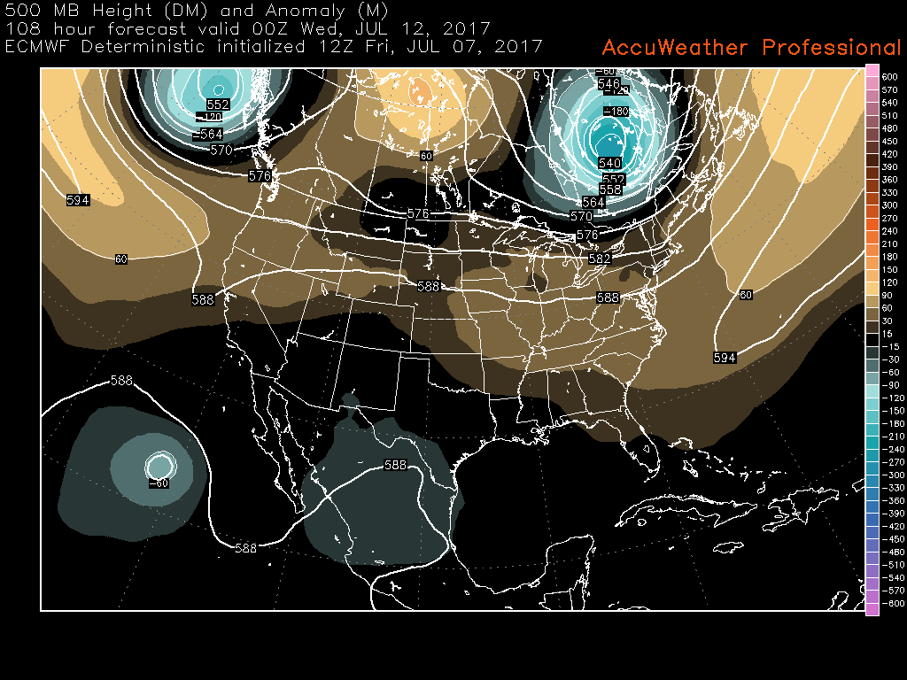
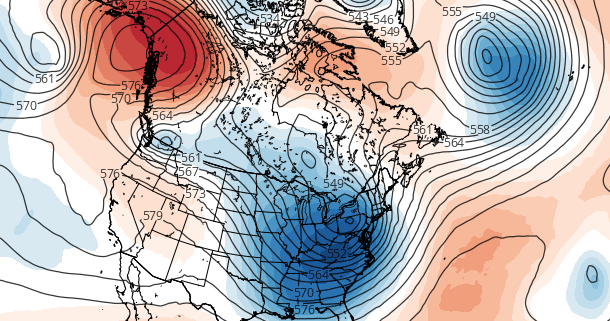
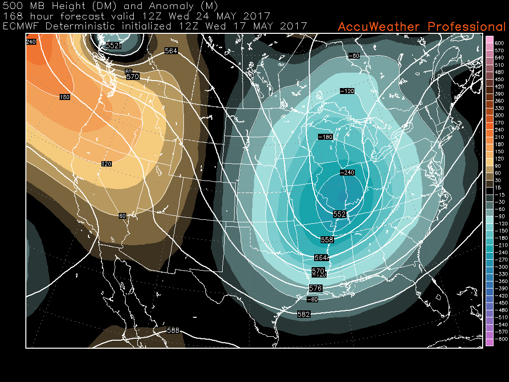
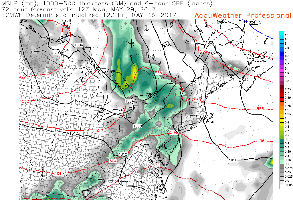
This afternoons ECMWF model showing near-zonal flow across the country, with the main weather features located in the central regions of Canada. (Courtesy of Accuweather Pro)
For more information and posts like this one, make sure you sign up for Premium Forecasts — where multiple detailed articles, videos, and interactives are posted each day. Also, come interact with our staff and many other weather enthusiasts at 33andrain.com!
Have a great evening!
Steve Copertino