Posts

Weekend Overview: Warmth, scattered storm chances return

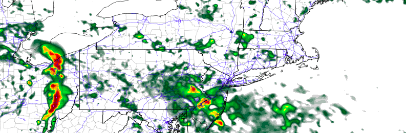
Worry not! When we say “warmth” we don’t mean the oppressive heat from last weekend. Instead, what will return this weekend are temperatures more typical of late summer. Highs in the upper 80’s will be commonplace throughout the area this weekend, especially away from the area shores. Showers and thunderstorms are possible on each day, most likely during the afternoon and evening, but aren’t expected to be severe. They’ll remain isolated to scattered throughout the area.

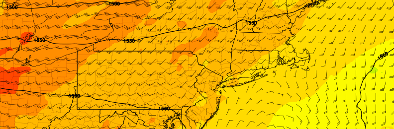
Winds will turn southeasterly by Saturday afternoon and evening, meaning the influence of the area waters will be felt a bit more near the beaches. A bit more of a breeze and cooler temperatures are likely near the coast on both Saturday and Sunday. This southeast flow comes ahead of a cold front, which is expected to bring a period of steady rain on Sunday Night. Here are your weekend weather highlights:

Read more

Weekend Overview: Pleasant, warmer conditions

With a cutoff low forming off the Southeast US Coast, and a disturbance looming in Southeast Canada, one might assume that unsettled weather would dominate this weekend’s forecast.

They would be wrong.

High pressure nudged in between those two aforementioned disturbances will keep our area in the midst of very pleasant conditions for the majority of the weekend. In fact, temperatures are expected to warm up into the upper 80’s and lower 90’s by Sunday, with plenty of sunshine anticipated throughout the area.

Read more

Thursday Overview: Unsettled start, nicer finish

The long stretch of sunshine and pleasant weather has ended! Well, sort of. A disturbance passing by this morning will bring periods of rain to the area, especially areas south and west of New York City. While clouds and showers will stick around for parts of the morning, clearing is expected as the day progresses.

Forecast models show the cloud deck meandering near the city itself, with partly to mostly cloudy conditions over Long Island and Connecticut. Meanwhile, much of Central and Southern NJ will battle showers until the late morning or afternoon hours. Once this disturbances slides seaward, however, clearing is expected throughout the area.

Read more

Cooler, but still pleasant weather this weekend

In response to warm southerly winds and a mid level atmospheric ridge, temperatures on Wednesday rose into the 70’s throughout much of the area. Temperatures on Thursday will behave similarly, rising again into the mid 70’s in many areas. Southerly winds will continue and, for the time being, the mid level atmospheric ridge will remain over head. But the pattern — in case you haven’t noticed, with below freezing temperatures on Monday — is transient, and the warm temperatures will be scoured out by a cold front by Friday.

Not all is lost, however. After a few showers late Thursday into Friday morning, cooler air in the mid levels of the atmosphere will move overhead, and the wind direction at the surface will turn more west/northwesterly. But pleasant conditions are expected to continue. High temperatures will be notably cooler on Friday than they were on Thursday, but the weather will remain pleasant — a trade off that most of us will surely take, this time of year.

Read more