Posts

3/13 Evening Zones Update: Blizzard with High Winds and Coastal Flooding Tuesday

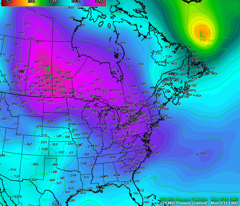
While many people focused on blizzard with very heavy snowfall, there will other important hazards that come with this storm. The blizzard will also be a major Nor’easter with strong winds, especially closer to the coast, tomorrow morning and early afternoon. There will be tight thermal gradient between deep low off Delmarva coast and high over Southeast Canada. This will  will east to northeast winds sustained at least between 20-30 mph with frequent gusts up to 40 mph over much of the region. But there potential for even much higher gusts with strong easterly 850mb-950mb jet moving through the region.

Read more

3/12 PM All Zones Update: High-Impact Blizzard Likely Tuesday Into Wednesday

Today has been what some may call the “calm before the storm”, as the day has been characterized by mostly sunny conditions across the entire area with temperatures only in the upper 20’s to low 30’s, which is below normal for this time of year. We have also seen some gusty winds across the area thanks to isobaric packing between an Arctic high pressure system centered over the central Canadian prairies and a deep low pressure system off of the eastern Canadian maritime region. As this low pressure continues to the east, winds should gradually diminish this evening as the high pressure from Canada takes control. Tonight should be an excellent night for steep radiational cooling. Under mostly clear skies and light winds, temperatures will be able to fall into the upper single digits for inland locations and teens for the rest of the region, so another very cold night is expected.

Read more

2.13 PM Zones: Winds die down, tranquil weather returns

Whew! It has been an active few weeks around here. The weather pattern, which largely has been progressive and transient over the past several months, was quite active since the beginning of February. Multiple storm systems affected the area just within the past week, and wintry weather was fairly widespread, particularly in the interior and throughout New England. A strong coastal storm in the Gulf of Maine today is beginning its move east/northeastwards, and that move will loosen a pressure gradient over the area tonight.

Read more

1/25/17 PM All Zones Update: Dry This Evening, Cold Front & Trough on Thursday

After beautiful day with plenty of sunshine and temperatures reaching the upper 40’s and lower 50’s, more clouds will begin to return this evening.  These clouds will thicken overnight but remain dry much of the night. This is well ahead of a cold front and mid-level shortwave approaching the region. Moisture remains limited overall with the approaching system — and any spotty rain showers are expected to hold off until well after midnight.

Read more