Afternoon Update: Periods of steady rain through early evening

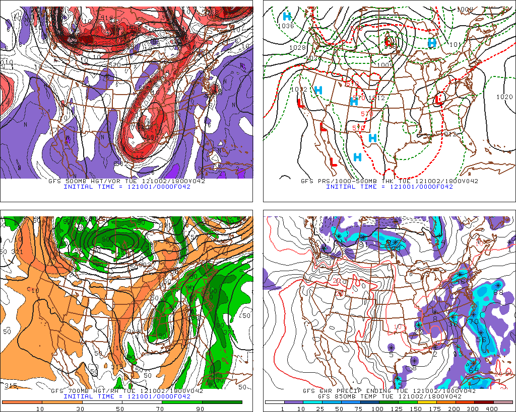
Forecast models struggled with the placement and intensity forecasts of the area of rain this afternoon, which has ended up farther east and closer to New York City than expected last night and even early this morning. The area of showers and steady rain, developing in response to a push of warm and moist air from the south, has moved north and east from the Mid-Atlantic into parts of the Northern Mid-Atlantic and New England this morning and early afternoon. Periods of rain, moderate to heavy at times, are expected through this afternoon as the warm air advection continues across most of the area. Eventually, the showers will become less widespread and far more isolated .. likely by early this evening. However, the poor forecasting by short term models has left some unprepared for the steady rain early this afternoon. Total rain amounts are not expected to be prolific, but the chance of showers as transitioned into more of a “rain likely” forecast for what will be a dreary Tuesday. By later tonight, isolated showers are expected as temperatures will continue to run a bit warmer than they did on Monday. The warm air will begin to make its presence felt on Wednesday and Thursday, when temperatures will rise into the 70’s for highs ahead of a cold front which is expected to approach the area this weekend.

Latest NYC-Area radar imagery courtesy of weather-underground shows the intensity and movement of precipitation over the last hour.

Rest of Today: Showers, and steady rain at times. The steady rain is more likely to occur west of New York City, especially over Western and Northwestern New Jersey, as well as Southeast New York. Here, moderate rain is likely through early this evening. Elsewhere, showers likely through around dinner-time. Bring an umbrella and a sweatshirt if you’re headed out as temperatures remain only in the 60’s this afternoon. East/southeast winds off the water keep things pretty raw throughout the area as well.

Tonight/YanksCast: The Yankees take on the Boston Red Sox in the Bronx tonight at 7:05pm in the second to last game of the season — and an important one at that, with the Yanks leading the AL East by 1 game over Baltimore with 2 to play. The last thing they need is a rainout and a doubleheader on Wednesday. It looks like the steady rain will taper off by late afternoon, but the soggy and damp conditions could create issues if the showers linger into early evening. One thing is for sure – the conditions will be poor for those of you who are attending. Expect a cool east wind, damp conditions, and isolated showers. But the lack of steady rain should prevent a rainout.

Wednesday: Much warmer with high temperatures in the upper 70’s to possibly 80 in some locations by afternoon. Scattered showers and isolated thunderstorms are expected to develop in the late afternoon and continue through the early evening before tapering off with the loss of daytime heating. South winds throughout the day — again, the biggest story will be the warmth.


Naming winter storms: Effective, or silly?

This morning, The Weather Channel announced that they would begin naming winter storms throughout the United States beginning during the Autumn and Winter of 2012-2013. For decades, hurricanes have been the only major weather events which have been given names, and they have been assigned by the government (The National Weather Service). Now, The Weather Channel is looking to change that, by naming winter storms that produce prolific snow or ice throughout the US this winter. There will be no set scale for a defined “named winter storm”, the main difference between The Weather Channel’s scale and the National Hurricane Center. Instead, The Weather Channel will decide which storms to name based on strength, snowfall totals, ice accretion, and population impact.  Such an announcement takes a while to process, and many throughout the meteorological community and even the general public are still reacting to the announcement.

Judging by various reactions on social networking sites (including Facebook, Twitter, and American Weather meteorology discussion community), the reaction to this announcement has been a mixed bag to say the least. In fact, one marketing company, MGH, buried TWC’s idea as a poor marketing scheme and a ratings-generator. In an article titled “At The Weather Channel it’s Marketing First, News Second“, and also discussed by our friends at Capital Weather Gang, Chris McCurry (Public Relations Director at MGH) writes..

“What makes this Weather Channel decision more about marketing than news is that it, as a ratings-generating television network, gets to set the parameters for what makes for a “name-worthy” winter storm.”

ABC 7 Senior Meteorologist Bob Ryan in New England shared his mixed thoughts on the decision. Conversely, other reputable names such as Dr. Ryan Maue support the decision.

The Boxing Day Blizzard of 2010 hammered New York and New Jersey with 25-30 inches of snow, but had no formal name.

To me the decision to name winter storms is one that comes off, at least initially, as amateur. Yes, he names are silly (Brutus, Q, Freyr ?). But the real problem, in my eyes, lies in the selection process. For meteorologists, winter storms are special. There are so many different types, each of varying strength and condition — and they are much more common than an Atlantic Hurricane. The Weather Channel says, in their press release, that the naming process will depend on the population affected and the severity of the storm. This means that a large, powerful, and textbook cyclone moving through the Rocky Mountains producing prolific snows in mountains with smaller populations probably wont be named — while a weak frontal wave that produces 1-2 inches of snow in Georgia will forever be remembered as “The Great Nemo Snowstorm of 2012”. From a meteorological perspective, the system is flawed.

This is not to say that the forecasters at The Weather Channel don’t know what they’re doing — because they do. They are, whether you like it or not, well versed in their profession. However, I think the exact implementation on the system will eventually decide how the public receives it. There is a good chance, in fact, that most of the general public will see it as a joke. The credibility of the organization could fall. Yet, it seems they are willing to take that risk, whether it be for more recognition and more website hits or not. We won’t dive into that. The issue is, with poor implementation the system won’t help anybody. It will become a game. If The Weather Channel doesn’t implement the naming system correctly, the names won’t help anyone prepare faster, spread the word of the storm, or forecast accurate accumulations for potential hazards. That’s what meteorologists are for.

If you ask me, winter storms don’t need names. You’ll always remember the Blizzard of ’96 and the Presidents Day Storm of 2003, not Nemo and Freyr of 2012. But hey, I guess the jury is still out on this one.


October Begins With Moderating Temperatures

For those of you who are not ready for true autumn conditions just yet, good news is in store, at least for the next week. The upper level low that had previously been giving our area lots of clouds, showers, and cool temperatures will depart to the north of the area and bring moderating temperatures behind it. Temperatures should generally run several degrees above normal throughout the upcoming work week.

This week should also be drier than the past few days have been, with some days being quite sunny. However, there may still be some showers around from time to time, mainly for Tuesday and Wednesday.

00z GFS Four-Panel Plot, 500mb Top Left, Surface Top Right, 700mb Bottom Left, 850mb Bottom Right, Showing The Warm Weather Pattern, Valid for 2pm Tuesday, October 2nd.

The departing upper level low will help bring clearing conditions for today. Additionally, as one can see from the image, we have a strong 500mb “cut-off” low in the southern states, which is when a storm cuts itself off from the jet stream. This makes a weather pattern slow down, as the jet stream is not moving this particular feature of the pattern. Since the jet stream becomes separate from the storm system, all of the chilly air remains bottled up in Canada. The cut-off low also helps to usher in warm air out ahead of it, as our 500mb heights continue to rise with a southwest flow at that level. There is also a ridge in the Atlantic which helps to provide warmth, but also provides some wind flow from the Ocean — this will all combine to provide warmth with some moisture. Once we move into Tuesday, the disturbance to our southwest will be moving northward, perhaps ushering in a few showers for Tuesday and Wednesday. Fortunately, however, this disturbance will move well to the north of our area by Thursday, providing more sunshine — with enough sunshine, temperatures could approach 80 degrees for much of the Metro region on Thursday and Friday.

(Click “Read More” below to see your Monday, Monday Night, Tuesday, and Tuesday Night forecast, along with a quick preview of next weekend and beyond) 


Read more