-2")
Tropical moisture could spoil weekend
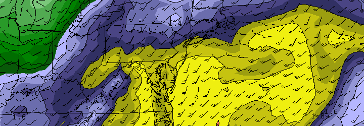
The pleasant, dry and less humid weather which has settled into the area during the middle of this week, however enjoyable, looks to be short lived. Forecast models have been consistent in taking a weak (possibly tropical) system with an impressive amount of low level moisture, and tracking it from the Gulf of Mexico up along the East Coast. With the weak shortwave being scooped up by a progressive trough over the Ohio Valley, a surface low is forecast to develop and move up the East Coast beginning Thursday and continuing into early Saturday.
The system in the Gulf of Mexico, which is forecast to develop into a tropical entity by some models, is struggling amidst strong upper level winds. But it still may develop into a weak system before ejecting north and east and being absorbed into the mid level flow. The National Hurricane Center suggests the system has a 50% chance of developing into a tropical system.
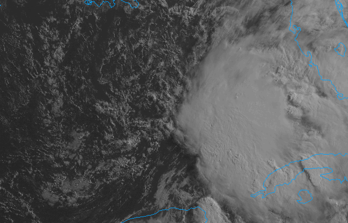
Visible satellite imagery of a tropical disturbance in the Gulf of Mexico on the morning of June 5th, 2013.
The result, in terms of sensible weather for our area, will be clouds and showers beginning late Thursday and continuing through at least the first part of the weekend. The exact track of the surface low and interactions aloft will determine where the heaviest rain falls, but needless to say periods of rain are likely with the potential for some thunderstorms as well. Late Thursday into early Saturday in particular look to feature the most unsettled weather. Things look to clear out a bit during the day on Saturday, so Sunday could be salvaged if the timing holds up.
Be sure to follow our social media accounts on both Facebook and Twitter for up to the minute information and interaction.