-2")
Warm, Muggy, and Unsettled Pattern to Continue for the Foreseeable Future
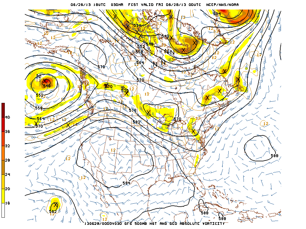
A strong ridge in the West, combined with a strong West Atlantic Ridge, will combine to funnel in warm, moist air from the Atlantic and Gulf. This will help to create a warm, muggy, and at times, wet weather pattern. This image is valid for tomorrow at 8 p.m.
Over the past several days, the humidity has really spiked, creating a true summer-like feel. There have also been afternoon thunderstorms in the area. This pattern will continue over the next week or so, and potentially even longer. And while there should not be one full washout day, there will be periods of heavy rain at times on any given day or night, adding up to several inches of rain over a week’s period for most of the region.
We currently have a pattern where there is a very strong ridge in the western half of the country, as evidenced by the image above. Additionally, there is a strong Western Atlantic ridge that is trying to poke towards our area. Clockwise flow around this strong ridge will help to yield a deep, moist southerly flow, giving our area plenty of warmth and moisture from the Atlantic Ocean and Gulf of Mexico. These two features are pretty large in scale, and are thus going to be pretty stagnant. Thus, this pattern should stick around a while. It’s a very Florida-like pattern — welcome to Florida!
Another important aspect of the pattern that these two ridges create is the trough in the eastern half of the country; primarily over the Great Lakes. Since these two ridges are strong and stagnant, a trough gets wedged in-between those ridges, further helping to induce southerly flow on the downstream side of the trough, and also increasing cyclogenesis potential in the Great Lakes and Northeast. Any storm system that dives down into the Great Lakes and Northeast will have plenty of moisture to work with, creating a plentiful moisture source for heavy downpours.
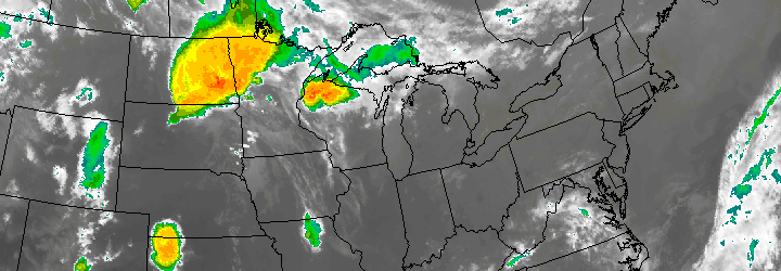
Lots of days in the near-future may start off sunny in the morning, but will have increasing clouds in the afternoon with widespread heavy showers and thunderstorms developing. As you can see in the image above, a shortwave is heading for the northeast tomorrow night, which will help create the potential for heavy rain and embedded thunderstorms for tomorrow night. If enough sunshine can occur in the morning and early afternoon to destabilize the atmosphere, a severe weather threat may ensue, with a few strong to severe wind gusts and an isolated low-level mesocyclone/tornado threat. The storms system will help to generate some south and southeast winds at the surface, while also creating a strong low-level jet at 850mb out of the southwest, inducing a bit of low-level rotation and shear.
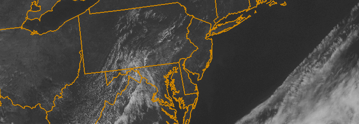
As of now, we primarily think that the strongest severe weather threat will be a bit to our southwest, but there is still a chance for something in our area, so everyone should keep in tune with weather forecasts tomorrow. Regardless, the wind profile at all levels of the atmosphere will be very favorable for moisture throughout the entire atmospheric column, so the threat for heavy downpours and flash flooding is high for tomorrow evening. Definitely have your umbrellas tomorrow!
Stay tuned to our Facebook and Twitter pages for up-to-the-minute information and interaction.