-2")
PM Update: Splendid Saturday, but unsettled pattern continues
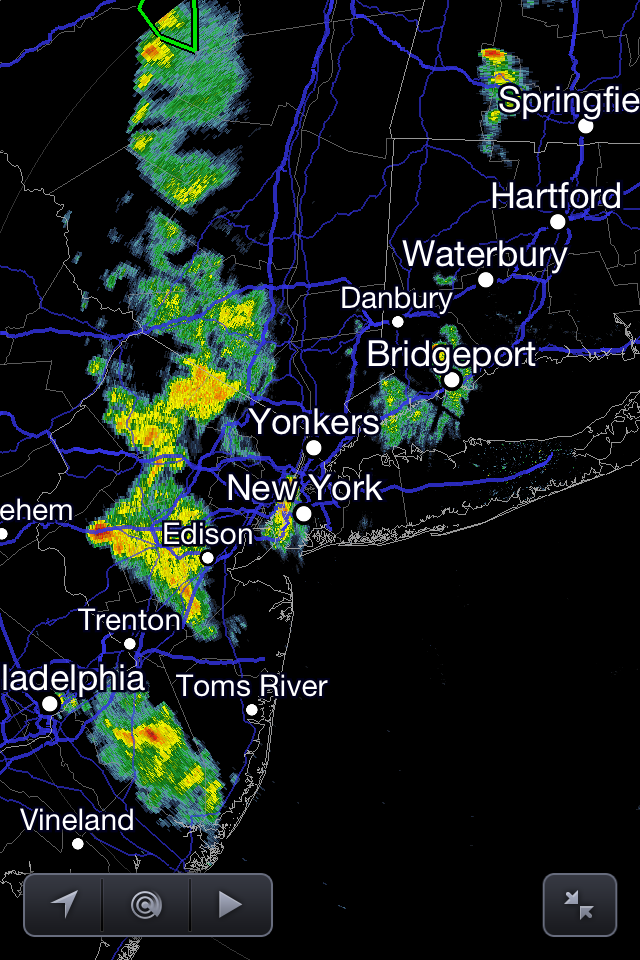
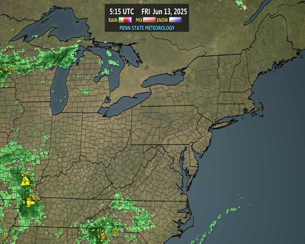
Radar image as of 5:30pm EDT shows numbers showers and thunderstorms in New Jersey, with less activity from NYC and east.
For a lot of the NYC Metro area, today turned out to be quite the nice day. However, the lingering storm system from yesterday and some day-time heating allowed some scattered showers and thunderstorms to develop across much of New Jersey. These storms are not severe, but could provide some locally heavy downpours and lightning. The upper level winds on the backside of the storm are oriented from north to south, so the storms in Jersey will also move from north to south. Thus, I anticipate the eastern parts of NYC and east to remain primarily dry for the rest of the afternoon and evening, whereas western NYC and much of New Jersey can expect some scattered showers and thunderstorms. However, an additional even weaker area of storms may hit central Long Island, producing moderate rain and a rumble of thunder. Not everywhere in Jersey will be hit, but it might be prudent to bring an umbrella if you’re in Jersey, just in case.
Tomorrow, however, looks beautiful. The storm system will finally move out of the way, and a ridge will build in from the west, leading to sunny skies and warm temperatures. Temperatures should sore to around 80, or even low 80s in the warm spots tomorrow, with dry, downsloping northwest winds.
Sunday morning and early afternoon also looks nice, with more warm temperatures. However, the active weather pattern will return for Sunday afternoon, Monday, and Tuesday. An upper level low in SE Canada will force storm systems to track to the south, across the Ohio Valley and Northeast. These storm systems will not be as strong as what we saw yesterday, but will still lead to unsettled weather, and perhaps isolated severe weather as well. The activity may be a bit more scattered on Sunday and Monday, and perhaps more widespread on Tuesday. Though for Tuesday, if the storm stays to our south, heavy rain will be the threat, and if it goes further north, severe weather becomes more likely. The main threat each day would be a line of storms producing strong winds. More detailed and more technical discussions will be issued over the next couple of days, further addressing this potential.
Rest of today and tonight: Partly sunny skies from NYC and east, with the chance for a shower or weak thunderstorm on central Long Island. Mostly cloudy with numerous showers and thunderstorms in New Jersey. Temperatures initially in the upper 60s to around 70 will fall into the mid 50s to around 60 tonight.
Saturday: Mostly sunny skies, with high temperatures around 82. Light northwest winds.
Saturday Night: Clear skies with lows around 60. Light westerly winds.
Sunday: Sunny in the morning, with increasing clouds as the day goes on and a 30% chance for a line of thunderstorms in the afternoon and evening. High temperatures in the upper 70s.
Monday: Mostly cloudy with a chance of scattered showers and thunderstorms. High temperatures in the upper 70s to around 80.
Tuesday: Mostly cloudy, with either widespread rain or the threat for severe storms, depending on the track of this storm system. High temperatures in the upper 70s.
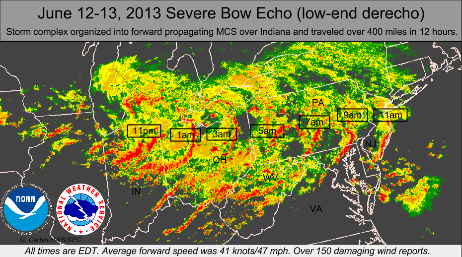
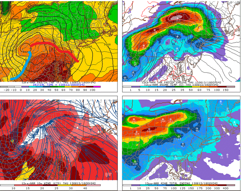
An image showing the time stamp of yesterday morning’s derecho.
In other news, yesterday morning’s squall-line was officially classified as a low-end derecho. It peaked in strength in Ohio, producing a wide swath of severe, damaging winds. It weakened a bit once it got east of the Appalachians, but still produced some severe winds in southern PA and southern NJ. It was not nearly as strong as the derecho that hit the Mid Atlantic on June 29 of last year, but it still packed a decent punch.
It was actually this system being stronger than expected that helped to halter the warm front’s progress northward, and stabilized the atmosphere over much of New Jersey, preventing yesterday’s severe weather outbreak from being as severe as once anticipated. Over the next few days, we will be doing a re-analysis of that event, going over what went right and what went wrong with our forecast.