Most of the region saw their coolest temperatures of the fall-season this morning. However, urban areas did not — the most extreme examples of the discrepancy were lows of 29 and 32 degrees at Westhampton Beach Airport, NY (KFOK) and Somerset Airport, NJ (KSMQ) respectively, while Central Park (KNYC) and LaGuardia Airport (KLGA) had lows of 50 and 52, respectively. There are often temperature differences between urban and suburban/rural areas, but not of this magnitude. The phenomenon is not without precedent, however, and once explained — it actually makes a ton of sense.
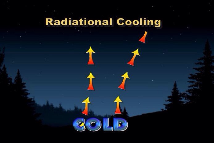
What do we know, to start, about radiational cooling? For one, we know that everything radiates heat. During the daytime hours, the suns incoming radiation serves as a heat source. But with nightfall, and the loss of daytime heating, the surface will continue to radiate the days heat outward — and cool. This is called, by definition, radiational cooling.
The coldest night of the season to date occurred from Sunday Night into Monday morning throughout most of the area suburbs. The pine barrens of Long Island, many interior areas of New Jersey, and the suburbs of New York and Connecticut fell into the 30’s with clear skies, light winds and a cool airmass settled into the area. The city and urban locations, however, struggled to fall — with Central Park already observing a temperature in the lower 50s as early as 730am on Monday.
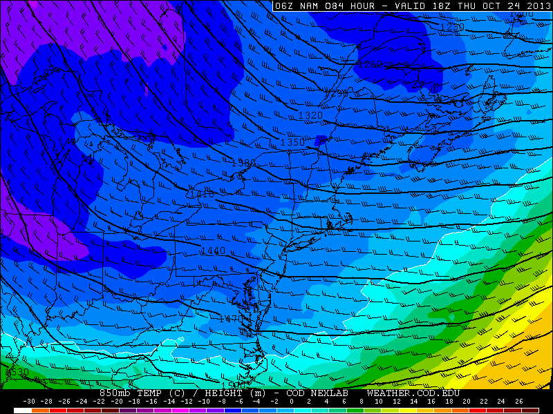
NAM showing 850mb temperatures falling between -4 and -6 C through the Northeast later this week.
As we progress deeper into the autumn season, many are beginning to wonder if the upcoming cold pattern is a precursor to the type of winter that we will see. Unfortunately, it is not as easy as cold October yields cold winter or warm October yields warm winter. If that were the case, we’d have long range forecasting figured out by now and there would be no need for winter outlooks, as the winter would be set in stone by the end of October. The best we have are correlations, analogs, physical pattern drivers, and pattern persistence. When added together, the summation of these various factors provide a higher probability of success in medium to long range forecasting, but these methods are far from perfect. With that being said, the evolution of different atmospheric oscillations during the autumn season can give us a substantial clue as to the ensuing winter’s dominant index modalities.
In this particular case, let’s examine the autumn north pacific pattern of years since 1990, giving us a sample size of 22 years (we would have to wait through this winter to see if 2013′s correlation holds up). The north pacific pattern is often represented as the East Pacific Oscillation (EPO). Like the North Atlantic Oscillation, the EPO has certain, generally predictable outcomes when it oscillates from positive to negative phases. The positive phase of the EPO is usually associated with lower than normal heights across the northeastern Pacific, much of Alaska, and northwestern Canada. Conversely, the negative phase of the EPO generally produces higher than normal heights over the region just described. The positive (+EPO) tends to flood the United States with maritime pacific air due to the low pressure around Alaska, while the negative (-EPO) acts as a block to maritime pacific air due to high pressure over the NE Pacific/Alaska. The -EPO often sets up a cross polar flow with high pressure centered over Alaska and the flow oriented across the north pole from Siberia into Canada. The -EPO pattern has yielded some of most impressive, severe arctic outbreaks on record. The upcoming 10-15 days, for example, will be colder than normal in the East primarily due to the forcing from the negative EPO signal in the northeast Pacific. There’s not much blocking in the north Atlantic or arctic regions, so the main impetus for this cold through November 5th is the -EPO.
https://www.nymetroweather.com/wp-content/uploads/2024/02/Empire-2000-x-300-px-2.png00Tom Stavolahttps://www.nymetroweather.com/wp-content/uploads/2024/02/Empire-2000-x-300-px-2.pngTom Stavola2013-10-20 14:09:592013-10-21 08:51:29Importance of the North Pacific Pattern in Autumn
Warmer and unsettled weather which affected the area late this week is on the way out, being pushed away by a cold front which pushed through the region Thursday Night. The first in a series of expected cold fronts through late next week, cooler and less humid air will spill into the region by Friday afternoon. Luckily, along with the cooler air will come pleasant conditions with clearing skies and light westerly winds. This weekends weather will be characterized by plenty of sunshine, and temperatures topping out in the upper 60s. As it looks now, another gem on a long running list of great weekends which stretched back to September.
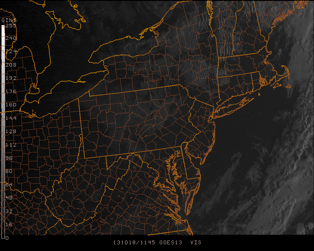
Visible satellite imagery from the morning of October 18th, 2013 showing improving conditions behind a cold front.
Hi friends! Our website uses cookies to provide an optimal browsing experience for you. New "Cookie Consent" laws mandate us to inform you of this. As long as you're cool with it, just hit OK. You'll only see this message once.
We may request cookies to be set on your device. We use cookies to let us know when you visit our websites, how you interact with us, to enrich your user experience, and to customize your relationship with our website.
Click on the different category headings to find out more. You can also change some of your preferences. Note that blocking some types of cookies may impact your experience on our websites and the services we are able to offer.
Essential Website Cookies
These cookies are strictly necessary to provide you with services available through our website and to use some of its features.
Because these cookies are strictly necessary to deliver the website, refusing them will have impact how our site functions. You always can block or delete cookies by changing your browser settings and force blocking all cookies on this website. But this will always prompt you to accept/refuse cookies when revisiting our site.
We fully respect if you want to refuse cookies but to avoid asking you again and again kindly allow us to store a cookie for that. You are free to opt out any time or opt in for other cookies to get a better experience. If you refuse cookies we will remove all set cookies in our domain.
We provide you with a list of stored cookies on your computer in our domain so you can check what we stored. Due to security reasons we are not able to show or modify cookies from other domains. You can check these in your browser security settings.
Other external services
We also use different external services like Google Webfonts, Google Maps, and external Video providers. Since these providers may collect personal data like your IP address we allow you to block them here. Please be aware that this might heavily reduce the functionality and appearance of our site. Changes will take effect once you reload the page.
-2")