-2")
PM Update: One storm out, another one in
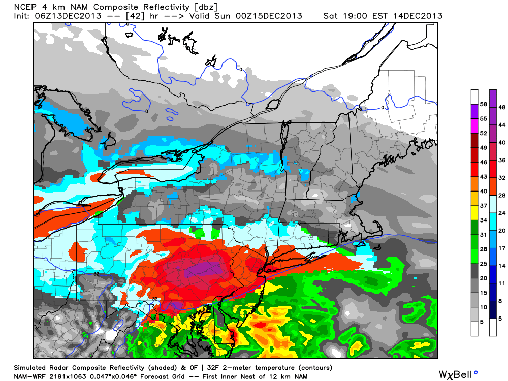
It is often said in the meteorological world that “dry begets dry”. In this case, snow begets snow. Amidst a hemispheric pattern which has historically been unfavorable for snow, multiple snowstorms have driven through the Northeast United States over the past two weeks. Most recently, for obvious reasons, is the snowstorm which occurred just this past Saturday Night into Sunday and left a significant snowfall accumulation in many areas, especially Northern New Jersey, New York City and Southeast New York into Connecticut. But even prior to that, a rare significant December snowfall over Philadelphia and Central New Jersey got winter off to a surprisingly fast start.
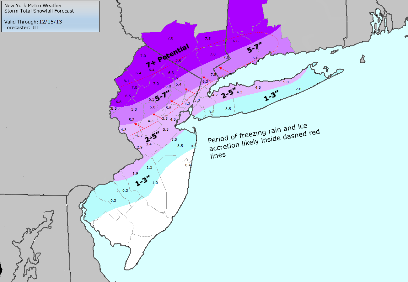
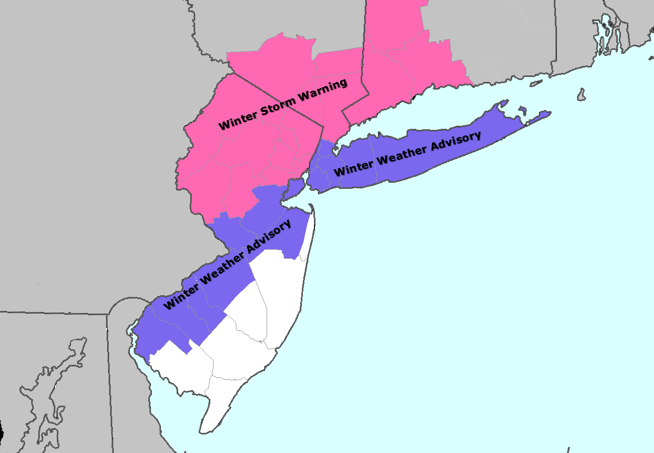
Saturday and Sunday’s event was certainly the most significant so far on this young winter’s season, with a significant snowfall and then icing across the interior. It was also the most interesting from a mesoscale perspective, with a dramatic coastal front and mid level warm air advection changing areas over to sleet and freezing rain despite surface temperatures in the 20’s. Regardless, after several inches of snow most areas changed over to rain. The cold air held on longer inland, and was much quicker to scour out near the coast. You can access our official verification map, with plotted totals over our forecast, right here. Attention now turns to a clipper type storm system, which will swing through the area on Tuesday — and forecast models are beginning to hone in on the potential for another light snowfall.
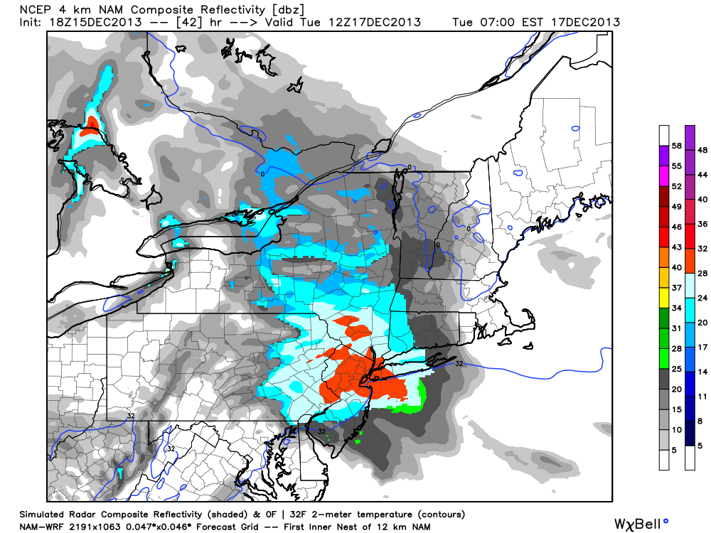
High resolution NAM model showing a period of moderate snow throughout the area on Tuesday morning.

