-2")
Tranquil weather will give way to weekend nor’easter
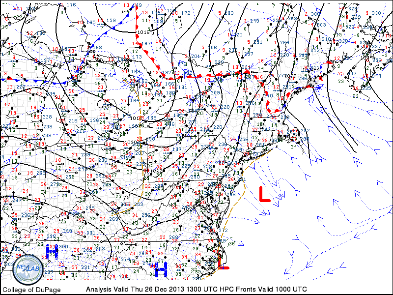
Colder, but more tranquil weather has settled into the forecast area to end the holiday week. After some light snow showers associated with a weak front and coastal system on Thursday, pleasant weather is expected on Friday and Saturday. Additionally, there will even be a bit of a warming trend both days, as high temperatures reach into the 40’s. The arctic air which stepped into the area earlier in the week won’t have any reinforcement until early next week, and so airmass modification will allow for temperatures to push warmer on both Friday and Saturday especially as the surface high pressure slips off the East Coast.
By Sunday, the weather becomes more active as a southern stream disturbance will slingshot up the coast. The system will ride on the eastern periphery of an incoming trough over the Central United States which, in its own right, will carry a ton of cold air with it. This means a few things, however. First, the system looks to be progressive despite its deepening off the coast. Second, the system will have plenty of warm air with it — and the cold air will have already modified out of the Northeast US. The aforementioned antecedent airmass won’t hold much potential for wintry precipitation. As such, the main concerns for this weekends system are a period of heavy rain and some gusty winds.
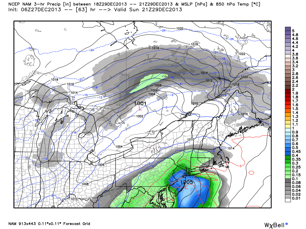
NAM model forecasting a coastal storm system on Sunday, providing the area with heavy rain.