-2")
Warmup continues, peaks Sunday
Forecast models continue to come into better agreement on the extent of the warmth reaching our area on Sunday, and it seems to be fairly anomalous and will certainly feel dramatically different from what we have experienced over the past several days and weeks. High temperatures are forecast to surge into the 60’s throughout much of the area by late this weekend, as a major storm system drives northward through the Central United States and into the Great Lakes. A warm front will push north of the area during the weekend (providing unsettled weather) but the main story will come after its passage, as southerly winds will bring in very warm air.
The trend towards warmth begins today, as high temperatures will push into the lower 40’s in many locations. For some, especially over the interior, it is the first day above freezing in over a week. But, moreso, Thursday will serve as the first sign of airmass modification, which has not been commonplace in our area recently as arctic intrusions have been relentless. Despite the cold air remaining just to our north over Canada (just because we’re warming up, doesn’t mean it’s depleted) the extent of warm air by this weekend will become quite impressive.
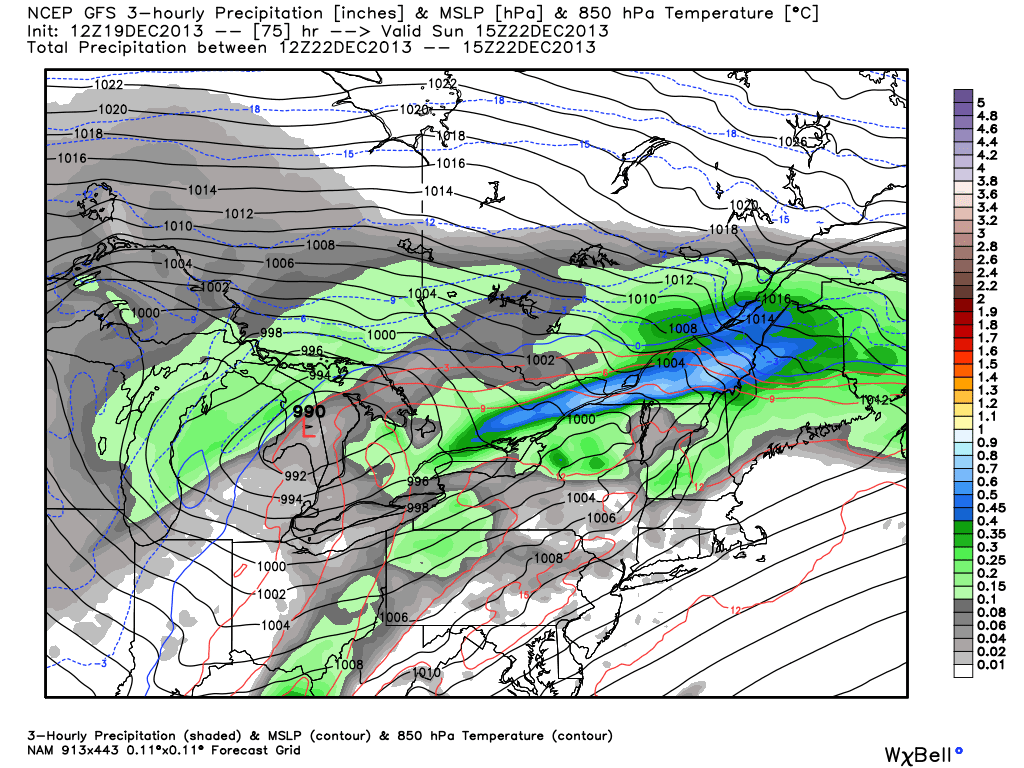
NAM model showing a storm system over the Great Lakes this weekend, with a warm front over New England and very warm air over our area (850mb temperatures 15+ C).
