-2")
Attention shifts to the weekend and next week for more snow chances
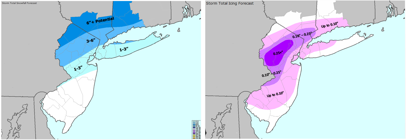
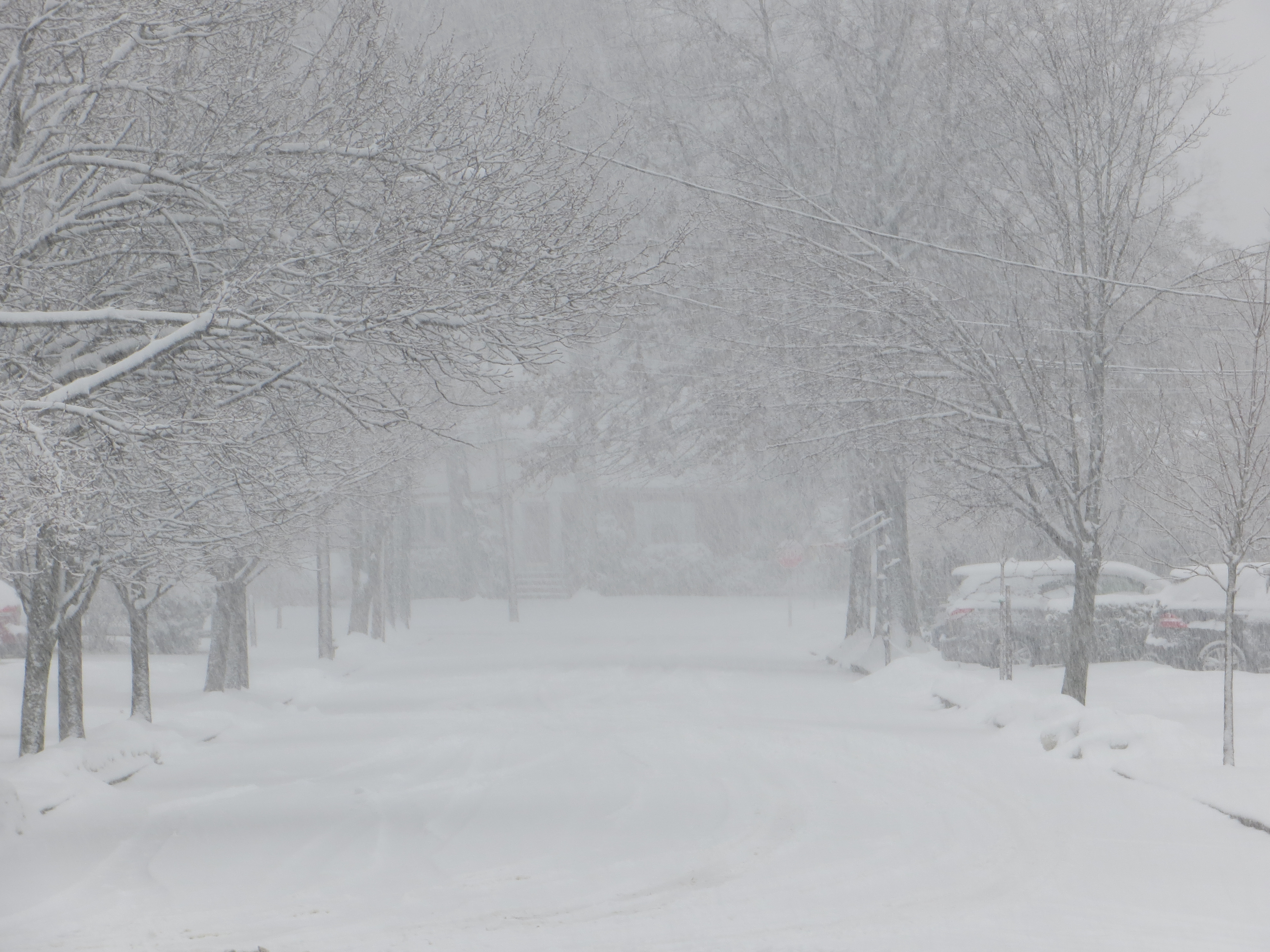
Our snow and ice storm is moving out of the region, producing copious amounts of snow just north of the city — where up to a foot fell in Southern New York and parts of New England. 4″ of snow fell in New York City, before turning over to 1/4″ of freezing rain, and a widespread significant ice storm resulted in widespread power losses in interior New Jersey and Pennsylvania. Quite frankly, it is a mess outside. Concerns begin to elevate again, as temperatures begin to fall back into the 20s, leading any standing water on roadways to refreeze back into ice. Additionally, tree limbs may also collapse on area roadways, leading to more problems. We highly recommend taking serious caution when commuting this evening and tonight. Tomorrow morning’s commute may even be hazardous, as well.
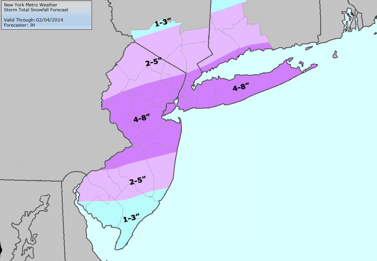
Now that this storm is wrapping up, we can begin to shift our attention towards the weekend. A couple of days ago, many computer models began to show a potent nor’easter hitting the East Coast producing widespread significant snowfall amounts. And while many of the ingredients are still there for a major snowfall, the evolution of the pattern has changed a bit as none of the models are forecasting a major snowstorm for the weekend at this time. That being said, we still need to keep a close eye on this system. For more background information on the evolution of the pattern, why it is so active, and what the models were initially showing this weekend, check out our article from two days ago.
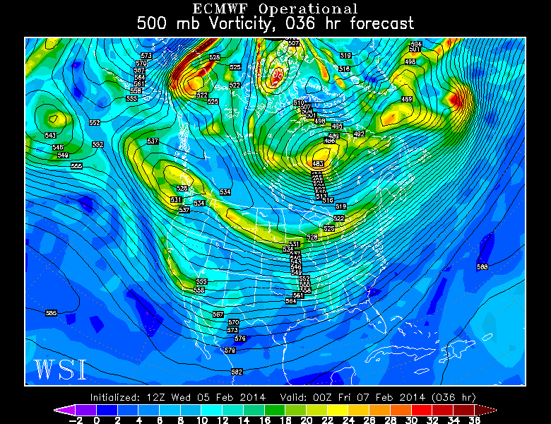
Let’s take a look at what has changed. Below, we will see the 500mb pattern on the European Model from two days ago, valid for Thursday evening, as well as today’s European model, valid for that same time period.
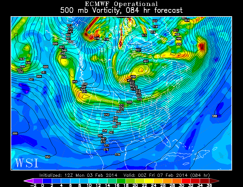
The European Model run at 500mb from two days ago, valid for Thursday evening. It showed more potential for a big storm this weekend. Image credit goes to the WSI Model Lab.
Today’s European Model valid for Thursday evening shows a less amplified pattern in Western Canada, which explains why it is not as threatening for this weekend. Image Credit goes to the WSI Model Lab.