-2")
Onshore flow, cooler through Friday
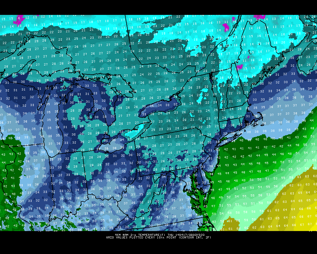
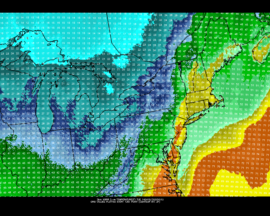
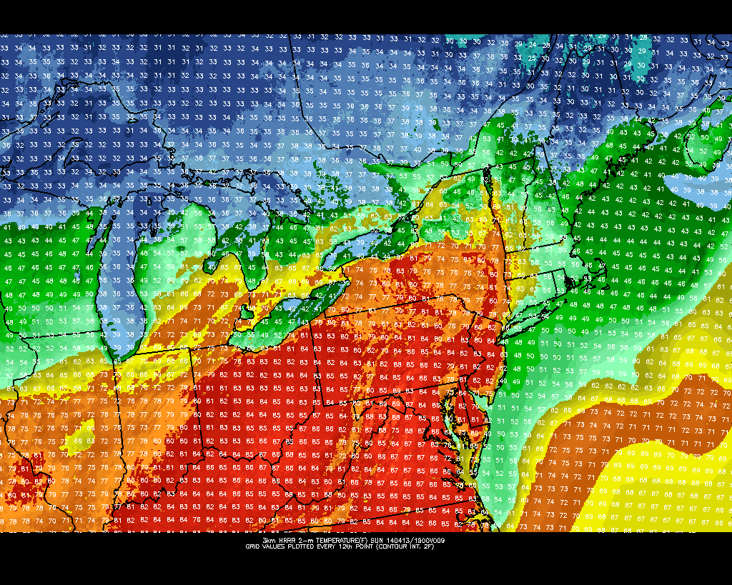
Cooler than normal weather has been settled into the region for the past few days, after snow and ice on Wednesday morning made for a dramatic entrance. An onshore flow, rooted by east/southeasterly winds off of cooler ocean waters, will continue on Friday bringing temperatures in the 40’s and 50’s throughout the area and the presence of some clouds. Farther inland, over Pennsylvania and much of the Ohio Valley, a warmup is underway as the ocean effects are much more muted. This warmup will head our way by later this weekend into the early next week, but before the cooler/unsettled weather puts up a fight.
To our south this weekend, an upper level low with a tremendous amount of moisture will shift from the Gulf Coast to the Southeast States. Several inches of rain are expected along the Southeast Coast as the low pressure system shifts east. Luckily for our area, the incredible moisture return will remain south of our area and the storm system will skirt out to sea — leaving us without any significant rainfall amounts. But temperatures will remain generally in the 50’s and possibly approach the 60’s as the system begins to pull away.
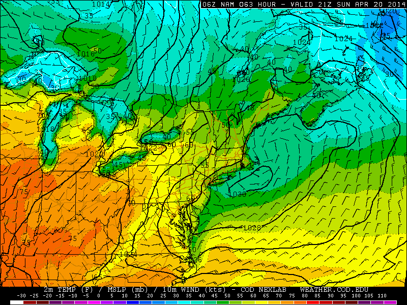
Onshore flow keeping temperatures cooler than normal this weekend.