-2")
Bouts of heavy rain expected through Thursday
Although it has been quite the grey, dreary, chilly day, rainfall throughout the area has not been all that heavy yet. The main reason for this is because the surface pressures are still quite high, thanks to a large high pressure system north of Maine, which is wedging in very high pressures into the area. Higher surface pressure is an indicator of downward motion in the atmosphere, which is not conducive to precipitation.
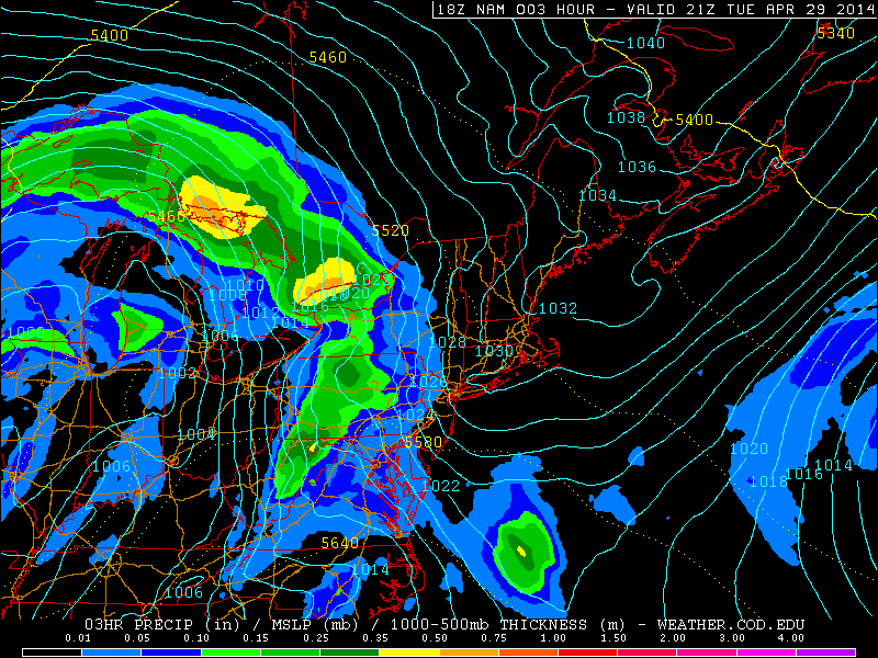
This afternoon’s NAM valid for 5:00pm shows a large high pressure system to the north, with high pressures still wedged into our area. This is why a lot of the rain has broken up as it has headed east (weather.cod.edu).
The image above explains it well — note the blue isobars of higher pressures that are being “pushed” into our area. The lower pressures are relegated to the west, southwest, and northwest, while the higher surface pressures are to the north and northeast. The station pressure at Rutgers Gardens is 1027mb. That is certainly not conducive for heavy precipitation. This is further augmented by the fact that an associated warm front is still well to the south of the area. If the atmosphere is going to generate lift for precipitation with high surface pressures, we need forced ascent from a frontal boundary, which will finally be approaching the area on Wednesday.
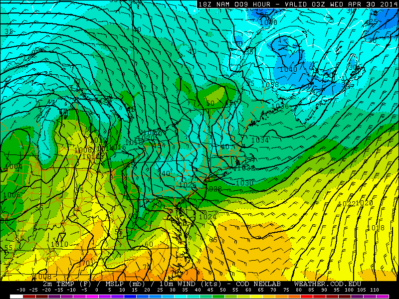
Moving forward through 11:00pm tonight, the surface pressures remain high, and the warm frontal boundary is still well to the south. This most likely means the Yankees will play baseball tonight (weather.cod.edu).
However, over the next several hours, notice how the strongest temperature gradient associated with the warm front is still well to the south, and the high surface pressures are still being wedged in. This combination leads us to believe that any rain that falls this evening and tonight will be very light, and not enough to cancel the Yankee game. As time goes on, the warm front will slowly be approaching the area, and the easterly winds from the cold, yet moist ocean will finally be enough to moisten the atmosphere and generate the necessary lift for precipitation.